Ukrainian air monitoring reports 2+ Russian Shahed-type drones heading toward Slavutych
What happened
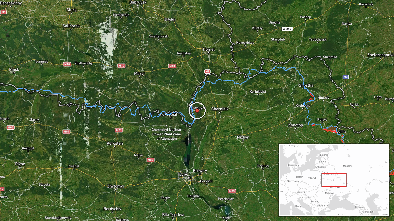
On 22 October 2026, at about 07:15 UTC, Ukrainian air monitoring channel Telegram (@kpszsu) reported a group of strike drones moving toward Slavutych, a city in northern Kyiv Oblast. The original Ukrainian post reads as a short alert, a scooter-style marker followed by the words 'group of strike UAVs toward Slavutych.' The event summary characterizes the aircraft as two or more Russian Shahed-type drones. The post does not describe impacts, damage, or casualties, and it gives no route or altitude details. The event is therefore best read as an air-threat transit warning rather than a confirmed strike on the city. The report was filed as a single-source alert and has not been corroborated by a second channel in the data provided.
Context and assessment
Slavutych matters less as a military objective in its own right than as a populated city lying on the route of drones that have been moving through northern Ukraine for much of the day before. The related events show a steady sequence on 21 October: a single jet-powered Geran-3 crossing from Bryansk toward northern Chernihiv Oblast in the early morning, another passing south of Chernihiv heading west, and groups of two or more drones moving from Chernihiv Oblast into northern Kyiv Oblast, with a later group passing the same area heading west. Taken together, this pattern suggests a corridor of northbound and westbound air movement across the Polissia lowlands, with Kyiv Oblast on the western and southern edge of the track. Slavutych sits close to that corridor, so a new report on 22 October fits a continuing pattern rather than a break from it. Operationally, such transits are often used to stretch air defence, draw interceptors into the area, or probe the approaches to Kyiv and nearby cities. Without follow-up reports, however, the intended target or the drones' final destination cannot be established from this data.
Sources and confidence
Only one channel, Telegram (@kpszsu), is listed for this event, and no independent outlet has been linked to it here. The channel is the official Ukrainian air-threat monitoring account, which gives the report a strong institutional basis, but the post itself is brief and contains no timestamp of detection or track data. The confidence score of 8.0 reflects that institutional origin and the consistency of the warning with a dense sequence of similar related reports on the previous day. It is held below the maximum because the report is single-sourced and does not confirm impact. Confidence would rise with a second monitoring source, a local authority statement, or a post-event impact report. It would fall if the alert were revised, withdrawn, or found to refer to a different settlement.
Location
The location is recorded at settlement level for Slavutych, with coordinates of approximately 51.52 N, 30.72 E, and location confidence rated high. The city was built in the 1980s to house workers from the Chornobyl nuclear plant after the 1986 accident, so the settlement is well mapped and unambiguous. It lies in the northern part of Kyiv Oblast, close to the Chornobyl exclusion zone and the Belarusian border. The surrounding terrain is flat Polissia lowland of forest, marsh and farmland, which offers few natural obstacles to low-flying drones.
Related events nearby
- Ukrainian air monitoring: 1 Russian jet-powered Shahed (Geran-3) drone heading toward Chernihiv.2026-10-21 18:03 UTC · Drone Transit · Chernihiv, Ukraine
- Ukrainian air monitoring: 1 Russian jet-powered Shahed (Geran-3) drone passing south of Chernihiv, heading wes2026-10-21 10:04 UTC · Drone Transit · south of Chernihiv, Ukraine
- Ukrainian air monitoring: 2+ Russian jet-powered Shahed (Geran-3) drones passing northern Kyiv Oblast, heading2026-10-21 15:51 UTC · Drone Transit · northern Kyiv Oblast, Ukraine
- Ukrainian air monitoring: 2+ Russian jet-powered Shahed (Geran-3) drones from Chernihiv Oblast toward northern2026-10-21 08:57 UTC · Drone Transit · northern Kyiv Oblast, Ukraine
- Ukrainian air monitoring: 1 Russian Zircon/Oniks missile passing Nizhyn, heading toward Brovary.2026-10-21 19:10 UTC · Cruise Missile · Brovary, Ukraine
▶ View this event on the live map

Intel Mapper aggregates open-source reports from monitored Telegram and X channels, geolocates them, cross-checks duplicates across sources and assigns a confidence score. Entries are updated as new confirmations arrive. Read how we verify events.