Jet-powered Shahed drones reported crossing northern Kyiv Oblast heading west
What happened
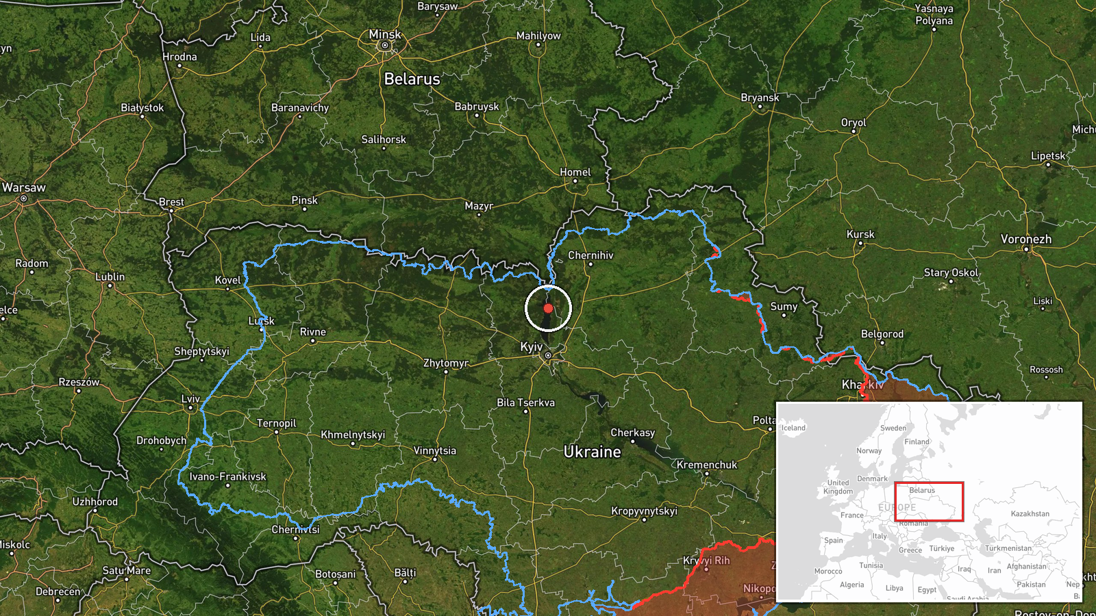
Ukrainian air monitoring channel @kpszsu reported on 21 October 2026 at 15:51 UTC that at least two Russian jet-powered Shahed drones, identified in the post as Geran-3, were passing over northern Kyiv Oblast and heading west. The original Ukrainian-language post refers to jet-type unmanned aircraft over the north of Kyiv and Zhytomyr regions on a westward course, so its wording describes a broader corridor than the single point tagged in the data. The report does not name a specific settlement, impact, damage or casualties. Its brevity and regional phrasing are typical of real-time air alerts issued while tracking is still underway.
Context and assessment
This report is one of several drone transit entries in the same region over roughly 30 hours. Earlier entries record a single drone near Kyiv Reservoir on the evening of 20 October, then drones heading toward Velyka Dymerka at 03:41 UTC, Hostomel at 04:46, and Dymer at 05:26 on 21 October. A further report at 08:57 described two or more drones moving from Chernihiv Oblast toward northern Kyiv Oblast. Taken together, the sequence shows movement from the northern border zone southward and westward across the approaches to the capital, which suggests drones entering along a northern corridor and crossing toward western Ukraine rather than converging on one aimpoint. Hostomel hosts an airfield, and Dymer is reported to host energy-related infrastructure, so repeated routing near these places may reflect a target set in the Kyiv region or simply a transit path used to reach distant targets. Because each entry records a transit rather than a strike, the pattern most plausibly indicates routing and monitoring activity, though it cannot confirm intended targets. Jet-powered Geran-3 variants are generally faster than earlier piston-engine Shaheds, which can shorten warning times for air defence units.
Sources and confidence
The item is a single Telegram post from @kpszsu, the Ukrainian Air Force monitoring channel, and no other source in the data corroborates it. The related entries come from the same channel and category, so they show a consistent pattern but do not independently confirm this specific report. The confidence score of 8.0 is relatively high for a single-source item, reflecting the channel's established role in real-time air alerts and the specific, time-stamped nature of the post. The rating is tempered by the absence of cross-reporting. Confidence would rise with corroboration from other Ukrainian official channels, independent monitors or regional authorities, and would fall if later updates contradicted the course, numbers or aircraft type.
Location
The location is recorded at region level, with coordinates near 50.995 N, 30.52 E. This places the marker in northern Kyiv Oblast close to the border with Chernihiv Oblast. Precision is marked region and confidence low, so the point is an approximate centre of a broad area rather than a settlement or facility. The terrain is mostly flat, partly forested Polissia-edge countryside drained by Dnipro tributaries, with the Kyiv Reservoir to the south. The original post also mentions Zhytomyr Oblast, which the coordinates do not reflect.
Related events nearby
- Ukrainian air monitoring: 2+ Russian jet-powered Shahed (Geran-3) drones from Chernihiv Oblast toward northern2026-10-21 08:57 UTC · Drone Transit · northern Kyiv Oblast, Ukraine
- Ukrainian air monitoring: 1 Russian jet-powered Shahed (Geran-3) drone passing Kyiv Reservoir, heading west.2026-10-20 18:44 UTC · Drone Transit · Kyiv Reservoir, Ukraine
- Ukrainian air monitoring: 1 Russian jet-powered Shahed (Geran-3) drone heading toward Dymer.2026-10-21 05:26 UTC · Drone Transit · Dymer, Ukraine
- Ukrainian air monitoring: 1 Russian jet-powered Shahed (Geran-3) drone heading toward Hostomel.2026-10-21 04:46 UTC · Drone Transit · Hostomel, Ukraine
- Ukrainian air monitoring: 1 Russian jet-powered Shahed (Geran-3) drone heading toward Velyka Dymerka.2026-10-21 03:41 UTC · Drone Transit · Velyka Dymerka, Ukraine
▶ View this event on the live map

Intel Mapper aggregates open-source reports from monitored Telegram and X channels, geolocates them, cross-checks duplicates across sources and assigns a confidence score. Entries are updated as new confirmations arrive. Read how we verify events.