Ukrainian monitors report 2+ Russian Shahed-type drones moving from northern Chernihiv toward Kyiv Oblast
What happened
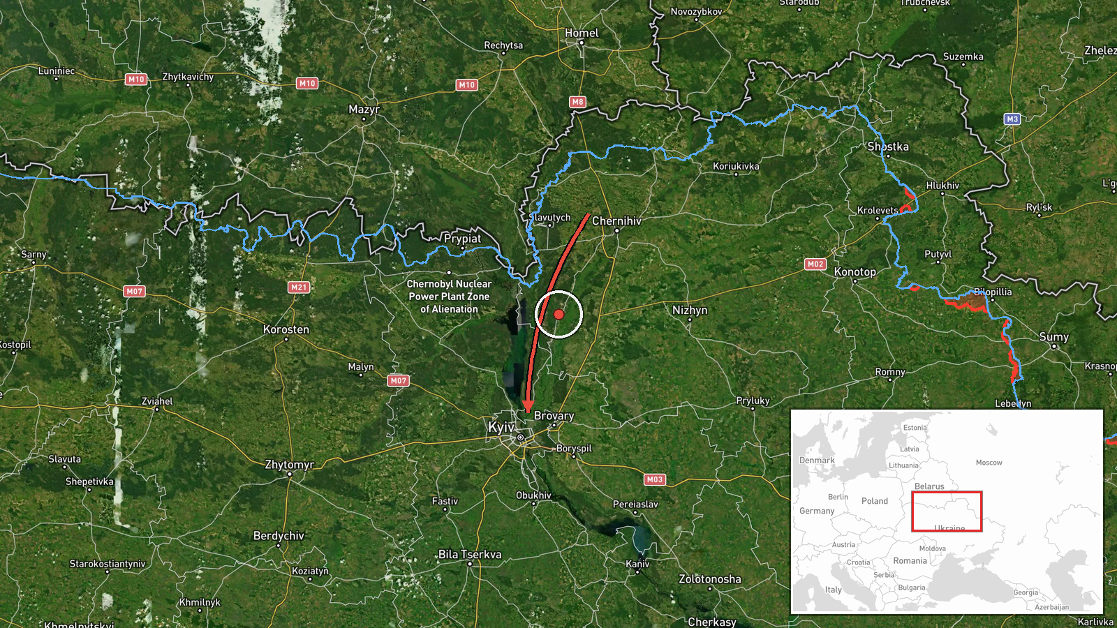
Ukrainian air monitoring channel @kpszsu reported on Telegram that a new group of unmanned aerial vehicles had been detected in northern Chernihiv Oblast, tracking along the border with Belarus in the direction of Kyiv Oblast. The post, timestamped 23 October 2026 at 00:18 UTC, described the group as a new BpLA (unmanned aircraft) formation and did not specify a precise number, so the event summary's count of 2 or more reflects that ambiguity. The original wording was brief and did not give coordinates, altitudes, or any impact information. The report is attributed to Russia in the event record, based on the identification of Shahed-type systems in the broader sequence of transit reports. No casualties, damage, or interceptions were stated in the source text.
Context and assessment
Northern Chernihiv and the Belarus border corridor have repeatedly served as a transit route for Russian long-range drones heading toward central Ukraine and the capital region. The related events show a sustained pattern over roughly fifteen hours on 22 and 23 October 2026. Monitoring posts logged single jet-powered Shahed-type drones (described as Geran-3 in the reports) passing Chabany, Chernihiv, and Zhashkiv, then over Kyiv itself, with a further single drone heading toward Kyiv city shortly after midnight. Taken together, these reports suggest a rolling series of separate tracks rather than one large raid, which may indicate launches staggered over time or drones routed to probe air defenses around the capital. Kyiv Oblast is a high-value target area containing government, energy, and transport infrastructure, so repeated approaches of this kind are operationally significant for air defense allocation. Because the new group was reported at the start of a fresh track, it may represent the next wave of a continuing campaign, though the source does not confirm onward targets.
Sources and confidence
This event rests on a single Telegram channel, @kpszsu, which is the Ukrainian air force-linked monitoring account and typically reports ahead of official statements. No independent outlet in the dataset cross-confirmed the group's count, route, or timing, so the confidence score of 8.0 reflects a low score for a single, non-corroborated source. The score is held down by the imprecise count, the absence of coordinates, and the lack of follow-up reporting. Confidence would rise with corroboration from Ukrainian air force statements, regional military administrations, or independent open-source trackers showing matching flight paths. It would fall if subsequent updates reclassify the tracks as false alarms or misidentified objects.
Location
The location is recorded as Kyiv Oblast at region level, with a central approximate coordinate near 50.45 N, 30.52 E. The source named northern Chernihiv Oblast as the origin and the Kyiv direction as the destination, so the pin does not mark a settlement or facility. The area lies in the flat, forested terrain of the Dnipro basin, with the Belarus border to the north and the Dnipro river valley to the east. Kyiv city and its surrounding suburbs sit within or near this approximate point.
Related events nearby
- Ukrainian air monitoring: 1 Russian Shahed-type drone heading toward Kyiv.2026-10-23 00:19 UTC · Drone Transit · Kyiv, Ukraine
- Ukrainian air monitoring: 1 Russian jet-powered Shahed (Geran-3) drone passing Zhashkiv, heading toward Kyiv O2026-10-22 17:00 UTC · Drone Transit · Kyiv Oblast, Ukraine
- Ukrainian air monitoring: 1 Russian jet-powered Shahed (Geran-3) drone passing Chernihiv, heading toward Kyiv 2026-10-22 16:59 UTC · Drone Transit · Kyiv Oblast, Ukraine
- Ukrainian air monitoring: 1 Russian jet-powered Shahed (Geran-3) drone passing Chabany, heading toward Kyiv.2026-10-22 08:48 UTC · Drone Transit · Kyiv, Ukraine
- Ukrainian air monitoring: 1 Russian jet-powered Shahed (Geran-3) drone over Kyiv.2026-10-22 08:27 UTC · Drone Transit · Kyiv, Ukraine
▶ View this event on the live map

Intel Mapper aggregates open-source reports from monitored Telegram and X channels, geolocates them, cross-checks duplicates across sources and assigns a confidence score. Entries are updated as new confirmations arrive. Read how we verify events.