Ukrainian air monitoring reports jet-powered Geran-3 drone heading toward Poltava
What happened
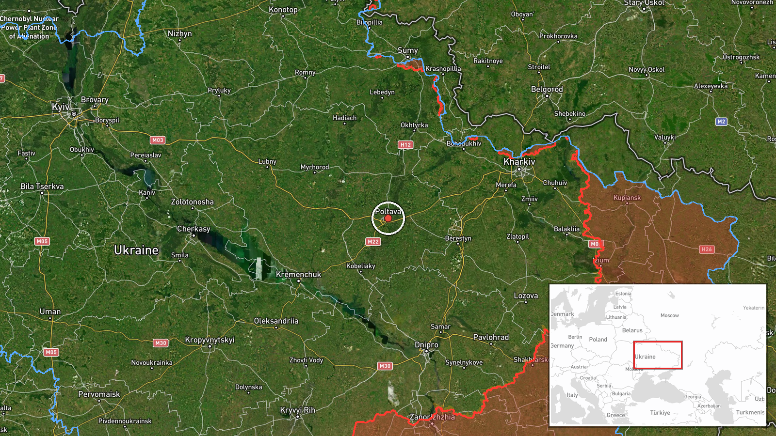
Ukraine's air monitoring channel on Telegram, @kpszsu, reported at 05:54 UTC on 23 October 2026 that one Russian jet-powered Shahed, identified as a Geran-3, was heading toward Poltava. The original Ukrainian post is brief, describing a jet-type unmanned aerial vehicle approaching Poltava from the east, in the shorthand format common to the channel's alerts. The report gives no impact location, no damage assessment, and no casualty information. It does not say whether the drone was intercepted or reached the city. The event is classed as a drone transit rather than a confirmed strike. Its timing falls within a cluster of Russian aerial activity across central and northeastern Ukraine during the same night and early morning, including multiple Shahed-type drones over Kharkiv.
Context and assessment
Poltava is a regional centre in central Ukraine on the Vorskla River, and it hosts military aviation infrastructure, which is widely known and helps explain why air alerts there recur. The related events show a pattern. At about 00:20 UTC the same day, a Geran-3 was reported passing Poltava heading west. The previous morning, at 08:17 UTC on 22 October, monitoring reported two or more Banderol mini cruise missiles heading toward the city. Taken together, these suggest repeated activity over the Poltava area across roughly a day, rather than a single isolated launch. Reports from Kharkiv and Sumy in the same window, including Shahed-type drones over Kharkiv at 03:13 UTC, a guided glide bomb over Kharkiv Oblast at 00:19 UTC, and artillery and airstrikes in Sumy Oblast, indicate Russian long-range and tactical pressure spread across the north-east and east. Operationally, a jet-powered Shahed moving toward a city already targeted by other munition types could be aimed at saturating air defences, forcing interceptor expenditure, or striking energy or military sites. The data alone cannot establish which.
Sources and confidence
Only one source is attached to this event: the Telegram channel @kpszsu, the Ukrainian Air Force's official monitoring feed. No independent cross-confirmation was available at the time of writing, and the entry has not been corrected. The confidence score of 8.0 reflects an official, typically rapid source with a clear time and place, offset by single-channel status and the absence of corroboration. Confidence would rise with reports from additional outlets, official statements on interception or impact, or local authority confirmation. It would fall if later updates changed the track, reclassified the event, or showed the drone on a different path.
Location
The location is recorded at settlement level, with Poltava city placed at approximately 49.59 N, 34.55 E, and location confidence rated high. The coordinates correspond to the city as a whole, since the source names no specific facility. Poltava lies in central Ukraine on the Vorskla River, in a largely flat landscape of river valleys, farmland and rail and road routes. The report's approach from the east makes the eastern approaches to the city the relevant direction.
Related events nearby
- Ukrainian air monitoring: 2+ Russian jet-powered Shahed (Geran-3) drones heading toward Poltava.2026-10-23 06:14 UTC · Drone Transit · Poltava, Ukraine
- Ukrainian air monitoring: 1 Russian jet-powered Shahed (Geran-3) drone passing Poltava, heading west.2026-10-23 00:20 UTC · Drone Transit · Poltava, Ukraine
- Ukrainian air monitoring: 2+ Russian Banderol mini cruise missiles heading toward Poltava.2026-10-22 08:17 UTC · Cruise Missile · Poltava, Ukraine
- Russian artillery shelled seven Sumy Oblast settlements, and airstrikes hit Lužky and Khotin; no casualty figu2026-10-23 05:02 UTC · Artillery · Lužky, Sumy Oblast, Ukraine
- Ukrainian air monitoring: 2+ Russian jet-powered Shahed (Geran-3) drones over Kharkiv.2026-10-23 03:13 UTC · Drone Transit · Kharkiv, Ukraine
▶ View this event on the live map

Intel Mapper aggregates open-source reports from monitored Telegram and X channels, geolocates them, cross-checks duplicates across sources and assigns a confidence score. Entries are updated as new confirmations arrive. Read how we verify events.