Ukrainian air monitoring reports two or more jet-powered Shahed drones heading toward Poltava
What happened
Ukrainian air monitoring, relayed through the Telegram channel @kpszsu, reported at about 06:14 UTC on 23 October 2026 that two or more Russian jet-powered Shahed (Geran-3) drones were heading toward Poltava in central Ukraine. The original Ukrainian-language post, headed Poltavshchyna, grouped the threat with Poltava, Lubny and Karlivka and was phrased as a warning about direction of flight rather than confirmed impacts. The report does not describe any detonation, damage, casualties or interception. The event is recorded as a Drone Transit, meaning it tracks aerial movement rather than a confirmed strike on a specific target.
Context and assessment
Poltava is the administrative centre of Poltava Oblast and a regional hub for road, rail and energy infrastructure, so repeated air alerts over the city are significant even when no impact is reported. This item is one of several linked reports from the same window. At 00:20 UTC a single Geran-3 was reported passing Poltava heading west, and at 05:54 UTC one was reported heading toward the city. On 22 October at 08:17 UTC, two or more Banderol mini cruise missiles were reported heading toward Poltava. The count has risen from one to two or more over roughly six hours, which may suggest a sustained or intensifying approach rather than an isolated transit. Earlier on 23 October, Shaheds were also reported over Kharkiv, and artillery and airstrikes were reported in Sumy Oblast, suggesting activity across several northern and eastern axes. Operationally, repeated tracks toward the same city could reflect efforts to test air defence coverage, to saturate defences, or to route through a corridor toward other targets. These readings are inferences and the available data does not confirm intent.
Sources and confidence
The item rests on a single channel, @kpszsu, which is the Ukrainian Air Force's official monitoring account, and no independent outlet has been listed as corroborating it. The confidence score of 8.0 is relatively high for a single source because the channel is an official military monitoring feed that has been consistent in the surrounding reports, and the event is not marked as corrected. It is not higher because nothing in the record independently confirms the track or any outcome. Confidence would rise with corroboration from another official air-alert channel, regional military administration statements, or reports of interceptions or impacts. It would fall if the channel later retracted or revised the warning, or if later reporting contradicted the track.
Location
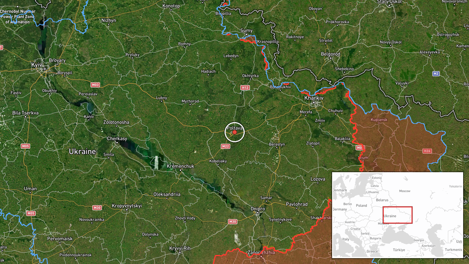
The location is recorded at settlement precision, placing the event at Poltava city with coordinates 49.59, 34.55, and the location confidence is high. Poltava lies on the Vorskla River in north-central Ukraine, in a largely flat landscape of steppe and forest-steppe with agricultural land and river valleys. Lubny and Karlivka, named in the original post, are also in Poltava Oblast but are not geolocated as separate points in this event.
Related events nearby
- Ukrainian air monitoring: 1 Russian jet-powered Shahed (Geran-3) drone heading toward Poltava.2026-10-23 05:54 UTC · Drone Transit · Poltava, Ukraine
- Ukrainian air monitoring: 1 Russian jet-powered Shahed (Geran-3) drone passing Poltava, heading west.2026-10-23 00:20 UTC · Drone Transit · Poltava, Ukraine
- Ukrainian air monitoring: 2+ Russian Banderol mini cruise missiles heading toward Poltava.2026-10-22 08:17 UTC · Cruise Missile · Poltava, Ukraine
- Russian artillery shelled seven Sumy Oblast settlements, and airstrikes hit Lužky and Khotin; no casualty figu2026-10-23 05:02 UTC · Artillery · Lužky, Sumy Oblast, Ukraine
- Ukrainian air monitoring: 1 Russian Shahed-type drone heading toward Kharkiv.2026-10-23 06:49 UTC · Drone Transit · Kharkiv, Ukraine
▶ View this event on the live map

Intel Mapper aggregates open-source reports from monitored Telegram and X channels, geolocates them, cross-checks duplicates across sources and assigns a confidence score. Entries are updated as new confirmations arrive. Read how we verify events.