Ukrainian air monitoring reports 2+ Russian jet-powered Shahed drones heading toward Slavutych
What happened
Ukrainian air monitoring channel Telegram (@kpszsu) reported on 23 October 2026 at 06:44 UTC that at least two Russian jet-powered Shahed (Geran-3) drones were heading toward Slavutych, a city in northern Ukraine. The original post, written in Ukrainian, describes jet-type unmanned aerial vehicles approaching Slavutych from the north, using the phrase 'Реактивні БпЛА на Славутич з півночі'. The report is a transit warning rather than a confirmed impact. It does not describe explosions, damage, casualties or interceptions. Attribution to Russia rests on the channel's identification of the drone type, which matches the Geran family used in long-range strikes. The event is logged as a single-source drone transit.
Context and assessment
Slavutych has appeared repeatedly in this monitoring window. Earlier on 22 October, the same channel reported 2+ Shahed-type drones heading toward the city at 07:15 UTC, and a jet-powered group heading toward it again at 09:31 UTC. Later that day, at 17:12 UTC, new jet-powered drones were tracked through the Chornobyl Exclusion Zone heading west. Around midnight on 23 October, a single jet-powered drone was reported passing Dobrianka, heading southwest. At 06:48 UTC, a further group of 2+ jet-powered drones was reported moving from Bryansk toward northern Chernihiv Oblast, only minutes after the Slavutych warning. Slavutych was built in 1986 to house workers displaced by the Chornobyl disaster, and its proximity to the exclusion zone makes it a recognizable waypoint on routes into northern Ukraine. Operationally, repeated tracks toward the same settlement over about a day may indicate routing toward several targets across the north, or decoy and saturation tactics. The data alone cannot distinguish between these. The shift to jet-powered variants is also notable, because they are faster and harder for mobile fire groups to engage than older piston-engine types.
Sources and confidence
The event rests on a single channel, Telegram @kpszsu, which is the Ukrainian air monitoring account. The data contains no independent second source for this report. Related reports in the same window come from the same channel, so they show consistency of pattern but do not provide separate confirmation. The confidence score of 8.0 reflects a credible monitoring channel with a consistent reporting record, offset by the absence of independent verification. Confidence would rise with corroboration from regional military administrations, radar or flight-tracking data, or wider press coverage. It would fall if the channel retracted the report, if subsequent tracks failed to appear, or if the drone type were later shown to be misidentified.
Location
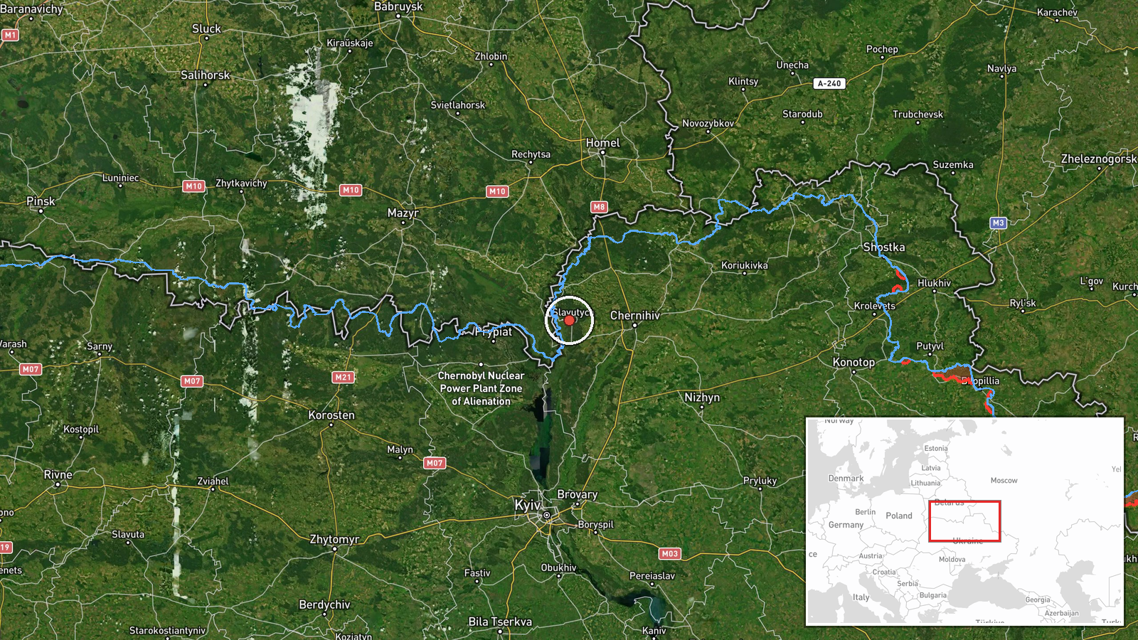
The location is recorded at settlement precision, with coordinates of 51.5225 N, 30.71806 E, and high location confidence. The point is derived from the settlement name Slavutych rather than a specific facility. Slavutych is a city in northern Ukraine, in Kyiv Oblast, close to the Belarus border. The Chornobyl Exclusion Zone lies to its south-west. The surrounding terrain is largely flat, with forest and the Desna river basin to the north-east.
Related events nearby
- Ukrainian air monitoring: 2+ Russian jet-powered Shahed (Geran-3) drones heading toward Slavutych.2026-10-22 09:31 UTC · Drone Transit · Slavutych, Ukraine
- Ukrainian air monitoring: 1 Russian jet-powered Shahed (Geran-3) drone from northern Chernihiv Oblast toward n2026-10-23 07:00 UTC · Drone Transit · northern Kyiv Oblast, Ukraine
- Ukrainian air monitoring: 1 Russian jet-powered Shahed (Geran-3) drone passing Dobrianka, heading southwest.2026-10-23 00:28 UTC · Drone Transit · Dobrianka, Ukraine
- Ukrainian air monitoring: new jet-powered Shahed (Geran-3) drones tracked through the Chornobyl Exclusion Zone2026-10-22 17:12 UTC · Drone Transit · Chornobyl Exclusion Zone, Ukraine
- Ukrainian air monitoring: 2+ Russian jet-powered Shahed (Geran-3) drones from Bryansk (Russia) toward northern2026-10-23 06:48 UTC · Drone Transit · northern Chernihiv Oblast, Ukraine
▶ View this event on the live map

Intel Mapper aggregates open-source reports from monitored Telegram and X channels, geolocates them, cross-checks duplicates across sources and assigns a confidence score. Entries are updated as new confirmations arrive. Read how we verify events.