Ukrainian air monitoring reports one Russian guided glide bomb heading toward Kherson Oblast
What happened
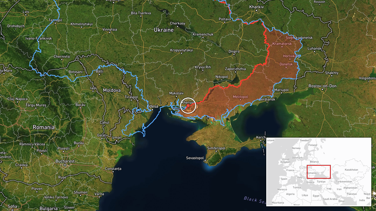
Ukrainian air monitoring, relayed through the Telegram channel @kpszsu, reported on 23 October 2026 at about 08:16 UTC that a single Russian guided glide bomb (KAB) was heading toward Kherson Oblast in southern Ukraine. The original post, written in Ukrainian, reads as a short warning that KABs were inbound to Kherson Oblast and the city of Kherson, using the phrase 'КАБи на Херсонщину/Херсон!'. The post does not confirm impact, casualties, or the specific target. A follow-up alert about the same threat was logged at 08:26 UTC with the same wording. Because the report is an advance warning of a munition in flight, it describes an intended or ongoing attack rather than a confirmed strike, and no outcome is stated in the source.
Context and assessment
Kherson Oblast sits on the Dnipro's lower reaches, and the city of Kherson, on the west bank, has been within reach of Russian glide bombs and artillery for much of the war, which makes repeated air warnings for the area routine rather than unusual. The same morning's monitoring also logged several Shahed-type drones moving through the region and neighbouring Mykolaiv Oblast, including a jet-powered Geran-3 variant, at 04:44, 06:31, 06:47 and 17:01 UTC on the previous day. Taken together, these entries point to a sustained, multi-axis pattern in which drones are used to stretch air defences and track movement, while glide bombs are launched against front-adjacent and urban targets in the south. Glide bombs are unpowered or lightly powered munitions released from aircraft at standoff range, so a single KAB warning typically signals an aircraft operating within reach of the line, not necessarily a deep strike. The pattern may suggest continued pressure on the Kherson axis, though the data alone cannot establish intent or target selection.
Sources and confidence
The report rests on a single Telegram channel, @kpszsu, which is the Ukrainian Air Force-linked monitoring account that typically posts warnings of this kind. No second outlet, official statement, or independent imagery confirms the munition or its arrival in the data provided. The confidence score of 8.0 reflects a credible official-linked source with a clear, specific message, but it is held below the top range because it is single-sourced, is a warning rather than a confirmed impact, and carries no independent verification. Confidence would rise with corroboration from a second Ukrainian military or regional channel, a local administration statement naming an impact site, or verified imagery. It would fall if a follow-up post retracted or downgraded the warning.
Location
The location is recorded at region level, Kherson Oblast, with coordinates of 46.64 N, 32.61 E, which fall within the oblast rather than at a specific settlement or facility, so the location confidence is low. The city of Kherson lies on the Dnipro's right or western bank, and the oblast's landscape is largely flat steppe with irrigation channels, lagoons and the wider Dnipro delta to the south. The Kakhovka reservoir area, much of it drained after the 2023 dam collapse, lies to the east and northeast, and the Black Sea coast is nearby to the south.
Related events nearby
- Ukrainian air monitoring: 1 Russian guided glide bomb (KAB) heading toward Kherson Oblast.2026-10-23 08:26 UTC · Airstrike · Kherson Oblast, Ukraine
- Ukrainian air monitoring: 1 Russian Shahed-type drone passing Kherson Oblast, heading north.2026-10-23 04:44 UTC · Drone Transit · Kherson Oblast, Ukraine
- Ukrainian air monitoring: 1 Russian jet-powered Shahed (Geran-3) drone passing southern Mykolaiv Oblast, headi2026-10-23 06:31 UTC · Drone Transit · southern Mykolaiv Oblast, Ukraine
- Ukrainian air monitoring: 1 Russian jet-powered Shahed (Geran-3) drone passing Mykolaiv Oblast, heading northw2026-10-23 06:47 UTC · Drone Transit · Mykolaiv Oblast, Ukraine
- Ukrainian air monitoring: 1 Russian jet-powered Shahed (Geran-3) drone heading toward Mykolaiv.2026-10-22 17:01 UTC · Drone Transit · Mykolaiv, Ukraine
▶ View this event on the live map

Intel Mapper aggregates open-source reports from monitored Telegram and X channels, geolocates them, cross-checks duplicates across sources and assigns a confidence score. Entries are updated as new confirmations arrive. Read how we verify events.