Jet-powered Geran-3 drone reported in transit over Mykolaiv Oblast, heading northwest
What happened
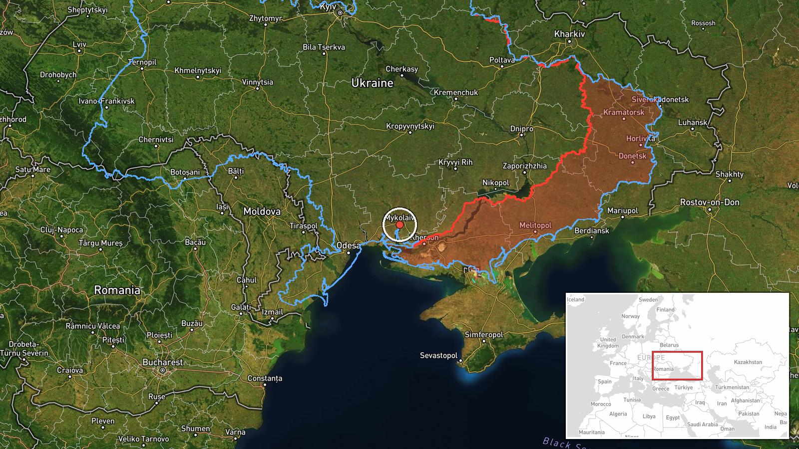
Ukraine's Air Force monitoring channel on Telegram, @kpszsu, reported on 23 October 2026 at 06:47 UTC that one Russian jet-powered Shahed, identified as a Geran-3, was passing near Voznesensk in Mykolaiv Oblast and heading northwest. The original post is written in Ukrainian. It uses the phrase "реактивний БпЛА," meaning jet-powered unmanned aerial vehicle, followed by a directional arrow. The post does not mention explosions, damage, casualties or interception. The event is therefore recorded as a drone transit, meaning an aircraft sighted in flight, not a confirmed strike. The place name is taken from the report's wording and the entry is currently based on that single post.
Context and assessment
Mykolaiv Oblast sits on Ukraine's southern coast, along the Southern Bug and the Dnipro-Bug estuary, and lies on the air corridor between the Black Sea and the Odesa and Kherson fronts. Its cities, including Mykolaiv itself, have been targets of Russian long-range drone and missile attacks, which is why repeated drone sightings in the oblast draw close attention. The related events show a dense sequence over roughly a day. A drone was reported coming from the Black Sea toward Ochakiv on 22 October, then passing Berezanka heading northwest, then heading toward Mykolaiv city in the evening. Earlier, on the morning of 22 October, another Geran-3 was reported passing the Mykolaiv district heading north, and a further sighting came in southern Mykolaiv Oblast just before the current report. The pattern of northbound and northwestbound tracks through the same area suggests either repeated launches along a coastal approach or several aircraft following similar routes. Jet-powered Geran-3 variants are generally assessed to be faster and harder to intercept than piston-engine Shaheds, so tracking them across successive reports is a sign of ongoing activity rather than a single incident. The reports alone do not show whether these drones were heading for specific targets, were being used for reconnaissance, or were diverted.
Sources and confidence
The entry rests on one source: a single Telegram post from @kpszsu, the Ukrainian Air Force's monitoring account. No other outlet or independent channel is listed as having reported this transit, so cross-confirmation is absent. The confidence score of 8.0 reflects an official military source with a consistent history of drone-tracking posts, which lends credibility to the sighting itself. It is held below the maximum because the post is unverified by a second source, gives no coordinates and carries only a region-level location. Confidence would rise with independent flight-tracking data, corroborating posts from regional military administrations, or reports of an impact or interception near the stated track. It would fall if later reports contradicted the direction of travel or placed the aircraft elsewhere.
Location
The coordinates attached to this entry, 46.97 N and 32.00 E, are a region-level approximation for Mykolaiv Oblast and do not mark Voznesensk or any exact point on the track. Voznesensk is a town on the Southern Bug in the north-western part of the oblast, and the report places the drone near it. The surrounding area is mostly flat steppe and farmland, crossed by river valleys and reservoirs. The Southern Bug and its estuary, together with the Black Sea coast to the south, form the main geographic features that shape drone routes in this area.
Related events nearby
- Ukrainian air monitoring: 1 Russian jet-powered Shahed (Geran-3) drone heading toward Mykolaiv.2026-10-22 17:01 UTC · Drone Transit · Mykolaiv, Ukraine
- Ukrainian air monitoring: 1 Russian jet-powered Shahed (Geran-3) drone passing southern Mykolaiv Oblast, headi2026-10-23 06:31 UTC · Drone Transit · southern Mykolaiv Oblast, Ukraine
- Ukrainian air monitoring: 1 Russian jet-powered Shahed (Geran-3) drone passing Berezanka, heading northwest.2026-10-22 16:58 UTC · Drone Transit · Berezanka, Ukraine
- Ukrainian air monitoring: 1 Russian jet-powered Shahed (Geran-3) drone from Black Sea toward Ochakiv.2026-10-22 09:35 UTC · Drone Transit · Ochakiv, Ukraine
- Ukrainian air monitoring: 1 Russian jet-powered Shahed (Geran-3) drone from Black Sea toward Ochakiv.2026-10-22 08:35 UTC · Drone Transit · Ochakiv, Ukraine
▶ View this event on the live map

Intel Mapper aggregates open-source reports from monitored Telegram and X channels, geolocates them, cross-checks duplicates across sources and assigns a confidence score. Entries are updated as new confirmations arrive. Read how we verify events.