Single jet-powered Shahed (Geran-3) drone reported heading toward Mykolaiv from the south
What happened
A Ukrainian air monitoring alert posted on Telegram by @kpszsu reported one Russian jet-powered Shahed drone, identified in the post as a Geran-3, on a course toward Mykolaiv from the south. The message is timestamped 17:01 UTC on 22 October 2026. The original Ukrainian wording, 'Реактивний БпЛА курсом на Миколаїв з півдня', translates roughly as a jet-powered UAV heading to Mykolaiv from the south. The post is brief and does not describe impact, damage, casualties, interception, or any detonation. It reports an in-flight track rather than a confirmed strike, and reporting so far covers transit only.
Context and assessment
Mykolaiv is a major port and shipbuilding city on the Southern Bug estuary, close enough to the Black Sea that it has been a recurring focus of Russian long-range drone and missile activity since 2022. Its port, industrial sites and energy infrastructure make it a plausible target for sustained attention. The related events on the same day fit a broader pattern. Earlier that morning, at 07:15 UTC, a single Geran-3 was reported passing through the Mykolaiv district heading north. At 08:35 and 09:35, single drones were reported moving from the Black Sea toward Ochakiv, a coastal town to the southwest. At 16:58, one drone was reported passing Berezanka heading northwest, and in the same minute two or more drones were reported crossing southern Kirovohrad Oblast heading west. Taken together, these entries describe repeated single-drone tracks running from the sea inland across several southern oblasts through the day. Operationally, this may indicate route probing, sustained pressure designed to stretch air defence attention, or a broader package whose other elements are not yet visible. A lone drone on this track could also be a decoy or a scout. The duplicate timestamps and overlapping locations suggest some entries may describe the same or closely linked tracks, so the daily count should be read cautiously.
Sources and confidence
Only one source is recorded for this event: the Telegram channel @kpszsu, which Ukrainian air monitoring alerts are commonly published through. The related events are consistent in type and wording, but the dataset does not record independent cross-confirmation from a second channel, official statement, or media outlet for this specific track. The confidence score of 8.0 reflects the specific aircraft identification, the timestamped and directional nature of the alert, and its consistency with the surrounding daily track sequence, offset by the single-source basis and the absence of impact or interception reporting. Confidence would rise with confirmation from a regional military administration, a second monitoring channel, or reports of interception or impact in Mykolaiv. It would fall with a correction, a change in drone type, or evidence that the track was misattributed.
Location
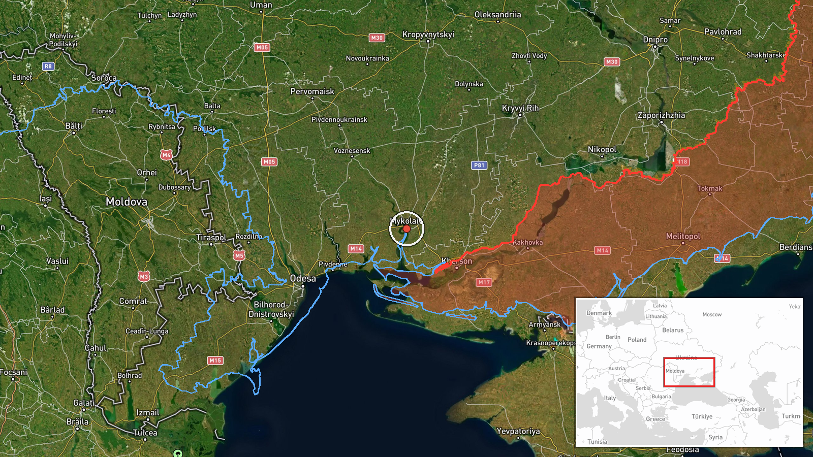
The location is recorded at settlement precision, with coordinates of approximately 46.97 N, 32.00 E, placing the marker in the city of Mykolaiv. Location confidence is rated high because the alert names the city directly. Mykolaiv lies on the Southern Bug River near its estuary, roughly 60 kilometres from the Black Sea coast. Nearby settlements named in related events, including Ochakiv and Berezanka, lie to the south and west, along the coastal and estuary approaches.
Related events nearby
- Ukrainian air monitoring: 1 Russian jet-powered Shahed (Geran-3) drone passing Mykolaiv district, heading nort2026-10-22 07:15 UTC · Drone Transit · Mykolaiv district, Ukraine
- Ukrainian air monitoring: 1 Russian jet-powered Shahed (Geran-3) drone passing Berezanka, heading northwest.2026-10-22 16:58 UTC · Drone Transit · Berezanka, Ukraine
- Ukrainian air monitoring: 1 Russian jet-powered Shahed (Geran-3) drone from Black Sea toward Ochakiv.2026-10-22 09:35 UTC · Drone Transit · Ochakiv, Ukraine
- Ukrainian air monitoring: 1 Russian jet-powered Shahed (Geran-3) drone from Black Sea toward Ochakiv.2026-10-22 08:35 UTC · Drone Transit · Ochakiv, Ukraine
- Ukrainian air monitoring: 2+ Russian jet-powered Shahed (Geran-3) drones passing southern Kirovohrad Oblast, h2026-10-22 16:58 UTC · Drone Transit · southern Kirovohrad Oblast, Ukraine
▶ View this event on the live map

Intel Mapper aggregates open-source reports from monitored Telegram and X channels, geolocates them, cross-checks duplicates across sources and assigns a confidence score. Entries are updated as new confirmations arrive. Read how we verify events.