Jet-powered Shahed drones reported heading west across southern Kirovohrad Oblast, Ukraine
What happened
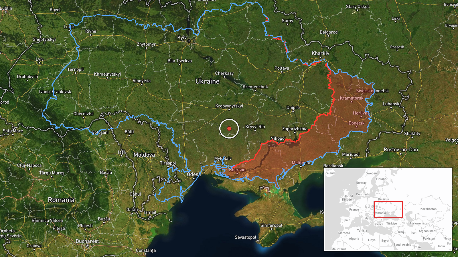
On 22 October 2026 at about 16:58 UTC, a Telegram channel run by Ukrainian air monitoring (@kpszsu) reported that jet-powered Russian Shahed (Geran-3) drones were moving through Kirovohrad Oblast. The channel's original Ukrainian wording refers to jet-type drones in the north and south of the oblast, on a western course. The English summary narrows the report to at least two drones passing the southern part of the region. The post gives no impact, damage, casualty, or launch-site details. The report is a transit notice based on air monitoring. The coordinates reflect a regional-level position rather than a precise track point, so the exact route cannot be confirmed from this single report.
Context and assessment
The location sits on a corridor the Russian drone campaign has used repeatedly in recent days. Earlier reports from 21 October describe jet-powered Shahed drones heading toward Kryvyi Rih, then tracked south of Dnipro and north of Kropyvnytskyi on a westward course. On 22 October, a single drone was reported near Oleksandriya, and another was reported passing the Mykolaiv district heading north. Taken together, these reports show a sequence of drones crossing central and southern Ukraine on routes that generally run west or north-west. Such patterns often point to long-range strike packages being routed around air defence concentrations, or to drones attacking targets in western or northern Ukraine. Transit reports alone rarely show the intended target, so these inferences remain tentative. The same window also included a ballistic missile warning, reportedly launched from Voronezh in Russia, which was lifted at 19:59 on 21 October.
Sources and confidence
The report comes from one channel, Telegram @kpszsu, and no second outlet or official statement in the provided data confirms it. The confidence score of 8.0 reflects the internal consistency of the report with the related Geran-3 transit sequence over the previous day, not independent verification. Confidence would rise with corroboration from Ukrainian Air Force statements, regional military administration updates, or reports of drones being shot down or falling in Kirovohrad Oblast. It would fall if later reports place the drones outside the region or contradict the western heading. Because the channel gives no location finer than the oblast, the record should be read as a transit notice rather than a confirmed route.
Location
The location is assigned at region level for southern Kirovohrad Oblast, with a low location confidence. The coordinates are a broad approximation rather than a settlement or facility. The area is mostly flat steppe farmland in central-southern Ukraine, with the Dnipro basin to the east and the Southern Buh and Inhulets river systems to the west and south. The oblast capital, Kropyvnytskyi, lies to the north, which is why the report's northern and southern references are relevant to the drone track.
Related events nearby
- Ukrainian air monitoring: 2+ Russian jet-powered Shahed (Geran-3) drones heading toward Kryvyi Rih.2026-10-21 18:04 UTC · Drone Transit · Kryvyi Rih, Ukraine
- Ukrainian air monitoring: jet-powered Shahed (Geran-3) drones tracked south of Dnipro and north of Kropyvnytsk2026-10-21 18:50 UTC · Drone Transit · Southern Dnipropetrovsk Oblast, Ukraine
- Ukrainian air monitoring: 1 Russian jet-powered Shahed (Geran-3) drone heading toward Oleksandriya.2026-10-22 07:16 UTC · Drone Transit · Oleksandriya, Ukraine
- Ukrainian air monitoring: 1 Russian jet-powered Shahed (Geran-3) drone passing Mykolaiv district, heading nort2026-10-22 07:15 UTC · Drone Transit · Mykolaiv district, Ukraine
- Ukrainian air monitoring: 1 Russian jet-powered Shahed (Geran-3) drone heading toward Mykolaiv.2026-10-22 17:01 UTC · Drone Transit · Mykolaiv, Ukraine
▶ View this event on the live map

Intel Mapper aggregates open-source reports from monitored Telegram and X channels, geolocates them, cross-checks duplicates across sources and assigns a confidence score. Entries are updated as new confirmations arrive. Read how we verify events.