Single Russian jet-powered Shahed drone reported heading toward Oleksandriya, Kirovohrad Oblast
What happened
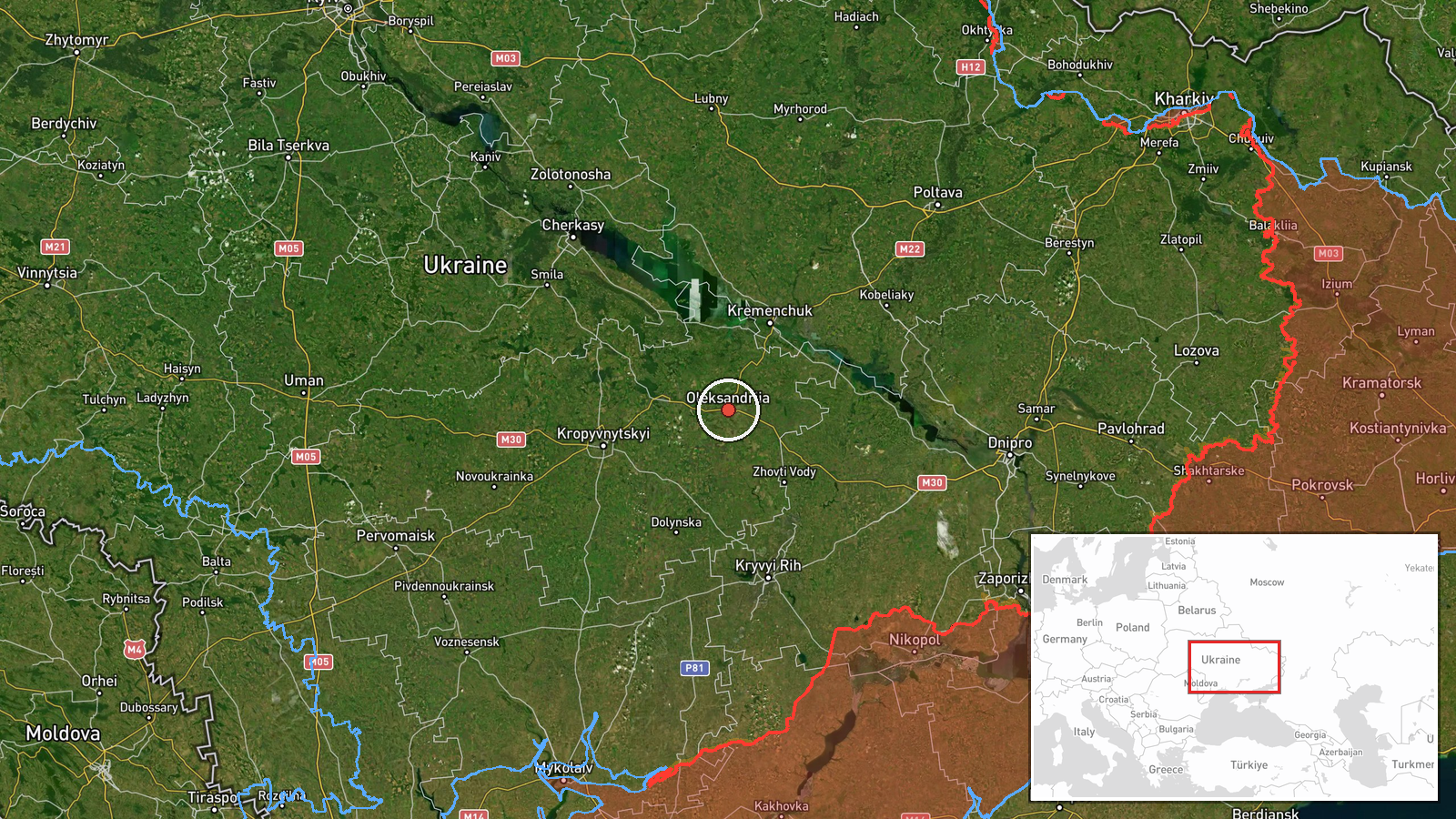
Ukrainian air monitoring channel Telegram (@kpszsu) reported on 22 October 2026 at about 07:16 UTC that one Russian jet-powered Shahed (Geran-3) drone was heading toward Oleksandriya in Kirovohrad Oblast, central Ukraine. The original post, written in Ukrainian, uses the term reactive UAV (реактивний БпЛА) and names the town directly, without describing impact, damage, or casualties. The report is a transit notice, meaning it tracks a drone's movement rather than confirming a strike. It is currently reported by a single channel, and no independent confirmation of the drone's path or any outcome appeared in the provided data.
Context and assessment
Oleksandriya lies in the Kirovohrad region, a central Ukrainian area that has received repeated drone traffic in the related reports. Over the preceding day, the Kremenchuk, Kropyvnytskyi and wider Kirovohrad Oblast corridor appears several times, with drones moving from Poltava, Mykolaiv and western Dnipropetrovsk toward the same administrative area. This pattern suggests a route that crosses central Ukraine rather than a single targeted location. Geran-3 jet-powered variants are faster and harder to intercept than earlier propeller-driven Shaheds, so tracking them along multiple axes gives air defense units less time to respond. Operationally, the sequence may indicate routing toward a set of targets further west or south, or simply the drones' transit over the region. The data does not establish which target, if any, was intended. Caution is warranted about linking this single report to a specific objective.
Sources and confidence
The report comes from one Telegram channel, @kpszsu, which is linked to Ukrainian air monitoring and is generally regarded as a timely source for drone movements. No second channel or outlet in the provided data reports the same track, so cross-confirmation is absent. The confidence score of 8.0 reflects the channel's operational role and the specificity of the town name, offset by the single-source status and the lack of outcome reporting. Confidence would rise if air force statements, regional military administration posts, or local officials confirmed the track or reported an impact. It would fall if the drone was later reported as shot down elsewhere or if the town name was revised.
Location
The location is recorded at settlement level for Oleksandriya, Ukraine, with coordinates of approximately 48.67 north and 33.12 east, and location confidence rated high. The coordinates mark the town rather than a specific facility, since the source names only the settlement. Oleksandriya sits in the Kirovohrad Oblast on the Ingul river plain of central Ukraine, a largely agricultural landscape of open fields and river valleys. The Kirovohrad area lies between the Dnipro and Southern Bug basins and is a transit zone for drone routes toward western and southern Ukraine.
Related events nearby
- Ukrainian air monitoring: one Russian jet-powered Shahed (Geran-3) drone tracked north of Kremenchuk, heading 2026-10-21 14:03 UTC · Drone Transit · North of Kremenchuk, Poltava Oblast, Ukraine
- Ukrainian air monitoring: 1 Russian jet-powered Shahed (Geran-3) drone heading toward Kropyvnytskyi.2026-10-21 16:03 UTC · Drone Transit · Kropyvnytskyi, Ukraine
- Ukrainian air monitoring: 1 Russian jet-powered Shahed (Geran-3) drone heading toward Kropyvnytskyi.2026-10-21 12:08 UTC · Drone Transit · Kropyvnytskyi, Ukraine
- Ukrainian air monitoring: 2+ Russian jet-powered Shahed (Geran-3) drones from western Dnipropetrovsk Oblast to2026-10-21 16:40 UTC · Drone Transit · Kirovohrad Oblast, Ukraine
- Ukrainian air monitoring: 1 Russian jet-powered Shahed (Geran-3) drone from northern Mykolaiv Oblast toward Ki2026-10-21 13:06 UTC · Drone Transit · Kirovohrad Oblast, Ukraine
▶ View this event on the live map

Intel Mapper aggregates open-source reports from monitored Telegram and X channels, geolocates them, cross-checks duplicates across sources and assigns a confidence score. Entries are updated as new confirmations arrive. Read how we verify events.