Single jet-powered Shahed drone reported tracked north of Kremenchuk, heading west, per Ukrainian monitoring
What happened
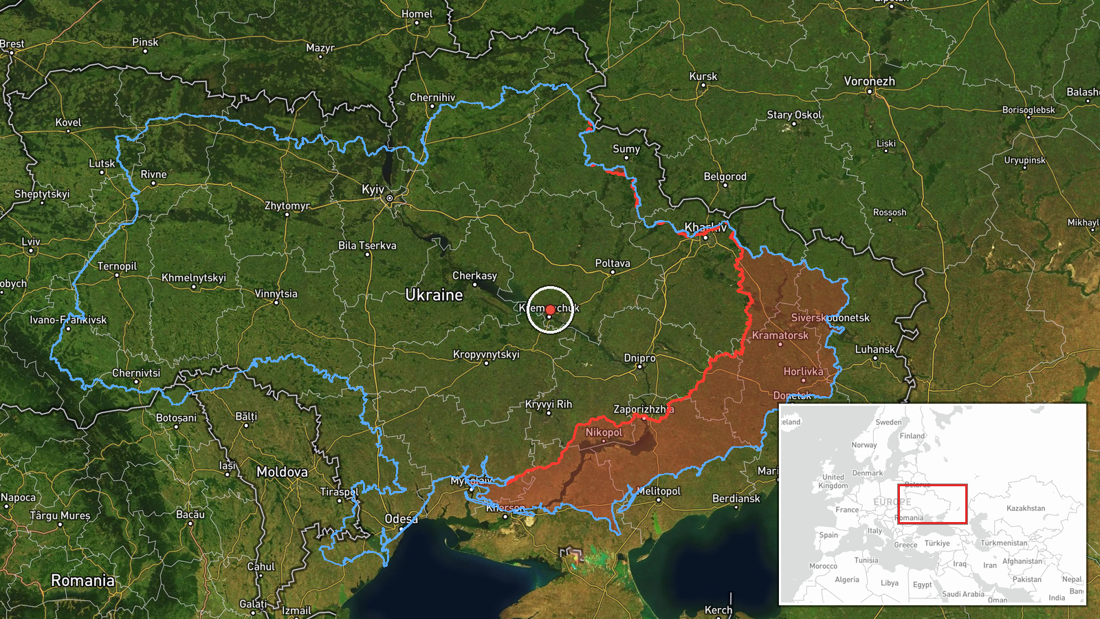
A Ukrainian air monitoring channel, Telegram @kpszsu, reported on 21 October 2026 at about 14:03 UTC that one Russian jet-powered Shahed, identified in the report as a Geran-3, was tracked north of Kremenchuk in Poltava Oblast on a westerly course. The original post is brief, describing a jet drone (реактивний БпЛА) moving on a western heading, and it does not state any impact, casualties, or the drone's intended target. The report is a transit notification rather than a strike report. Because it comes from a single channel and no second source is listed, the details should be treated as provisional. The event is recorded as a drone transit with low location precision.
Context and assessment
Kremenchuk sits on the Dnipro in central Ukraine, a city with a large industrial base and a major hydroelectric reservoir nearby, which makes it a recurring point on Russian long-range drone routes. The related events show a sustained pattern over the previous day and a half: a single Geran-3 heading toward Kremenchuk on 20 October, multiple drones passing the city on the morning of 21 October, and repeated single-drone tracks toward Semenivka, a settlement further along the same corridor. A group of two or more drones was also reported moving from Dnipropetrovsk Oblast toward Novi Sanzhary earlier on 20 October. Taken together, the sequence suggests a steady flow of jet-powered Shaheds moving through central Ukraine rather than a single isolated launch. Jet-powered variants are generally faster than the older piston-engine Shaheds, which can shorten warning windows. A lone drone on a westward track may be part of a wider raid, a rerouted unit, or a drone that has already passed its aim point, and the report alone cannot distinguish these possibilities.
Sources and confidence
The report comes from one Ukrainian Telegram channel, @kpszsu, and no independent outlet or second monitoring source is listed for this entry. Confidence is scored at 8 out of 10, which reflects the official-style origin of the channel and the consistency of the wider Shahed transit pattern in related reports, but it is held below the top range because the entry is single-sourced and the wording is terse. Confidence would rise with corroboration from another air monitoring feed, regional military administration statements, or imagery of the flight path. It would fall if later reporting contradicts the track or identifies the drone as a decoy or a different airframe.
Location
The location is recorded as north of Kremenchuk in Poltava Oblast, with a region-level precision flag and low location confidence. The coordinates sit at about 49.15 north, 33.42 east, a broad approximate point rather than a settlement or facility, since the source gives only a directional reference. The terrain is largely flat steppe and farmland drained by the Dnipro system, with the river and its reservoir lying to the southwest of the city. Major routes and rail lines through the area make the corridor easy to follow for monitoring but also mean the drone's exact position is uncertain.
Related events nearby
- Ukrainian air monitoring: 2+ Russian jet-powered Shahed (Geran-3) drones passing Kremenchuk, heading west.2026-10-21 06:16 UTC · Drone Transit · Kremenchuk, Ukraine
- Ukrainian air monitoring: 1 Russian jet-powered Shahed (Geran-3) drone heading toward Kremenchuk.2026-10-20 19:06 UTC · Drone Transit · Kremenchuk, Ukraine
- Ukrainian air monitoring: 1 Russian jet-powered Shahed (Geran-3) drone heading toward Semenivka.2026-10-21 08:59 UTC · Drone Transit · Semenivka, Ukraine
- Ukrainian air monitoring: 1 Russian jet-powered Shahed (Geran-3) drone heading toward Semenivka.2026-10-21 03:49 UTC · Drone Transit · Semenivka, Ukraine
- Ukrainian air monitoring: 1 Russian jet-powered Shahed (Geran-3) drone over Khorol.2026-10-21 02:18 UTC · Drone Transit · Khorol, Ukraine
▶ View this event on the live map

Intel Mapper aggregates open-source reports from monitored Telegram and X channels, geolocates them, cross-checks duplicates across sources and assigns a confidence score. Entries are updated as new confirmations arrive. Read how we verify events.