Single jet-powered Shahed drone reported heading toward Semenivka, Poltava Oblast
What happened
Ukrainian air monitoring reported on Telegram that one Russian jet-powered Shahed (Geran-3) drone was heading toward the settlement of Semenivka in Poltava Oblast, approaching from the southeast. The post was timestamped 21 October 2026 at 03:49 UTC. The original Ukrainian-language message describes it as a jet-type unmanned aerial vehicle moving toward Semenivka from the southeast. The report concerns a drone in transit and does not describe any impact, casualties, or damage at the settlement. The alert came from the monitoring channel @kpszsu and has not been independently reported by other outlets in the dataset.
Context and assessment
Semenivka lies in northern Poltava Oblast, in the wider corridor of central Ukraine that Russian long-range drones have crossed repeatedly during the autumn of 2026. The related events show a sequence of single and small-group Geran-3 transits on 20 and 21 October, moving through Bilyky, Novi Sanzhary, Lubny, Kremenchuk and Khorol. Several of these reports indicate drones arriving from Dnipropetrovsk Oblast, which is consistent with a pattern of routes crossing central Ukraine rather than striking a single fixed target. The jet-powered variant is faster than the older piston-engine Shahed, which may reduce the warning window available to air defence units and could be one reason for the frequency of alerts. Because the reports describe heading and transit rather than impact, the pattern more plausibly reflects routing across the region, possibly toward targets further along the flight path, or decoy and saturation activity. Such an inference remains uncertain without confirmation of intended targets or later reporting.
Sources and confidence
The event rests on a single Telegram channel, @kpszsu, which publishes Ukrainian air monitoring alerts. No second outlet in the dataset has independently confirmed this specific transit. The confidence score of 8.0 reflects a credible, official-style monitoring source with a precise timestamp and clear wording, offset by the absence of cross-confirmation and the single-channel basis. Confidence would rise with corroboration from Ukrainian air force statements, regional military administration posts, or consistent reports from additional monitoring channels. It would fall if later updates contradicted the heading or if the drone were reported as shot down elsewhere.
Location
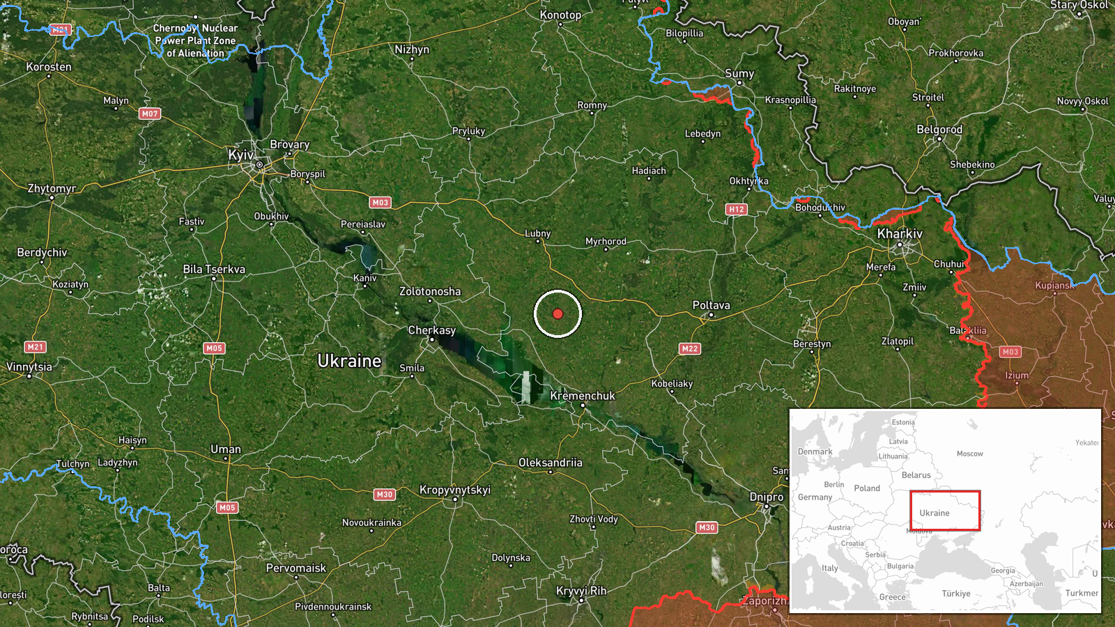
The location is a settlement-level match for Semenivka in Poltava Oblast, placed at approximately 49.597 N, 33.179 E, and rated high confidence for location. The drone is described as heading toward the settlement, not as being over it, so the point marks the stated destination rather than a confirmed position. The area is flat agricultural steppe and river valley land in the northern part of Poltava Oblast, with the Vorskla and Psel river systems and a network of rural roads and small settlements nearby. The surrounding terrain offers little natural cover and is open to low-altitude drone flight.
Related events nearby
- Ukrainian air monitoring: 1 Russian jet-powered Shahed (Geran-3) drone over Khorol.2026-10-21 02:18 UTC · Drone Transit · Khorol, Ukraine
- Ukrainian air monitoring: 2+ Russian jet-powered Shahed (Geran-3) drones heading toward Lubny.2026-10-20 16:52 UTC · Drone Transit · Lubny, Ukraine
- Ukrainian air monitoring: 1 Russian jet-powered Shahed (Geran-3) drone heading toward Kremenchuk.2026-10-20 19:06 UTC · Drone Transit · Kremenchuk, Ukraine
- Ukrainian air monitoring: 2+ Russian jet-powered Shahed (Geran-3) drones from Dnipropetrovsk Oblast toward Nov2026-10-20 15:11 UTC · Drone Transit · Novi Sanzhary, Ukraine
- Ukrainian air monitoring: 2+ Russian jet-powered Shahed (Geran-3) drones heading toward Bilyky.2026-10-20 13:10 UTC · Drone Transit · Bilyky, Ukraine
▶ View this event on the live map

Intel Mapper aggregates open-source reports from monitored Telegram and X channels, geolocates them, cross-checks duplicates across sources and assigns a confidence score. Entries are updated as new confirmations arrive. Read how we verify events.