Ukrainian air monitoring reports one Russian Geran-3 jet drone heading toward Kremenchuk
What happened
Ukrainian air monitoring reported on Telegram, via the @kpszsu channel, that a single Russian jet-powered Shahed drone, described as a Geran-3, was on a course toward Kremenchuk from the south. The original Ukrainian-language post is brief and reads roughly as a jet-type UAV heading for Kremenchuk from the south. The report is timestamped 20 October 2026 at 19:06 UTC and is logged as a drone transit, not a confirmed impact. The source gives no information on damage, casualties, or whether the drone was intercepted. Attribution to Russia rests on the drone type named in the Ukrainian warning. The record describes a movement of the aircraft, not a strike on a specific site.
Context and assessment
Kremenchuk is a city of roughly a quarter million people on the Dnipro in Poltava Oblast, in central Ukraine. It sits beside the Kremenchuk Reservoir and hosts a major industrial base, including a large oil refinery, which has made it a recurring subject of concern in air-defence planning. The report fits a pattern visible in the related events. Between the evening of 19 October and midday on 20 October, monitoring channels logged several separate Geran-3 transits across central Ukraine: west of Poltava heading south at 20:59 on 19 October, near Nova Praha and Oleksandriia district heading northwest in the early hours of 20 October, eastern Kirovohrad Oblast heading west at 08:13, and two or more drones toward Bilyky at 13:10. The varied headings suggest multiple aircraft following different routes over several oblasts rather than a single coordinated axis. Operationally, this kind of dispersed movement may be intended to saturate air defence, test radar and interceptor coverage, or fix routes toward several possible targets. The single report does not show which, if any, of these purposes applies to Kremenchuk.
Sources and confidence
The event rests on a single channel, the Telegram account @kpszsu, which relays Ukrainian air-monitoring warnings. No independent outlet or second monitoring channel in the dataset reports the same drone heading toward Kremenchuk. The confidence score of 8.0 reflects a credible official-style warning with a clear type designation and a precise timestamp, offset by the lack of cross-confirmation and the absence of any outcome reporting. Confidence would rise with corroboration from other air-monitoring channels, regional military administration statements, or local reports of sirens or impacts in Kremenchuk. It would fall if later updates showed the drone was diverted elsewhere, downed away from the city, or if the warning was revised.
Location
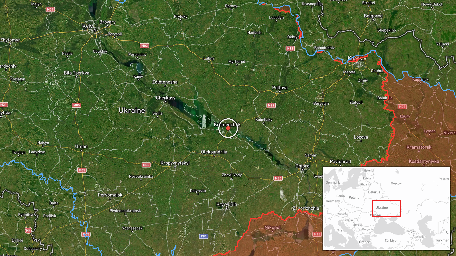
The location is recorded at settlement level, with coordinates of about 49.07 N, 33.42 E, placing the marker at the city of Kremenchuk rather than a specific facility. The warning named the city as the heading, so the point reflects the stated destination, not a confirmed target. Geographically, Kremenchuk lies in Poltava Oblast on the Dnipro, where the river widens into the Kremenchuk Reservoir, a feature that forms a prominent landmark visible from the air. The city lies south of Poltava and east of the central Ukrainian corridor where the related transits were logged.
Related events nearby
- Ukrainian air monitoring: 1 Russian jet-powered Shahed (Geran-3) drone passing Oleksandriia district, heading 2026-10-20 01:25 UTC · Drone Transit · Oleksandriia district, Ukraine
- Ukrainian air monitoring: 2+ Russian jet-powered Shahed (Geran-3) drones heading toward Bilyky.2026-10-20 13:10 UTC · Drone Transit · Bilyky, Ukraine
- Ukrainian air monitoring: 1 Russian jet-powered Shahed (Geran-3) drone passing eastern Kirovohrad Oblast, head2026-10-20 08:13 UTC · Drone Transit · eastern Kirovohrad Oblast, Ukraine
- Ukrainian air monitoring: 1 Russian jet-powered Shahed (Geran-3) drone passing Nova Praha, heading northwest.2026-10-20 01:31 UTC · Drone Transit · Nova Praha, Ukraine
- Ukrainian air monitoring: one Russian jet-powered Shahed (Geran-3) drone tracked west of Poltava, heading sout2026-10-19 20:59 UTC · Drone Transit · West of Poltava, Poltava Oblast, Ukraine
▶ View this event on the live map

Intel Mapper aggregates open-source reports from monitored Telegram and X channels, geolocates them, cross-checks duplicates across sources and assigns a confidence score. Entries are updated as new confirmations arrive. Read how we verify events.