Two or more jet-powered Shahed drones reported passing Kremenchuk area, heading west
What happened
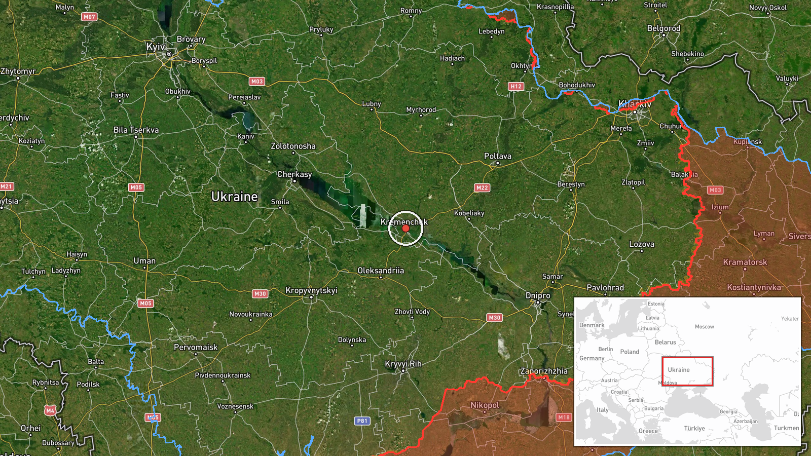
Ukrainian air monitoring, relayed through the Telegram channel @kpszsu, reported that two or more Russian jet-powered Shahed (Geran-3) drones were passing Kremenchuk and moving west at about 06:16 UTC on 21 October 2026. The original Ukrainian-language post describes jet-type unmanned aerial vehicles flying between Poltava and Kremenchuk on a westward course. The report places the drones in the Kremenchuk area of Poltava Oblast, a city on the Dnipro River in central Ukraine. The post gives no information on impacts, damage, or casualties, and it does not identify a target. The entry is a transit observation rather than a strike report. The phrases 'passing' and 'heading west' describe direction of travel only.
Context and assessment
Kremenchuk sits on the Dnipro in central Ukraine and is home to a large industrial base, a major river crossing, and a hydroelectric complex that anchors the Kremenchuk Reservoir. It is also a rail and road junction, which makes it a recurring point of interest for air-threat monitoring. The Geran-3 is the jet-powered variant of the Shahed family, and its higher speed compared with piston-engined models shortens warning times for civilians and air defence crews. The related entries form a clear pattern. Across roughly 24 hours on 20 and 21 October, monitoring reported drone tracks over eastern Kirovohrad Oblast heading west, a group of two or more drones heading toward Bilyky, a group from Dnipropetrovsk Oblast toward Novi Sanzhary, a single drone toward Kremenchuk on the evening of 20 October, and a single drone toward Semenivka in the early hours of 21 October. Operationally, this sequence may suggest repeated routing through the Poltava and Kirovohrad corridor, possibly toward western targets, or the use of multiple small groups to stretch air defence. Because the entries describe movement rather than outcomes, these readings remain tentative.
Sources and confidence
The event rests on a single Telegram channel, @kpszsu, which is a Ukrainian air-monitoring account. Source count is one, and no wire service, official Ukrainian Air Force statement, or second monitoring channel appears in the dataset for this specific report. The confidence score of 8.0 reflects the channel's established role in real-time air monitoring and the fact that the entry is consistent with the related reports from the same day. Confidence is held below the maximum because the report is uncorroborated. Confidence would rise with confirmation from the Ukrainian Air Force or Poltava regional authorities, or with additional monitoring reports showing the same track. It would fall if the channel later retracted or amended the post, or if track data contradicted the reported course. The correction flag is currently unset.
Location
The location is recorded at settlement level, with coordinates of 49.07 N and 33.42 E for Kremenchuk, and location confidence is rated high. The city is the reference point for the report, but the drones were described as passing between Poltava and Kremenchuk, so the true track may lie in the open area between the two cities. The setting is flat to gently rolling forest-steppe terrain, with the Dnipro River and the Kremenchuk Reservoir as the principal nearby features.
Related events nearby
- Ukrainian air monitoring: 1 Russian jet-powered Shahed (Geran-3) drone heading toward Kremenchuk.2026-10-20 19:06 UTC · Drone Transit · Kremenchuk, Ukraine
- Ukrainian air monitoring: 1 Russian jet-powered Shahed (Geran-3) drone heading toward Semenivka.2026-10-21 03:49 UTC · Drone Transit · Semenivka, Ukraine
- Ukrainian air monitoring: 2+ Russian jet-powered Shahed (Geran-3) drones heading toward Bilyky.2026-10-20 13:10 UTC · Drone Transit · Bilyky, Ukraine
- Ukrainian air monitoring: 1 Russian jet-powered Shahed (Geran-3) drone passing eastern Kirovohrad Oblast, head2026-10-20 08:13 UTC · Drone Transit · eastern Kirovohrad Oblast, Ukraine
- Ukrainian air monitoring: 2+ Russian jet-powered Shahed (Geran-3) drones from Dnipropetrovsk Oblast toward Nov2026-10-20 15:11 UTC · Drone Transit · Novi Sanzhary, Ukraine
▶ View this event on the live map

Intel Mapper aggregates open-source reports from monitored Telegram and X channels, geolocates them, cross-checks duplicates across sources and assigns a confidence score. Entries are updated as new confirmations arrive. Read how we verify events.