Jet-powered Shahed (Geran-3) drone reported heading toward Kropyvnytskyi in central Ukraine
What happened
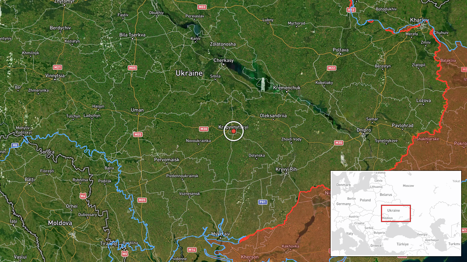
Ukrainian air monitoring alerts posted on the Telegram channel @kpszsu reported a single jet-powered Russian Shahed-type drone, described as a Geran-3, heading toward Kropyvnytskyi at about 16:03 UTC on 21 October 2026. The original Ukrainian wording, 'Реактивний БпЛА на Кропивницький з півдня', describes a jet-powered UAV approaching Kropyvnytskyi from the south. The message is a transit warning rather than a report of impact, so it does not describe any strike, damage, casualties, or interception at that point. The drone is attributed to Russia on the basis of its type. The target is the city itself, which is also the administrative centre of Kirovohrad Oblast. Because the entry gives only the approach direction and the target settlement, the track and any outcome remain unconfirmed by this report alone.
Context and assessment
Kropyvnytskyi is a regional hub in central Ukraine, and alerts naming it carry weight because it sits well inside the country, far from the front line, where air defence coverage is thinner than in major cities. The same-day record shows a pattern of repeated Geran-3 transits. Earlier alerts at 06:23 and 13:06 UTC described single drones moving from Mykolaiv Oblast toward Kirovohrad Oblast, and a separate 12:08 alert gave Kropyvnytskyi as the heading, before this 16:03 report. A broader overnight attack, reported at 05:36 with Iskander-K cruise missiles and 186 drones including jet Shaheds, was described as having 150 downed according to Ukrainian air defence, though the data for that entry is truncated. A Ukrainian Navy mobile fire group, Sargan 3000, reportedly destroyed a Shahed using the Sting interceptor drone at 14:20, but that location was not specified. Operationally, repeated single-drone tracks through the same corridor may point to probing, reconnaissance, or sustained pressure on air defence assets, but the data does not establish intent or a specific target within the city.
Sources and confidence
The report rests on one channel, Telegram @kpszsu, which posts air monitoring alerts. No independent outlet or second channel in the data confirms this particular track. The confidence score of 8.0 reflects that the channel is a dedicated air alert source, that the alert is specific about drone type and direction, and that similar Geran-3 transits were logged the same day in the same region. It is held below the top of the scale because it is single-sourced and describes a transit, not a confirmed event. Confidence would rise with a corroborating alert from another monitoring source, an official air force statement, or a report of impact or debris in the city. It would fall if subsequent reports show the track changed or no further mention appears.
Location
The location is placed at settlement level for Kropyvnytskyi, with coordinates 48.51 N, 32.27 E, and confidence is rated high because the city name is explicit in the source and matches the regional alerts. Kropyvnytskyi lies in central Ukraine on the Inhul (Ingul) River and serves as the administrative centre of Kirovohrad Oblast. The coordinates mark the urban area rather than a specific facility, so no particular site within the city is implied.
Related events nearby
- Ukrainian air monitoring: 1 Russian jet-powered Shahed (Geran-3) drone heading toward Kropyvnytskyi.2026-10-21 12:08 UTC · Drone Transit · Kropyvnytskyi, Ukraine
- Ukrainian air monitoring: 2+ Russian jet-powered Shahed (Geran-3) drones from western Dnipropetrovsk Oblast to2026-10-21 16:40 UTC · Drone Transit · Kirovohrad Oblast, Ukraine
- Ukrainian air monitoring: 1 Russian jet-powered Shahed (Geran-3) drone from northern Mykolaiv Oblast toward Ki2026-10-21 13:06 UTC · Drone Transit · Kirovohrad Oblast, Ukraine
- Ukrainian air monitoring: 1 Russian jet-powered Shahed (Geran-3) drone from Mykolaiv Oblast toward Kirovohrad 2026-10-21 06:23 UTC · Drone Transit · Kirovohrad Oblast, Ukraine
- Ukraine reportedly shot down a Russian Su-30SM fighter jet, separate from the earlier Kaliningrad crash; both 2026-10-21 17:02 UTC · Aircraft Shootdown · Ukraine (location not reported)
▶ View this event on the live map

Intel Mapper aggregates open-source reports from monitored Telegram and X channels, geolocates them, cross-checks duplicates across sources and assigns a confidence score. Entries are updated as new confirmations arrive. Read how we verify events.