Two or more Russian Geran-3 jet drones reported transiting toward Kirovohrad Oblast
What happened
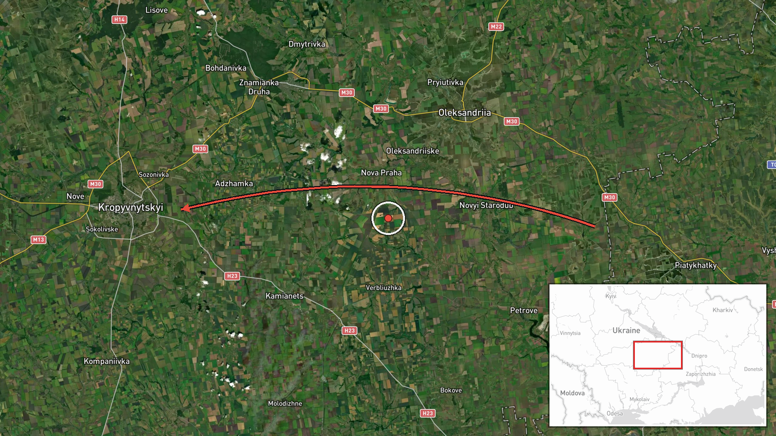
Ukrainian air monitoring, as posted on the Telegram channel @kpszsu, reported at 16:40 UTC on 21 October 2026 that at least two jet-powered Shahed (Geran-3) drones were moving from western Dnipropetrovsk Oblast on a course toward Kirovohrad Oblast in central Ukraine. The original Ukrainian-language post describes 'reactive UAVs' on the western Dnipropetrovsk side heading toward Kirovohrad region. The English summary's '2+' reflects that the count was not fixed beyond two. The report describes transit only. It does not state that any drone struck a target, caused damage, or injured anyone, and it gives no impact location. The event rests on a single channel.
Context and assessment
Kirovohrad Oblast lies on a main north-south and east-west corridor between the southern front and western Ukraine, and it contains Kropyvnytskyi, the oblast's administrative centre and largest city, along with road, rail and energy infrastructure. Its frequent appearance in air alerts reflects that position. The related reports show a pattern. At 06:23 and 13:06 UTC, single jet drones were reported moving from Mykolaiv Oblast toward Kirovohrad Oblast. At 12:08 and 16:03 UTC, single drones were reported heading toward Kropyvnytskyi. The tracks are staggered over roughly ten hours, which could indicate a sustained series of launches along the southern axis, drones being routed across the oblast toward targets further west or north, or drones being redirected after interception attempts. At 14:20 UTC a Ukrainian Navy mobile fire group reported destroying a Shahed with a Sting interceptor drone, without specifying the location, which suggests air defence was active in the wider south during the same window. Transit reports alone cannot establish the intended targets, so any operational reading should remain provisional.
Sources and confidence
The event rests on one channel, Telegram @kpszsu, which is the Ukrainian Air Force's official channel and a common origin for air alert reports. No independent confirmation appears in the supplied data, and the record is not marked as corrected. The confidence score of 8.0 reflects the official, specific nature of the post. It is held back by single-source reliance and by transit-only wording that describes no impact. Confidence would rise with corroboration from other Ukrainian air alert or regional military administration channels, with reported impacts or debris in Kirovohrad Oblast, or with a confirmed follow-up from the Navy group. It would fall if the drone count or track were revised, or if a correction were issued.
Location
The location was set at oblast level, not at a settlement or facility. The coordinates (48.51, 32.26) are an approximate regional point, and the location confidence is recorded as low. Kirovohrad Oblast sits in central Ukraine, a largely flat steppe and agricultural landscape crossed by river valleys, including the Inhul, and its towns are spread across that terrain. The report gives no more precise position, so no specific site can be inferred.
Related events nearby
- Ukrainian air monitoring: 1 Russian jet-powered Shahed (Geran-3) drone from northern Mykolaiv Oblast toward Ki2026-10-21 13:06 UTC · Drone Transit · Kirovohrad Oblast, Ukraine
- Ukrainian air monitoring: 1 Russian jet-powered Shahed (Geran-3) drone from Mykolaiv Oblast toward Kirovohrad 2026-10-21 06:23 UTC · Drone Transit · Kirovohrad Oblast, Ukraine
- Ukrainian air monitoring: 1 Russian jet-powered Shahed (Geran-3) drone heading toward Kropyvnytskyi.2026-10-21 16:03 UTC · Drone Transit · Kropyvnytskyi, Ukraine
- Ukrainian air monitoring: 1 Russian jet-powered Shahed (Geran-3) drone heading toward Kropyvnytskyi.2026-10-21 12:08 UTC · Drone Transit · Kropyvnytskyi, Ukraine
- Headline 'Дед не приходит одна' (Shahed slang: 'Grandpa never comes alone') suggests a group of Russian Shahed2026-10-21 17:46 UTC · Drone Transit · Ukraine (location not reported)
▶ View this event on the live map

Intel Mapper aggregates open-source reports from monitored Telegram and X channels, geolocates them, cross-checks duplicates across sources and assigns a confidence score. Entries are updated as new confirmations arrive. Read how we verify events.