Jet-powered Shahed drone reported heading toward Kropyvnytskyi from the south
What happened
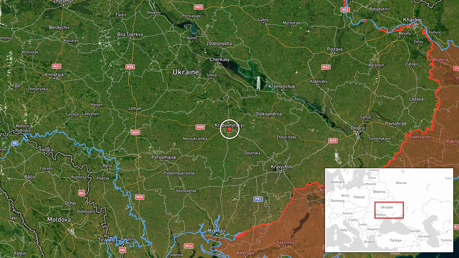
Ukrainian air monitoring, relayed on the Telegram channel @kpszsu, reported one Russian jet-powered Shahed drone, identified as the Geran-3, moving toward Kropyvnytskyi from the south. The report is timestamped 21 October 2026 at 12:08 UTC. The original Ukrainian post is brief, describing a jet-type UAV heading toward the city from the south. The report does not state whether the drone was intercepted, whether it struck anything, or whether any casualties or damage occurred. The alert describes a transit, not an impact. Kropyvnytskyi is the administrative center of Kirovohrad Oblast in central Ukraine. The attribution to Russia in the summary rests on the drone type, which is associated with Russian long-range strike campaigns.
Context and assessment
Kropyvnytskyi sits in central Ukraine, well north of the front line, so its appearance in air alerts reflects the reach of Russian long-range drone operations rather than proximity to combat. The report belongs to a cluster of related events logged the same day. Shortly before 06:00 UTC, a mass overnight attack reportedly combined Iskander-K cruise missiles with 186 drones, including jet-powered Shaheds, and Ukrainian air defense reported 150 downed. In the hours that followed, separate monitoring reports tracked jet Shaheds from Mykolaiv Oblast toward Kirovohrad Oblast at 06:23, passing Kremenchuk heading west at 06:16, moving from Poltava Oblast toward Cherkasy Oblast at 06:26, and from Kirovohrad Oblast toward Cherkasy Oblast at 08:54. The pattern is sustained movement across a broad corridor of central Ukraine rather than a single axis. A transit alert indicates that a drone is airborne and being tracked, but it does not by itself establish a target. Repeated tracking through oblasts around Kropyvnytskyi could reflect routing toward infrastructure elsewhere, or continued pressure across the region. Until later reporting identifies a target, the intended destination should be treated as unknown.
Sources and confidence
The event rests on a single channel, Telegram @kpszsu, which is widely associated with Ukraine's Air Force monitoring and is the only listed source. No independent outlet, regional administration, or secondary account has been logged for this drone. The confidence score of 8.0 reflects the channel's institutional nature and the specificity of the alert, offset by the absence of cross-confirmation and any impact or interception report. Confidence would rise with corroborating monitoring from other channels, a later official statement confirming the track, or reports of an interception or impact in the city. It would fall if the alert were retracted or later reporting contradicted the drone type or heading.
Location
The coordinates correspond to Kropyvnytskyi at settlement precision, with high location confidence, so the point marks the city as a whole rather than any specific facility. Kropyvnytskyi lies in central Ukraine within Kirovohrad Oblast, on the Inhul River. The surrounding terrain is largely flat agricultural land, and the city serves as a regional road and rail hub. The alert names only the city, not a district or site.
Related events nearby
- Ukrainian air monitoring: 1 Russian jet-powered Shahed (Geran-3) drone from northern Mykolaiv Oblast toward Ki2026-10-21 13:06 UTC · Drone Transit · Kirovohrad Oblast, Ukraine
- Ukrainian air monitoring: 1 Russian jet-powered Shahed (Geran-3) drone from Mykolaiv Oblast toward Kirovohrad 2026-10-21 06:23 UTC · Drone Transit · Kirovohrad Oblast, Ukraine
- Russia launched a mass overnight attack with Iskander-K cruise missiles and 186 drones, including jet Shaheds.2026-10-21 05:36 UTC · Cruise Missile · Ukraine (location not reported)
- Ukrainian air monitoring: 2+ Russian jet-powered Shahed (Geran-3) drones from Kirovohrad Oblast toward Cherkas2026-10-21 08:54 UTC · Drone Transit · Cherkasy Oblast, Ukraine
- Ukrainian air monitoring: 2+ Russian jet-powered Shahed (Geran-3) drones from Poltava Oblast toward Cherkasy O2026-10-21 06:26 UTC · Drone Transit · Cherkasy Oblast, Ukraine
▶ View this event on the live map

Intel Mapper aggregates open-source reports from monitored Telegram and X channels, geolocates them, cross-checks duplicates across sources and assigns a confidence score. Entries are updated as new confirmations arrive. Read how we verify events.