Single jet-powered Shahed-type drone reported transiting near Berezanka, Mykolaiv Oblast
What happened
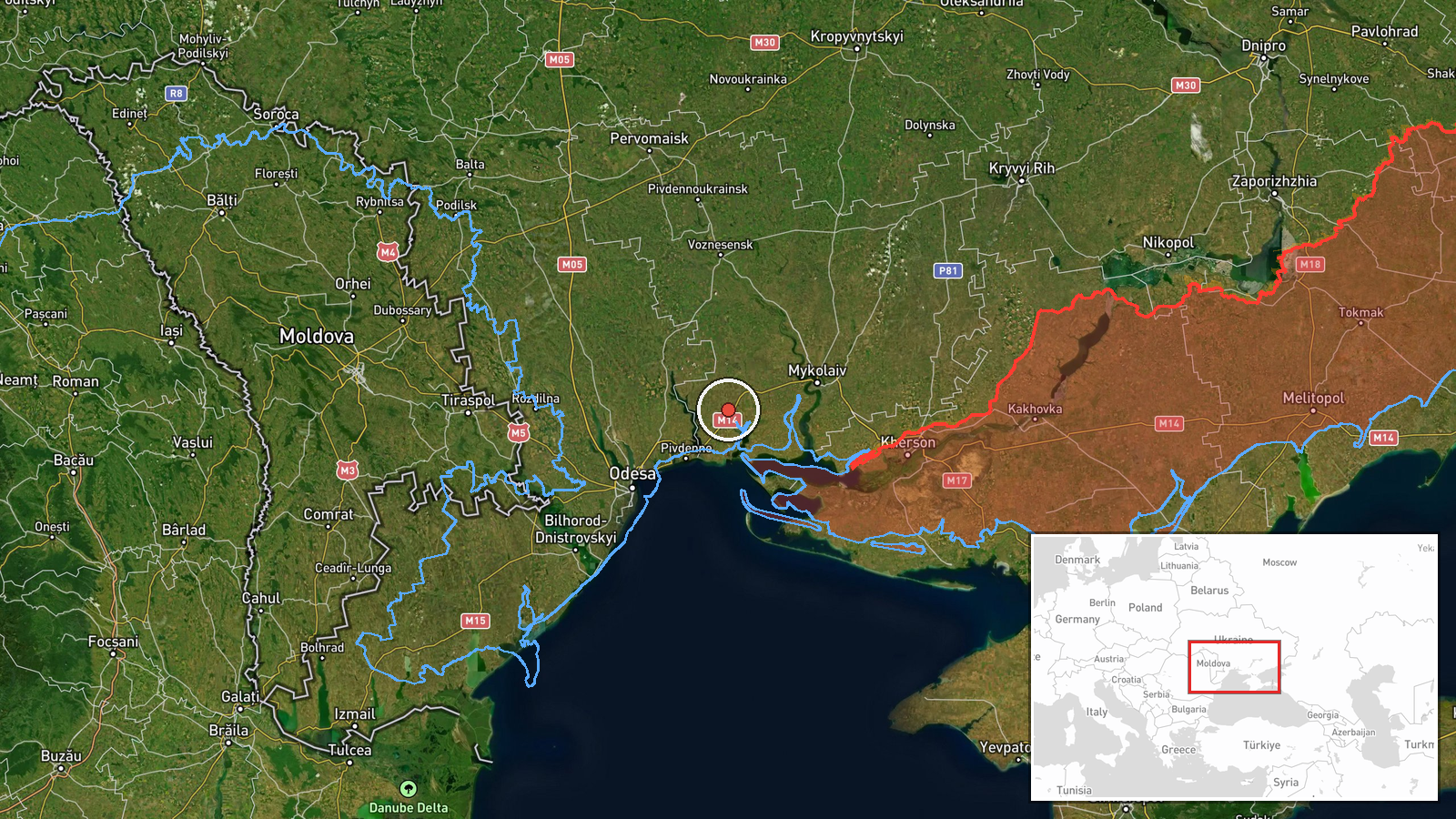
Ukrainian air monitoring reported on 22 October 2026 at 16:58 UTC that one jet-powered Russian Shahed-type drone, identified in the source as a Geran-3, was passing the settlement of Berezanka on a northwesterly course. The original Ukrainian-language post, which describes it as a reactive UAV passing near the settlement, does not mention impact, casualties, or damage. The report names no intercept, debris, or strike, so it should be read as a track observation rather than a confirmed hit. The location lies in Mykolaiv Oblast in southern Ukraine. The post appeared on the Telegram channel @kpszsu, which is associated with Ukrainian air monitoring reporting. Its wording is brief and gives no altitude, speed, or intended target.
Context and assessment
Berezanka sits in southern Ukraine, in the Mykolaiv Oblast lowlands that link the Black Sea coast with the interior. The Ochakiv port area, to the southwest, has been a recurring point of reference in today's tracks. The related events show a sequence of single-drone reports through the same southern oblasts. At 07:15 UTC one drone was tracked in the Mykolaiv district heading north. At 08:35 and 09:35 UTC drones were reported approaching Ochakiv from the Black Sea. At 08:55 UTC one was reported heading toward Ananyiv, and at 16:58 UTC two or more were reported passing southern Kirovohrad Oblast heading west. The Berezanka report shares its timestamp with the Kirovohrad report, but the data does not establish whether these are the same aircraft or separate groups. The pattern suggests drones entering from the sea and moving inland across several oblasts over the day. The Geran-3 is a jet-powered variant, generally faster than piston-engined Geran-2 models. Such drones are typically used against infrastructure or in mass attacks. A northwesterly heading could indicate routing toward central Ukraine, though a single track cannot confirm a target. Some tracks may also be intended to draw air defence attention.
Sources and confidence
The event rests on one channel, the Telegram account @kpszsu, and no other source in the data cross-confirms it. The channel's air monitoring posts are a recognised type of reporting and the track is consistent with several same-day reports in neighbouring areas, which supports plausibility. The confidence score of 8.0 reflects that consistency together with the lack of independent verification. Confidence would rise with corroboration from another official statement, regional military administration, air defence reporting, or imagery of the aircraft or debris. It would fall if later updates revised the track, contradicted the location, or showed the report was a duplicate. The record is not marked as corrected.
Location
The location is placed at settlement level with high confidence, using the coordinates for Berezanka in Mykolaiv Oblast. The settlement lies in the southwestern part of the oblast, in the broad steppe lowlands of the Southern Bug basin north of the Black Sea coast. The terrain is largely flat and agricultural, with river valleys and scattered settlements. Its position places it on a plausible approach path between the coastal Ochakiv area and the Kirovohrad axis.
Related events nearby
- Ukrainian air monitoring: 1 Russian jet-powered Shahed (Geran-3) drone from Black Sea toward Ochakiv.2026-10-22 09:35 UTC · Drone Transit · Ochakiv, Ukraine
- Ukrainian air monitoring: 1 Russian jet-powered Shahed (Geran-3) drone from Black Sea toward Ochakiv.2026-10-22 08:35 UTC · Drone Transit · Ochakiv, Ukraine
- Ukrainian air monitoring: 1 Russian jet-powered Shahed (Geran-3) drone passing Mykolaiv district, heading nort2026-10-22 07:15 UTC · Drone Transit · Mykolaiv district, Ukraine
- Ukrainian air monitoring: 1 Russian jet-powered Shahed (Geran-3) drone heading toward Mykolaiv.2026-10-22 17:01 UTC · Drone Transit · Mykolaiv, Ukraine
- Ukrainian air monitoring: 2+ Russian jet-powered Shahed (Geran-3) drones passing southern Kirovohrad Oblast, h2026-10-22 16:58 UTC · Drone Transit · southern Kirovohrad Oblast, Ukraine
▶ View this event on the live map

Intel Mapper aggregates open-source reports from monitored Telegram and X channels, geolocates them, cross-checks duplicates across sources and assigns a confidence score. Entries are updated as new confirmations arrive. Read how we verify events.