Ukrainian Air Force reports one Russian Geran-3 drone transiting southern Mykolaiv Oblast
What happened
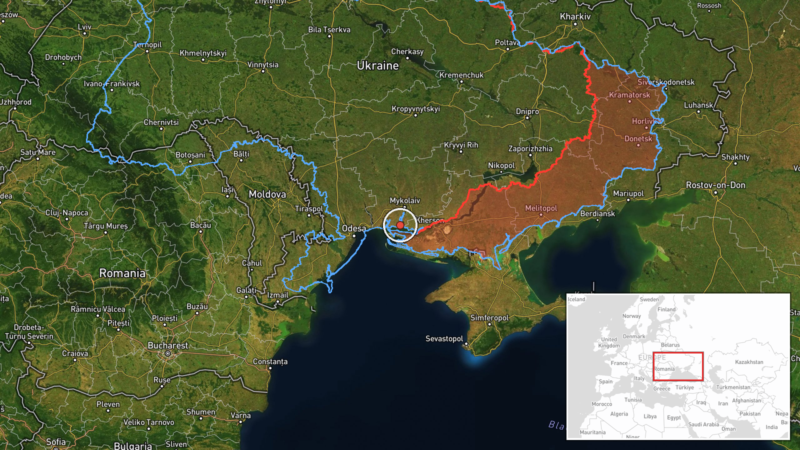
Ukraine's air monitoring channel on Telegram, @kpszsu, reported on 23 October 2026 at 06:31 UTC that a single Russian jet-powered Shahed-type drone, identified in the report as a Geran-3, was passing through the southern part of Mykolaiv Oblast and moving in a northern direction. The original post was written in Ukrainian and refers only to a jet-powered UAV in the south of the oblast, without naming a specific settlement, target or time of entry into the area. The data records no impact, casualties or damage. The event is classified as a drone transit, meaning the report describes movement rather than a strike. The source wording is brief and operational, and the report should be read as an air-monitoring alert issued while the drone was in flight.
Context and assessment
Southern Mykolaiv Oblast lies on the approaches between the Black Sea coast and the city of Mykolaiv, and the Dnipro-Buh estuary runs through the wider area. That geography makes it a natural corridor for drones moving inland from the sea toward central and western Ukraine. The related reports show a pattern over roughly 24 hours. On 22 October, single Geran-3 transits were logged near Mykolaiv district at 07:15 UTC and near Ochakiv at 08:35 and 09:35 UTC, with the latter two described as coming from the Black Sea. Later that day, at 17:01, another single drone was reported heading toward Mykolaiv city. The next morning, at 06:47, a further transit was logged passing Mykolaiv Oblast heading northwest, about sixteen minutes after the report under analysis. The repetition of single-airframe alerts along the same southern belt suggests sustained, individual drone movement along the coast and into the oblast rather than one mass raid. Operationally, such routing could reflect reconnaissance of air defence or infrastructure, or drones transiting toward targets further north or west. The reports alone do not establish which, so the pattern is best read as indicative of ongoing activity rather than evidence of a particular objective.
Sources and confidence
The report comes from one Telegram channel, @kpszsu, which is widely understood to be the Ukrainian Air Force's monitoring account, and no second channel in the data corroborates it. The confidence score of 8.0 reflects an official military source with a clear, time-stamped message, offset by the single-source status and the absence of independent confirmation. Confidence would rise if other Ukrainian official channels, regional military administrations or later monitoring updates repeated the track, or if debris or impact were reported. It would fall if subsequent updates contradicted the direction or type of drone, or if the track could not be matched to the other Mykolaiv reports.
Location
The location is recorded at region precision, so the coordinates mark an approximate point in southern Mykolaiv Oblast rather than a settlement or facility, and the location confidence is low. The original report names only the southern part of the oblast, so the placement is inferred from that general description. The area is a low-lying coastal and estuarine setting near the Black Sea and the Dnipro-Buh estuary, with Mykolaiv city lying to the north and Ochakiv to the southwest of the broader region.
Related events nearby
- Ukrainian air monitoring: 1 Russian jet-powered Shahed (Geran-3) drone from Black Sea toward Ochakiv.2026-10-22 09:35 UTC · Drone Transit · Ochakiv, Ukraine
- Ukrainian air monitoring: 1 Russian jet-powered Shahed (Geran-3) drone from Black Sea toward Ochakiv.2026-10-22 08:35 UTC · Drone Transit · Ochakiv, Ukraine
- Ukrainian air monitoring: 1 Russian jet-powered Shahed (Geran-3) drone passing Mykolaiv Oblast, heading northw2026-10-23 06:47 UTC · Drone Transit · Mykolaiv Oblast, Ukraine
- Ukrainian air monitoring: 1 Russian jet-powered Shahed (Geran-3) drone heading toward Mykolaiv.2026-10-22 17:01 UTC · Drone Transit · Mykolaiv, Ukraine
- Ukrainian air monitoring: 1 Russian jet-powered Shahed (Geran-3) drone passing Berezanka, heading northwest.2026-10-22 16:58 UTC · Drone Transit · Berezanka, Ukraine
▶ View this event on the live map

Intel Mapper aggregates open-source reports from monitored Telegram and X channels, geolocates them, cross-checks duplicates across sources and assigns a confidence score. Entries are updated as new confirmations arrive. Read how we verify events.