Single jet-powered Geran-3 drone reported heading toward Kyiv, per Ukrainian air monitoring
What happened
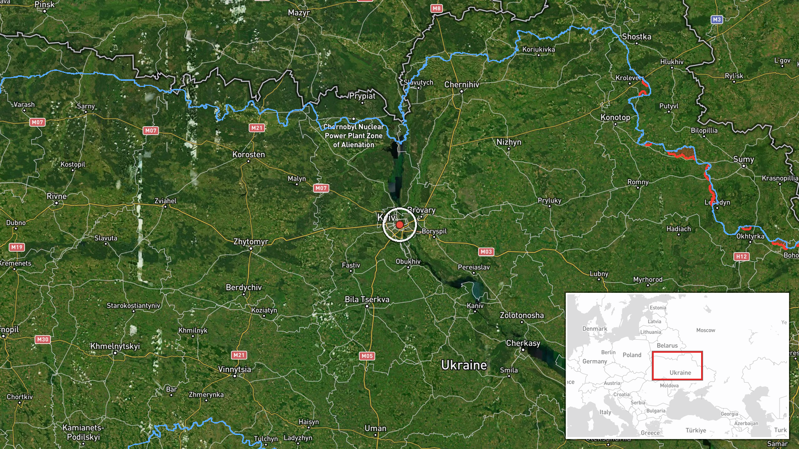
Ukrainian air monitoring reported on Telegram via the channel @kpszsu that one Russian jet-powered Shahed, identified in the report as a Geran-3, was heading toward Kyiv at about 08:28 UTC on 23 October 2026. The original post, written in Ukrainian with a motorcycle emoji, reads roughly as 'Jet-type UAV on Kyiv.' The notice is a short transit alert and does not report impact, damage, casualties, or interception. It names no launch point, altitude, or track beyond the city. Because the report comes from a single channel and is a brief alert, the wording should be read as the monitoring body's own assessment of a drone in flight rather than a confirmed strike.
Context and assessment
Kyiv is the capital and the political and administrative centre of Ukraine, so even single-drone alerts over the city draw public attention and trigger air-raid responses. This report fits a visible pattern earlier the same morning. Related monitoring alerts logged at 01:04 and 03:14 UTC describe two or more Geran-3 drones over Kyiv, and a 03:00 UTC alert placed similar drones passing Slavutych and heading toward Kyiv Oblast, a northern approach corridor. A lone drone following a cluster of multi-drone transits may indicate a trailing or reconnaissance element, a decoy, or a unit simply straggling behind the main group, though the data cannot distinguish these. Russia's continued use of jet-powered Shahed variants suggests an effort to raise speed and complicate interception compared with older piston-engined models. Ukrainian forces are also reported to be developing long-range FPV drones, a separate line of activity noted in a related statement, and that does not bear directly on this transit.
Sources and confidence
The report rests on one Telegram channel, @kpszsu, which is linked to Ukraine's air monitoring messaging. No independent outlet, wire service, or official second channel in the dataset confirms this specific alert. The confidence score of 8.0 reflects a credible official-style source with a precise timestamp and clear geography, offset by the single-channel basis and the absence of any outcome reporting. Confidence would rise with corroboration from another Ukrainian air force or regional military administration post, or from reports of an interception or impact in Kyiv. It would fall if later updates retracted the track, identified the object as a different type, or indicated a false alarm.
Location
The location is recorded at settlement level for the city of Kyiv, at approximately 50.45 N, 30.52 E, which represents the city centre rather than a specific facility or district. The alert concerns the city as a whole, so no particular building or installation is identified. Kyiv lies on the high right bank of the Dnipro River, with the wider river valley, islands, and reservoirs to the east and south. The surrounding Kyiv Oblast is largely flat to gently rolling, which gives drones on northern approaches little terrain cover.
Related events nearby
- A prisoner-of-war exchange between Russia and Ukraine is reportedly expected today; exact location not reporte2026-10-23 07:49 UTC · Diplomacy · Kyiv, Ukraine
- Ukrainian forces announced development of FPV drones with roughly 50 km range, able to carry heavier explosive2026-10-23 03:56 UTC · Statement · Kyiv, Ukraine
- Ukrainian air monitoring: 2+ Russian jet-powered Shahed (Geran-3) drones over Kyiv.2026-10-23 03:14 UTC · Drone Transit · Kyiv, Ukraine
- Ukrainian air monitoring: 2+ Russian jet-powered Shahed (Geran-3) drones passing Slavutych, heading toward Kyi2026-10-23 03:00 UTC · Drone Transit · Kyiv Oblast, Ukraine
- Ukrainian air monitoring: 2+ Russian jet-powered Shahed (Geran-3) drones over Kyiv.2026-10-23 01:04 UTC · Drone Transit · Kyiv, Ukraine
▶ View this event on the live map

Intel Mapper aggregates open-source reports from monitored Telegram and X channels, geolocates them, cross-checks duplicates across sources and assigns a confidence score. Entries are updated as new confirmations arrive. Read how we verify events.