Single jet-powered Shahed (Geran-3) drone reported heading toward Rivne city from the north
What happened
Ukraine's Air Force monitoring channel on Telegram (@kpszsu) reported on 23 October 2026 at 10:14 UTC that one Russian jet-powered Shahed (Geran-3) drone was flying toward the city of Rivne from the north. The original Ukrainian post is brief, describing a jet-type UAV (реактивний БпЛА) moving toward the city, and it does not mention impacts, casualties, or damage. The report is one of a sequence of drone-transit notices logged over Rivne Oblast in the preceding hours, all attributed to Russian Shahed-type drones. The event is recorded as a transit warning, not a confirmed strike.
Context and assessment
Rivne sits in northwestern Ukraine, far from the front line in the east and south, so drone activity there reflects how far Russian long-range strike flights now extend across the country. The related events show a sustained pattern. Between 17:52 on 22 October and 00:39 on 23 October, the channel logged repeated single or multiple Geran-3 and Shahed-type drones heading toward Zdolbuniv, Rivne Oblast, and Rivne itself. Some reports describe drones entering from Zhytomyr Oblast and passing Zaporizhzhia, which suggests a multi-axis approach across central and western Ukraine. Taken together, the sequence may indicate a rolling series of launches or a deliberate effort to stretch air defense across a wide area rather than a single targeted attack. Routes passing through the northwest could also be aimed at infrastructure, transport nodes, or logistics hubs, though the data does not establish a specific target. Because the notices describe transit and heading rather than impact, the most cautious reading is that the drones were tracked as they moved toward Rivne, not that they were confirmed to have struck it.
Sources and confidence
The event rests on one Telegram channel, @kpszsu, which is the official air-monitoring account associated with Ukraine's Air Force. Its warnings are generally timely, but this report has no independent cross-confirmation from another outlet or channel in the dataset. The confidence score of 8.0 reflects the official nature of the source and the specificity of the report, offset by the absence of corroboration. Confidence would rise if regional military administrations, local officials, or wire services confirmed the sighting or reported air defense activity over Rivne. It would fall if later updates revised the heading, reclassified the object, or showed the drone was not in the area.
Location
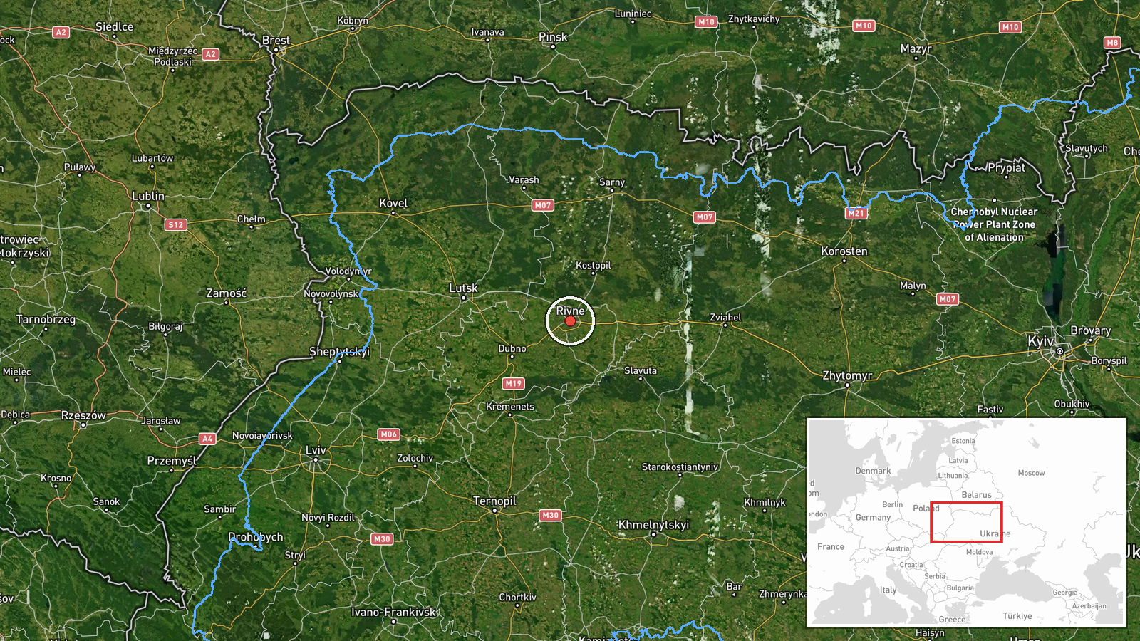
The location is recorded at settlement level for the city of Rivne, with coordinates of approximately 50.62 N, 26.25 E, and location confidence rated high. The report itself names the city and a northern approach, which matches the settlement-level precision. Rivne is the administrative centre of Rivne Oblast in northwestern Ukraine, on lowland terrain typical of the Polissia region. The northern parts of the oblast lie toward the Belarusian border, which is the likely direction of the approach described in the report.
Related events nearby
- Ukrainian air monitoring: 1 Russian jet-powered Shahed (Geran-3) drone heading toward Rivne Oblast.2026-10-23 00:39 UTC · Drone Transit · Rivne Oblast, Ukraine
- Ukrainian air monitoring: 1 Russian Shahed-type drone heading toward Rivne; 1 Russian Shahed-type drone passin2026-10-23 00:20 UTC · Drone Transit · Rivne, Ukraine
- Ukrainian air monitoring: 2+ Russian jet-powered Shahed (Geran-3) drones from Zhytomyr Oblast toward Rivne Obl2026-10-23 00:20 UTC · Drone Transit · Rivne Oblast, Ukraine
- Ukrainian air monitoring: 1 Russian jet-powered Shahed (Geran-3) drone heading toward Zdolbuniv.2026-10-23 00:21 UTC · Drone Transit · Zdolbuniv, Ukraine
- Ukrainian air monitoring: 1 Russian jet-powered Shahed (Geran-3) drone heading toward Zdolbuniv.2026-10-22 17:52 UTC · Drone Transit · Zdolbuniv, Ukraine
▶ View this event on the live map

Intel Mapper aggregates open-source reports from monitored Telegram and X channels, geolocates them, cross-checks duplicates across sources and assigns a confidence score. Entries are updated as new confirmations arrive. Read how we verify events.