Air monitoring reports one jet-powered Shahed-type drone heading toward Vasylkiv
What happened
On 23 October 2026, at about 11:40 UTC, the Telegram channel @kpszsu, which posts Ukrainian air monitoring alerts, reported a single jet-powered unmanned aerial vehicle approaching Vasylkiv from the southeast. The original Ukrainian wording reads as a short tracking notice, 'Реактивний БпЛА на Васильків з південного сходу,' meaning a jet UAV toward Vasylkiv from the southeast. The summary attributes the type to the Russian Geran-3 jet-powered Shahed variant, a classification that is not stated in the original line. The post reports a heading, not an impact, and no damage, casualties, or interception outcome is given in the data.
Context and assessment
Vasylkiv is a town in Kyiv Oblast about 30 kilometres southwest of the capital, and it sits within the drone corridor that has repeatedly targeted the Kyiv area. The related events show a dense pattern on the same day. Earlier alerts at 00:19 and 05:33 to 05:34 UTC described single or small groups of Shahed-type drones toward Vasylkiv, Pechersk and Sviatoshyn in Kyiv. Later alerts at 11:22 and 11:52 UTC described two or more jet-powered drones toward Kozyn and Kyiv Oblast, with the latter explicitly noted as coming from Belarus. This suggests drones were arriving on several bearings within a few hours rather than a single axis. Operationally, the pattern may indicate a sustained series of long-range launches designed to stretch air defence coverage across the capital region, though the data alone cannot confirm intent or whether the launches were coordinated. The jet-powered designation, if accurate, is also relevant because such variants are generally faster than the older piston-engine Shahed models, which narrows the warning window for towns on the approach path.
Sources and confidence
The event rests on one source, the Telegram channel @kpszsu, with no independent outlet or official follow-up recorded in the data. Its confidence score of 8.0 reflects a credible monitoring channel with a consistent track record and a specific, time-stamped heading. It is not higher because the post is a single unverified transit notice that reports intent of travel rather than observed impact, and the Geran-3 type comes from the summary rather than the original text. Confidence would rise with corroboration from Ukrainian Air Force statements, regional military administration reports, or local impact or debris reports in Vasylkiv. It would fall if later updates revise the track, the type, or the target, or if the drone is reported as diverted or downed elsewhere.
Location
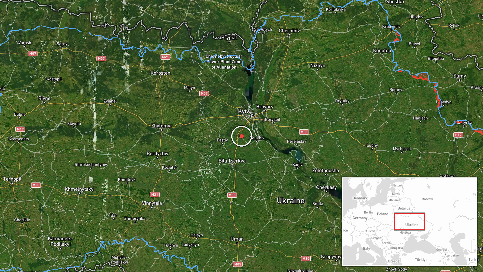
The location is a settlement-level match for Vasylkiv, Kyiv Oblast, with high location confidence and coordinates near 50.18 N, 30.31 E. This places the marker at the town rather than a specific facility, which is appropriate given the monitoring-style report. Vasylkiv lies in the flat, wooded and river-valley terrain south-west of Kyiv, with the Stugna River system nearby, and it is connected to the capital by major roads and rail lines that often serve as reference points in air alerts.
Related events nearby
- Ukrainian air monitoring: 1 Russian Shahed-type drone heading toward Vasylkiv.2026-10-23 00:19 UTC · Drone Transit · Vasylkiv, Ukraine
- Ukrainian air monitoring: 2+ Russian jet-powered Shahed (Geran-3) drones heading toward Kozyn.2026-10-23 11:22 UTC · Drone Transit · Kozyn, Ukraine
- Ukrainian air monitoring: 2+ Russian jet-powered Shahed (Geran-3) drones heading toward Sviatoshyn, Kyiv.2026-10-23 05:34 UTC · Drone Transit · Sviatoshyn, Kyiv, Ukraine
- Ukrainian air monitoring: 1 Russian jet-powered Shahed (Geran-3) drone heading toward Pechersk, Kyiv.2026-10-23 05:33 UTC · Drone Transit · Pechersk, Kyiv, Ukraine
- Ukrainian air monitoring: 2+ Russian jet-powered Shahed (Geran-3) drones from Belarus toward Kyiv Oblast.2026-10-23 11:52 UTC · Drone Transit · Kyiv Oblast, Ukraine
▶ View this event on the live map

Intel Mapper aggregates open-source reports from monitored Telegram and X channels, geolocates them, cross-checks duplicates across sources and assigns a confidence score. Entries are updated as new confirmations arrive. Read how we verify events.