Ukrainian air monitoring reports one Shahed-type drone heading toward Vasylkiv, Kyiv Oblast
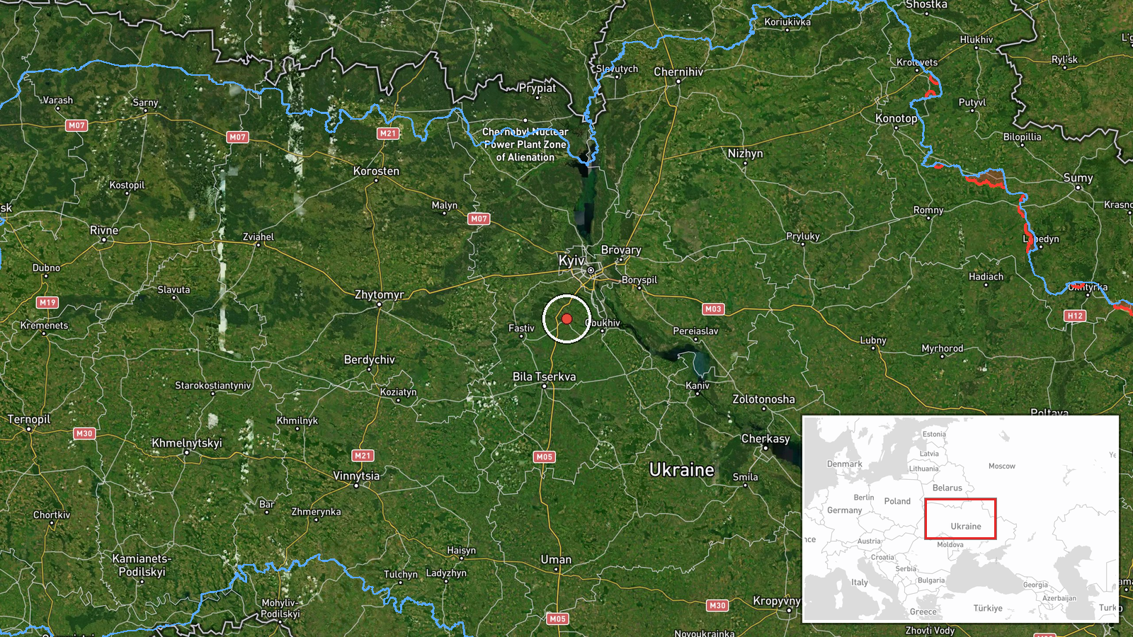
What happened
Ukraine's air monitoring channel on Telegram (@kpszsu) reported one Russian Shahed-type drone heading toward Vasylkiv, a city in Kyiv Oblast, at 00:19 UTC on 23 October 2026. The original post, written in Ukrainian under a Kyiv region heading, reads as a short air-alert notice: a UAV is tracking toward Vasylkiv. The report does not specify the drone variant, whether it was intercepted, or whether any damage or casualties occurred. The 'Shahed-type' label is the channel's attribution rather than a confirmed model. In the same minute, the channel also logged a drone heading toward Kyiv city, so this notice belongs to a wider overnight track rather than a standalone strike report.
Context and assessment
Vasylkiv appears twice in the recent record. On 22 October at 08:44 UTC the channel reported a jet-powered Shahed (Geran-3) heading toward the city, and the earlier Boyarka track at 07:16 UTC used the same wording. Between those reports, a Geran-3 was logged passing Zhashkiv toward Kyiv Oblast at 17:00, and in the early hours of 23 October two or more drones were reported moving from northern Chernihiv Oblast toward Kyiv Oblast at 00:18, one minute before this report. Vasylkiv lies on the southwestern approach to the capital, so the town is best read as a point on a flight corridor toward Kyiv rather than a target in its own right. Operationally, repeated tracks along the same axis may suggest drones are being routed through the Kyiv approaches toward several aim points, or that some are used for reconnaissance or to draw air defence attention. The shift from a jet-powered label to a generic Shahed-type label is also worth noting, since variant attributions in alert feeds are not always consistent. These are inferences from track patterns, not confirmed intent.
Sources and confidence
Only one channel is recorded for this event, the Telegram account @kpszsu, and no independent cross-confirmation appears in the data. The confidence score of 8.0 reflects that the channel is an official Ukrainian air-monitoring account, that its track is consistent with several related alerts in the same window, and that the location is specified at settlement level. Confidence would fall if no corroboration emerged from other monitors, local officials or ground reports, or if the track were later revised. It would rise if interception, explosions or debris reports from Vasylkiv were confirmed by a second source.
Location
The location is set at settlement level, using a central point for Vasylkiv at roughly 50.18 north and 30.31 east, which the data rates as high confidence. Vasylkiv is a town in Kyiv Oblast about 30 km south of central Kyiv. The surrounding terrain is largely flat, agricultural and dotted with woodland, forming part of the Dnieper lowlands. Smaller river valleys, including tributaries feeding into the Dnieper system, run through the wider area. Because the alert names the town rather than a facility, the coordinates describe the settlement, not any specific installation.
Related events nearby
- Ukrainian air monitoring: 1 Russian jet-powered Shahed (Geran-3) drone heading toward Vasylkiv.2026-10-22 08:44 UTC · Drone Transit · Vasylkiv, Ukraine
- Ukrainian air monitoring: 1 Russian jet-powered Shahed (Geran-3) drone heading toward Boyarka.2026-10-22 07:16 UTC · Drone Transit · Boyarka, Ukraine
- Ukrainian air monitoring: 1 Russian Shahed-type drone heading toward Kyiv.2026-10-23 00:19 UTC · Drone Transit · Kyiv, Ukraine
- Ukrainian air monitoring: 2+ Russian Shahed-type drones from northern Chernihiv Oblast toward Kyiv Oblast.2026-10-23 00:18 UTC · Drone Transit · Kyiv Oblast, Ukraine
- Ukrainian air monitoring: 1 Russian jet-powered Shahed (Geran-3) drone passing Zhashkiv, heading toward Kyiv O2026-10-22 17:00 UTC · Drone Transit · Kyiv Oblast, Ukraine
▶ View this event on the live map

Intel Mapper aggregates open-source reports from monitored Telegram and X channels, geolocates them, cross-checks duplicates across sources and assigns a confidence score. Entries are updated as new confirmations arrive. Read how we verify events.