Ukrainian air monitoring reports one Russian guided glide bomb heading toward eastern Kharkiv Oblast
What happened
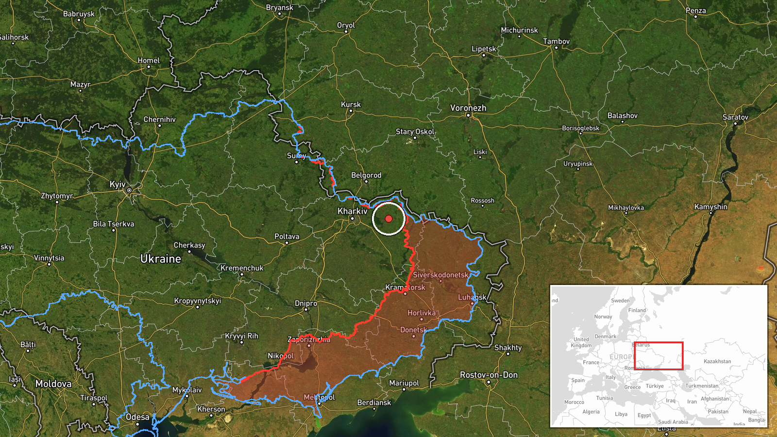
Ukraine's air monitoring channel, the Telegram account @kpszsu, reported on 23 October 2026 at about 12:09 UTC that a single Russian guided glide bomb (KAB) was heading toward eastern Kharkiv Oblast. The original post, written in Ukrainian, reads roughly as 'KABs to the east of Kharkiv region!' and gives no target, impact point or casualty information. The event is recorded as a single-channel report with no independent confirmation at the time of compilation. The location is given only at regional level, so the exact settlement or impact area is not established by the data. The entry describes an approaching munition rather than a confirmed strike, and any outcome would need to be reported separately.
Context and assessment
Eastern Kharkiv Oblast has been one of the most persistently contested parts of the front, and guided glide bombs are a standard Russian tool for striking Ukrainian positions and towns within reach of the front line. The related events show a dense sequence over roughly 24 hours. On 22 October, the Ukrainian General Staff reported eleven combat clashes in the Sloboda-Northern direction around Izbytske, Radkivka and Vilkhuvatka, with one still ongoing. Later that evening, footage circulated of close-quarters underground fighting in the Kupiansk direction, though the attacking side was not confirmed. The following morning, air monitoring logged a jet-powered Shahed (Geran-3) toward Balakliya, a Banderol mini cruise missile toward Zmiyiv, and another Geran-3 toward Kharkiv city. Taken together, the pattern suggests a coordinated effort combining ground pressure with long-range and standoff strikes on rear and urban areas. The glide bomb report fits that picture, though a single munition does not by itself indicate a larger operation.
Sources and confidence
The event rests on one Telegram channel, @kpszsu, which is associated with Ukrainian air monitoring reporting. No second outlet in the data confirms the glide bomb track. The confidence score of 8.0 out of 10 reflects an official-linked channel with a consistent record for air alerts, but it is held below the top range because the post is unverified, has no impact confirmation, and lacks a specific target. Confidence would rise if regional authorities, Ukrainian Air Force statements, or local officials confirmed an impact, or if independent imagery or munition debris were published. It would fall if the track were later revised, cancelled, or attributed to a different munition.
Location
The coordinates correspond to a broad point over eastern Kharkiv Oblast rather than a named settlement, and the location is rated low confidence with regional precision. The position was set from the regional description in the post, not from a confirmed impact site. The area is largely flat steppe and farmland of the Kharkiv-Donetsk border zone, with the Oskil River valley and the Siverskyi Donets basin to the east and south. Settlements such as Kupiansk, Izyum and Balakliya lie in the wider area, and the frontline sectors mentioned in related events are within tens of kilometres.
Related events nearby
- Ukrainian General Staff reports 11 combat clashes in the Sloboda-Northern direction near Izbytske, Radkivka an2026-10-22 19:02 UTC · Combat · Izbytske, Kharkiv Oblast, Ukraine
- Footage shared of underground close-quarters clashes between Russian and Ukrainian soldiers in the Kupiansk di2026-10-22 19:10 UTC · Combat · Kupiansk, Kharkiv Oblast, Ukraine
- Ukrainian air monitoring: 1 Russian jet-powered Shahed (Geran-3) drone heading toward Balakliya.2026-10-23 04:30 UTC · Drone Transit · Balakliya, Ukraine
- Ukrainian air monitoring: 1 Russian Banderol mini cruise missile heading toward Zmiyiv.2026-10-23 06:09 UTC · Cruise Missile · Zmiyiv, Ukraine
- Ukrainian air monitoring: 1 Russian jet-powered Shahed (Geran-3) drone heading toward Kharkiv.2026-10-23 11:35 UTC · Drone Transit · Kharkiv, Ukraine
▶ View this event on the live map

Intel Mapper aggregates open-source reports from monitored Telegram and X channels, geolocates them, cross-checks duplicates across sources and assigns a confidence score. Entries are updated as new confirmations arrive. Read how we verify events.