Ukrainian air monitoring reports jet-powered drones heading toward Dnipro from the south
What happened
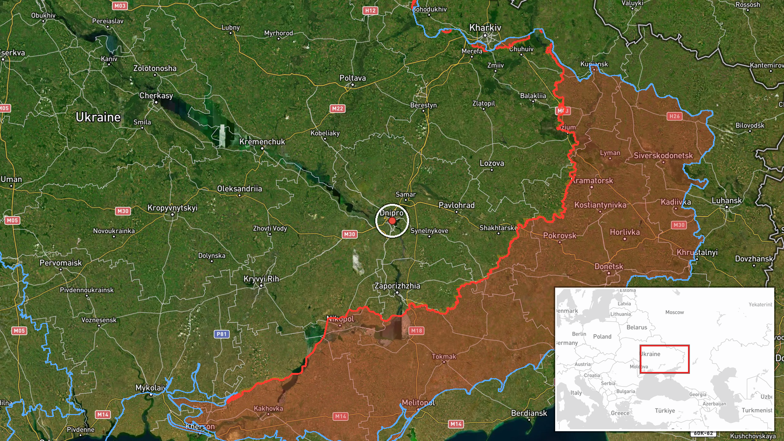
Ukraine's air monitoring channel on Telegram, @kpszsu, reported at 12:28 UTC on 23 October 2026 that two or more jet-powered unmanned aerial vehicles were heading toward Dnipro from the south. The original Ukrainian wording, 'Реактивні БпЛА у напрямку Дніпра з півдня', describes jet-powered UAVs moving in the direction of Dnipro from the south. The post opens with a motorcycle emoji used as a stylised marker rather than a unit or type designation. The event summary attributes the aircraft to Russia and identifies them as Geran-3 drones, the jet-powered variant of the Shahed family. The report gives no impact location, casualty information or damage assessment. It is a trajectory warning issued while the aircraft were in flight.
Context and assessment
Dnipro is Ukraine's fourth-largest city and the administrative centre of Dnipropetrovsk Oblast, on the Dnipro River in the centre-east of the country. Its industrial base, rail and road junctions and dense population make it a recurring focus for long-range strike activity, and air alerts there are closely followed by residents and local authorities. This report sits inside a run of activity logged the same morning. At 08:35 UTC a guided glide bomb was reported heading toward Dnipropetrovsk Oblast. At 09:36 a single Geran-3 was reported passing Synelnykove, heading toward Dnipro, and at 09:50 one was tracked in the Dnipro area itself. A further glide bomb was reported at 11:00, and at 11:19 a single drone was seen passing the oblast heading northwest. The pattern is of repeated, individually small detections across several hours rather than one large salvo. Operationally, this may reflect sustained probing, staggered launches intended to stretch air defence, or aircraft being redirected between targets. Because each entry is a monitoring alert rather than a confirmed impact, the sequence is best read as evidence of continued pressure on the region, not as a measure of damage.
Sources and confidence
All information comes from a single Telegram channel, @kpszsu, which is linked to Ukraine's air monitoring reporting. No second channel, wire service or official statement is listed in the data to corroborate the post. The confidence score of 8.0 reflects a credible, official-facing source and a high-confidence location, offset by single-source status and the fact that the report describes aircraft in flight rather than any outcome. Confidence would rise with confirmation from regional authorities, reports of impact or interception, or matching open-source flight tracking. It would fall if later updates contradicted the direction or type of aircraft.
Location
The point is placed at the city of Dnipro, a settlement-level match rather than a specific facility, and the high location confidence reflects that the report names the city directly. Dnipro lies on the Dnipro River in central-eastern Ukraine, and the river divides the city into banks linked by several bridges. The reported approach from the south crosses lower-lying terrain of the oblast. The direction is relative to the city as a whole, not to any particular site within it.
Related events nearby
- Ukrainian air monitoring: 1 Russian jet-powered Shahed (Geran-3) drone passing Dnipropetrovsk Oblast, heading 2026-10-23 11:19 UTC · Drone Transit · Dnipropetrovsk Oblast, Ukraine
- Ukrainian air monitoring: 1 Russian guided glide bomb (KAB) heading toward Dnipropetrovsk Oblast.2026-10-23 11:00 UTC · Airstrike · Dnipropetrovsk Oblast, Ukraine
- Ukrainian air monitoring: one Russian jet-powered Shahed (Geran-3) drone tracked in the Dnipro area.2026-10-23 09:50 UTC · Drone Transit · Dnipro, Dnipropetrovsk Oblast, Ukraine
- Ukrainian air monitoring: 1 Russian jet-powered Shahed (Geran-3) drone passing Synelnykove, heading toward Dni2026-10-23 09:36 UTC · Drone Transit · Dnipro, Ukraine
- Ukrainian air monitoring: 1 Russian guided glide bomb (KAB) heading toward Dnipropetrovsk Oblast.2026-10-23 08:35 UTC · Airstrike · Dnipropetrovsk Oblast, Ukraine
▶ View this event on the live map

Intel Mapper aggregates open-source reports from monitored Telegram and X channels, geolocates them, cross-checks duplicates across sources and assigns a confidence score. Entries are updated as new confirmations arrive. Read how we verify events.