Telegram reports trucks set ablaze on Novorossiya highway near Odesa; attacker unconfirmed
What happened
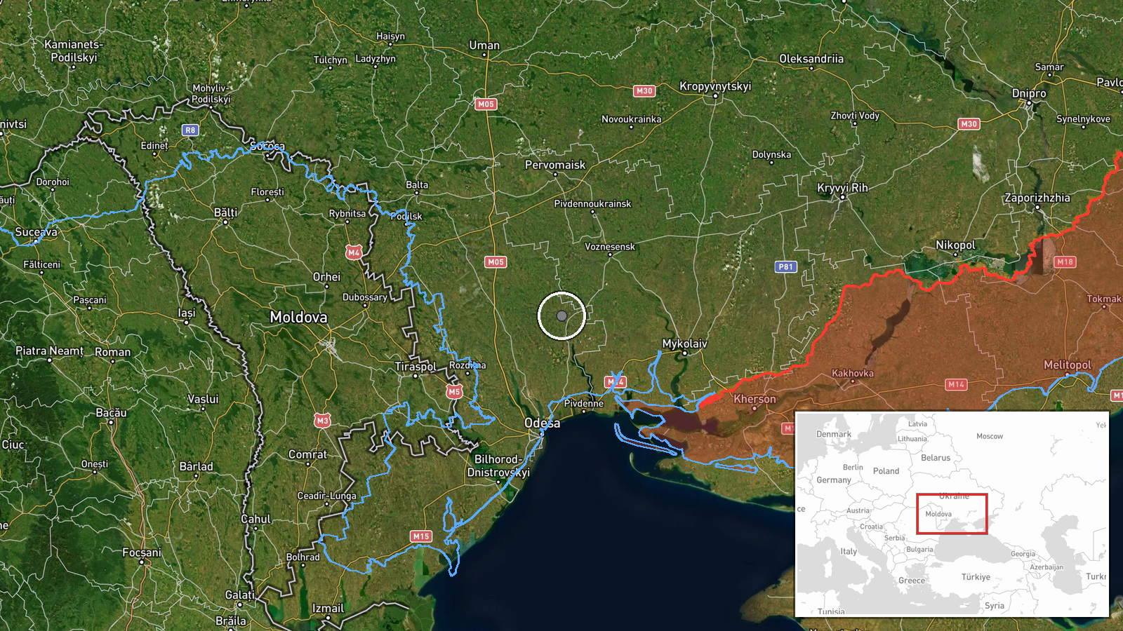
A single Telegram channel, @supernova_plus, reported on 16 October 2026 at 14:28 UTC that trucks were set ablaze on the Novorossiya highway, designated M-14, in Ukraine. The source text is truncated in the record. The fragment available reads roughly as trucks being set alight, and the rest of the message is missing. The event is classed as an explosion, but the report does not say what caused the fire, and no attacker has been identified; the actor field reads unidentified. The post does not give a settlement, a number of vehicles, or any casualty information, and none of those details should be assumed. Coordinates place the event in the Odesa area, but precision is recorded at regional level, so the pin marks a general corridor rather than a specific site.
Context and assessment
The M-14 is a major north-south route linking the Odesa region with Mykolaiv and areas further east, so trucks along it carry logistics, fuel, and goods that matter to the regional economy and to the supply chains serving Odesa port. Any incident on this corridor draws attention for that reason alone. The report sits within a busy monitoring day. Ukrainian air monitoring logged several jet-powered Shahed (Geran-3) drones on 16 October 2026, including one passing north of Buialyk at 01:06 UTC, a drone moving through western Mykolaiv Oblast at 04:01, several drones north of Odesa at 02:25 heading west, and further single drones over Odesa Oblast at 04:43 and 07:50. Those transits are the nearest related activity in time and place. The records do not link the drones to the highway fire, and the timestamps alone do not establish cause. Still, the pattern shows sustained aerial activity over the same region during the hours before the report. If the highway incident was an aerial strike, the drone record would be the most relevant explanation. If it was a ground-based attack or a fire of another origin, the drone traffic would be background only. Analysts would need an independent account of the event before drawing a conclusion.
Sources and confidence
Only one channel, Telegram @supernova_plus, carries the report, so cross-confirmation is absent. The confidence score of 5.7 is low. It reflects a single unverified source, a truncated text, no named attacker, and a location recorded only at regional precision. Confidence would rise with corroboration from regional authorities, road operators, established local media, or imagery showing burned vehicles at the same stretch of road. It would fall if checking found the post was recycled from an earlier incident or misdated.
Location
The location is approximate. Coordinates are given at region precision, and the location confidence field is marked high, so the point most likely reflects the highway corridor north-west of Odesa rather than a verified settlement or facility. The M-14 runs through the Odesa region toward Mykolaiv across mostly flat, open terrain. Estuaries and lagoons lie to the south near the Black Sea coast. Useful checks include the Odesa urban fringe and the junctions where local roads meet the highway.
Related events nearby
- Ukrainian air monitoring: 1 Russian jet-powered Shahed (Geran-3) drone passing north of Buialyk, heading north2026-10-16 01:06 UTC · Drone Transit · north of Buialyk, Ukraine
- Ukrainian air monitoring: 1 Russian jet-powered Shahed (Geran-3) drone passing western Mykolaiv Oblast, headin2026-10-16 04:01 UTC · Drone Transit · western Mykolaiv Oblast, Ukraine
- Ukrainian air monitoring: 2+ Russian jet-powered Shahed (Geran-3) drones passing north of Odesa, heading west.2026-10-16 02:25 UTC · Drone Transit · north of Odesa, Ukraine
- Ukrainian air monitoring: 1 Russian jet-powered Shahed (Geran-3) drone over Odesa Oblast.2026-10-16 07:50 UTC · Drone Transit · Odesa Oblast, Ukraine
- Ukrainian air monitoring: 1 Russian jet-powered Shahed (Geran-3) drone from Black Sea toward Odesa Oblast.2026-10-16 04:43 UTC · Drone Transit · Odesa Oblast, Ukraine
▶ View this event on the live map

Intel Mapper aggregates open-source reports from monitored Telegram and X channels, geolocates them, cross-checks duplicates across sources and assigns a confidence score. Entries are updated as new confirmations arrive. Read how we verify events.