Two Russian Shahed drones tracked transiting Kirovohrad Oblast
What happened
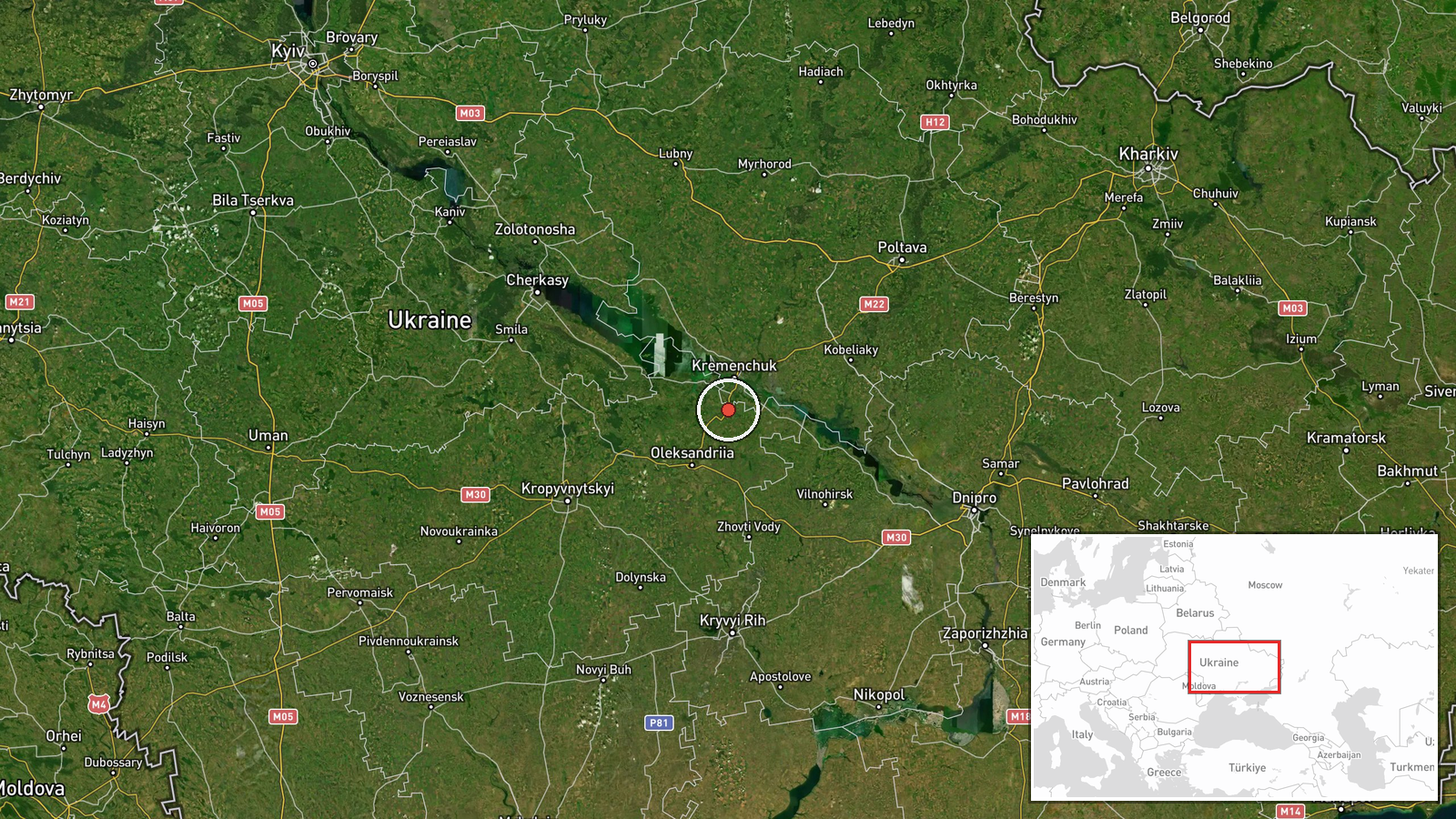
Ukrainian air monitoring reported two Russian reactive Shahed-variant kamikaze drones in transit over Pavlysh, Kirovohrad Oblast, on 2 September at 21:56 UTC. The drones were tracked as part of ongoing Russian unmanned aerial operations against Ukraine. The report does not specify the drones' intended target or ultimate destination. The observation comes amid a broader pattern of Russian drone activity across central Ukraine on the same date.
Context and assessment
Pavlysh lies in central Kirovohrad Oblast, a region that has faced repeated drone transits and strikes throughout the conflict. The detection follows multiple tracked drone movements earlier on 2 September, including groups transiting through Poltava and Cherkasy oblasts toward the south and west. The pattern suggests Russia may be conducting coordinated multi-directional drone operations, potentially aimed at targets across a wide geographic arc. Shahed-variant drones, jet-powered reactive systems, are typically used for strikes on critical infrastructure, military facilities, or populated areas at extended range from Russian territory.
Sources and confidence
Reported by Telegram channel @war_monitor on 2 September 2026. Single-source reporting with no cross-confirmation noted in available data. Confidence score of 6.0 reflects standard Ukrainian air monitoring reporting credibility but limited corroboration. Confirmation by additional independent monitoring channels or air force statements would strengthen confidence; lack of follow-up impact reporting may indicate transit without strike.
Location
Pavlysh is a settlement in Kirovohrad Oblast, south-central Ukraine, at coordinates 48.92°N 33.36°E. The location sits approximately 200 kilometers south-southwest of Kyiv and roughly 100 kilometers north of Mykolaiv Oblast. The region is relatively open agricultural terrain with limited air defense density compared to major urban centers, making it a common transit corridor for Russian drone operations heading toward southern and western Ukraine.
Related events nearby
- Three Russian Shahed-136 reactive (jet-powered) kamikaze drones tracked transiting from Poltava Oblast toward 2026-09-02 10:08 UTC · Drone Transit · En route: Poltava Oblast → Kyiv Oblast, Ukraine
- Three Russian Shahed-136 reactive (jet-powered) kamikaze drones tracked transiting through Poltava Oblast, pas2026-09-02 10:02 UTC · Drone Transit · En route: Reshetylivka → Drabiv, Poltava Oblast, U
- Ukrainian air monitoring reports 2 Russian reactive (Shahed-variant) kamikaze drones tracked transiting over K2026-09-02 21:57 UTC · Drone Transit · Kozelivka, Poltava Oblast, Ukraine
- Six Russian Shahed-136 reactive (jet-powered) kamikaze drones detected in transit from Dnipro toward Kirovohra2026-09-02 14:35 UTC · Drone Transit · Dnipro, Dnipropetrovska Oblast, Ukraine
- Ukrainian air monitoring reports 6 Russian reactive (Shahed-variant) kamikaze drones transiting over Poltava O2026-09-02 21:46 UTC · Drone Transit · Drabiv, Cherkasy Oblast, Ukraine
▶ View this event on the live map
Intel Mapper aggregates open-source reports from monitored Telegram and X channels, geolocates them, cross-checks duplicates across sources and assigns a confidence score. Entries are updated as new confirmations arrive. Read how we verify events.