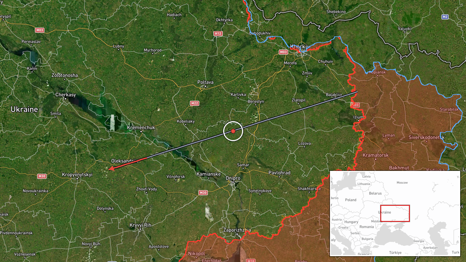
Two Russian Shahed drones detected transiting toward Kropyvnytskyi in central Ukraine
What happened
Ukrainian air monitoring reported detecting two Russian Shahed-variant unmanned aerial vehicles with jet engines in transit from Aleksandriya toward Kropyvnytskyi District in Kirovohrad Oblast on September 24 at 02:04 UTC. The drones were tracked moving westward across the region. The report was issued as part of ongoing Ukrainian air defense monitoring of massed drone operations across central Ukraine.
Context and assessment
Kirovohrad Oblast sits in central Ukraine and has become a regular target corridor for Russian drone strikes, particularly attacks on civilian and energy infrastructure. The detection of multiple Shahed variants in transit westward suggests a coordinated multi-target engagement, consistent with Russia's established pattern of massed drone operations. A related transit was reported over the region the previous day, indicating sustained pressure. The Shahed-136 series—jet-powered, relatively slow, and radar-detectable—allows Ukrainian air defenses advance warning, though interception rates remain incomplete.
Sources and confidence
Single source: Telegram channel @war_monitor, a widely monitored Ukrainian open-source intelligence aggregator. Confidence of 6.0 reflects lack of cross-confirmation from independent channels or Ukrainian official defense statements. Confidence would increase with corroboration from additional OSINT monitors or official SBU/Air Force statements; would decrease if subsequent reports contradicted the transit claim.
Location
Aleksandriya and Kropyvnytskyi District both lie in Kirovohrad Oblast, central Ukraine. The transit direction runs roughly west-northwest across flat, open terrain typical of the region. Kirovohrad Oblast borders Dnipropetrovsk to the north and Mykolaiv to the south, positioning it on a common corridor for Russian strikes into central Ukraine. Geographic precision rated as regional rather than pinpoint.
Related events nearby
- One Russian Shahed-136 reactive (jet-motorized) kamikaze drone detected in transit over Kirovohrad District, K2026-09-23 04:43 UTC · Drone Transit · Kirovohrad District, Kirovohrad Oblast, Ukraine
- Ukrainian air monitoring reports 3 Russian reactive (jet-engined) Shahed variant UAVs transiting over Cherkasy2026-09-24 02:37 UTC · Drone Transit · Cherkasy Oblast, Ukraine
- Ukrainian air monitoring detects 5 Russian reactive (jet-engined) Shahed-variant UAVs transiting from Poltava 2026-09-24 02:38 UTC · Drone Transit · Zolotonosha, Cherkasy Oblast, Ukraine
▶ View this event on the live map
Intel Mapper aggregates open-source reports from monitored Telegram and X channels, geolocates them, cross-checks duplicates across sources and assigns a confidence score. Entries are updated as new confirmations arrive. Read how we verify events.