Two Russian jet-powered Shahed drones tracked over Chernihiv heading toward Kyiv
What happened
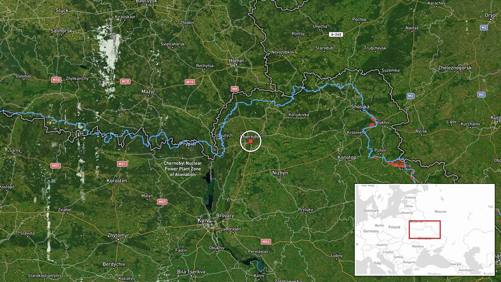
Ukrainian air monitoring detected two Russian jet-powered Shahed-variant reactive UAVs in transit over Chernihiv Oblast early on 28 September, flying in the direction of Kyiv Oblast. The drones were identified and tracked by Ukrainian air defense systems. No strikes have been confirmed at the time of reporting. The detection was reported via Telegram by war monitoring channels tracking Russian air operations.
Context and assessment
The sighting continues an established pattern of Russian drone operations against Kyiv and surrounding regions. Related detections from 27–28 September show repeated Shahed transits through the same northern corridor—via Chernihiv Oblast and over the Chornobyl Exclusion Zone toward Kyiv Oblast—suggesting sustained massed drone attacks. Jet-powered Shaheds are faster and harder to intercept than earlier variants, capable of reaching central Kyiv. The frequency and consistency of these northern approach routes indicate Russia maintains operational tempo against Ukrainian infrastructure and civilian areas despite ongoing air defense efforts.
Sources and confidence
Reported by Telegram channel @war_monitor on 28 September 05:34 UTC. Single source detection with no cross-confirmation noted in available data. Confidence score of 6.0 reflects that Ukrainian air monitoring is generally reliable for tracking in-flight drones, but absence of corroborating reports limits certainty. Confirmation of actual strikes or interceptions would raise confidence; radar/visual reports from multiple independent channels would strengthen assessment.
Location
Chernihiv Oblast, northern Ukraine, approximately 51.5°N, 31.3°E. Region-level precision; exact flight path not pinpointed. Chernihiv lies roughly 150 km north of Kyiv and serves as a standard approach corridor for Russian drone strikes heading south. The Chornobyl Exclusion Zone lies between Chernihiv and Kyiv, another frequently used transit area.
Related events nearby
- Ukrainian air monitoring detected one Russian jet-powered Shahed-variant (reactive) UAV transiting near Slavut2026-09-27 21:42 UTC · Drone Transit · Slavutych, Chernihiv Oblast, Ukraine
- Ukrainian air monitoring reports one Russian reactive (jet-powered) Shahed-variant UAV detected transiting ove2026-09-27 12:57 UTC · Drone Transit · Chornobyl Exclusion Zone, Kyiv Oblast, Ukraine
- Ukrainian air monitoring detected three Russian jet-powered Shahed-variant reactive UAVs transiting over Kyiv 2026-09-28 06:59 UTC · Drone Transit · Kyiv Reservoir, Kyiv Oblast, Ukraine
- Ukrainian air monitoring detected two Russian jet-powered Shahed-variant UAVs in transit toward Kyiv Oblast. P2026-09-27 16:22 UTC · Drone Transit · Kyiv Oblast, Ukraine
- Ukrainian air monitoring confirms two Russian jet-powered Shahed-variant UAVs detected transiting from Chernih2026-09-27 15:05 UTC · Drone Transit · Kyiv Oblast, Ukraine
▶ View this event on the live map
Intel Mapper aggregates open-source reports from monitored Telegram and X channels, geolocates them, cross-checks duplicates across sources and assigns a confidence score. Entries are updated as new confirmations arrive. Read how we verify events.