Russian kamikaze drones transit Kyiv Oblast toward unconfirmed targets
What happened
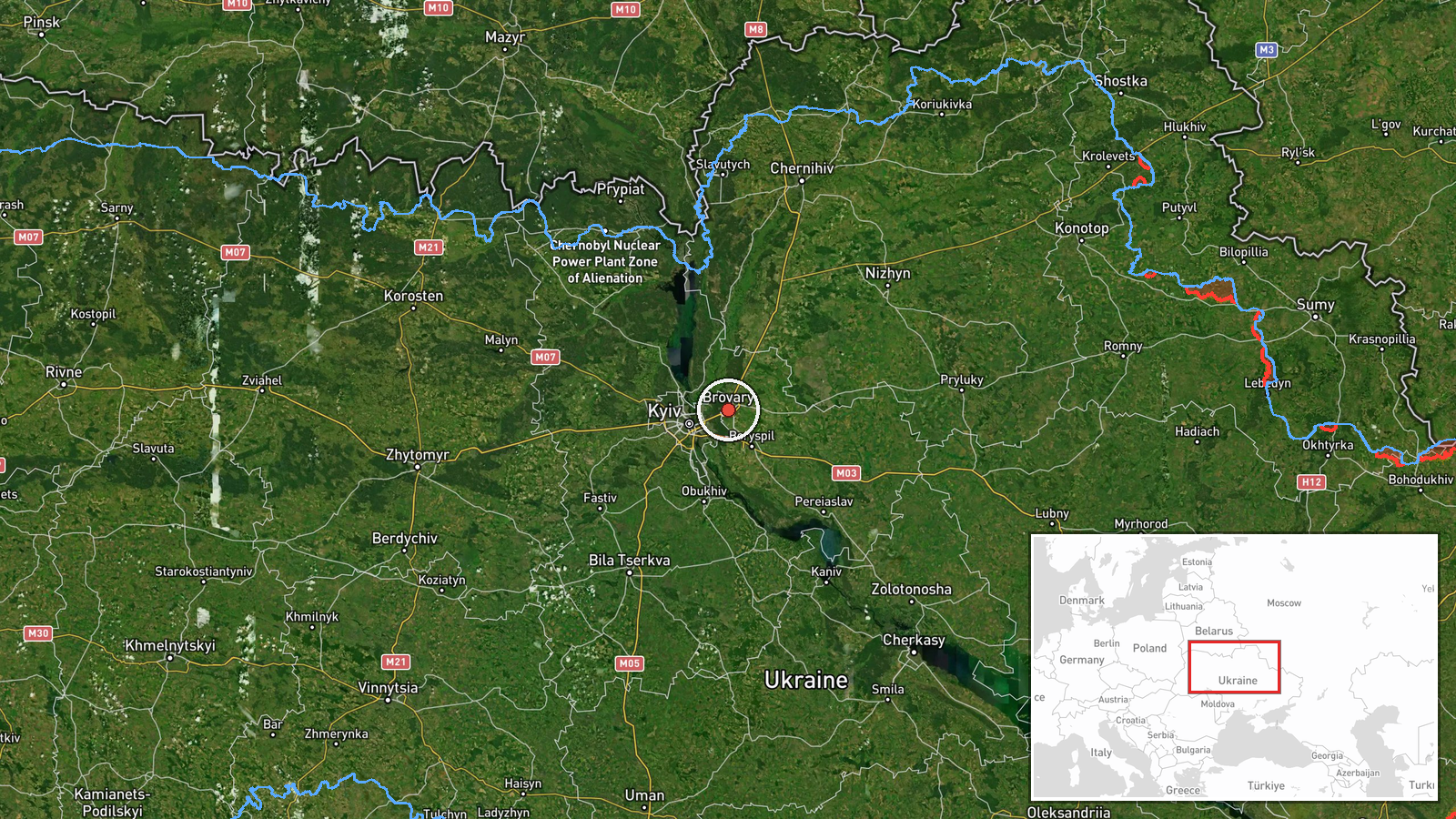
Russian kamikaze drones, identified as Shahed or reaktiv types, were sighted transiting through Kyiv Oblast on October 2 at approximately 01:51 UTC. According to Telegram channel @war_monitor, one drone passed over Brovary and another over Pereyaslav. The drones were en route to targets, though the intended destination was not specified in the report. No impact or interception was reported in this transit observation.
Context and assessment
Brovary lies approximately 20 kilometers northeast of central Kyiv and serves as a key approach corridor for Russian drones targeting the capital and surrounding infrastructure. The sightings on October 2 continue a pattern of sustained Russian drone activity documented over preceding hours, with multiple Shahed-136 detections across Kyiv Oblast on October 1. Pereyaslav, located further east, sits along a major avenue of approach from Russian-held territory. These transit reports suggest either renewed strikes on Kyiv-area targets or continued reconnaissance pressure, consistent with Russia's sustained campaign against Ukrainian civilian and military infrastructure in the capital region.
Sources and confidence
Reported by Telegram channel @war_monitor (Ukraine-focused open-source military monitoring). Single-source report with high location confidence but unconfirmed interception or impact outcome. Confidence score of 6.0 reflects the established reliability of transit observations but limited independent corroboration. Cross-confirmation from Ukrainian air defense channels or damage reports would strengthen confidence; absence of broader reporting on resulting strikes could indicate successful air defense or drone malfunction.
Location
Brovary is a city in Kyiv Oblast, approximately 20 kilometers northeast of Kyiv city center, situated in the capital's suburban belt. Pereyaslav lies roughly 60 kilometers southeast of Kyiv. Both settlements occupy positions along typical drone approach corridors from Russian-held eastern and northern territories into the Kyiv metropolitan area.
Related events nearby
- Russian Shahed/reactive kamikaze drones transiting through Kyiv Oblast. One sighted over Brovary, one over Tri2026-10-02 01:51 UTC · Drone Transit · Brovary, Kyiv Oblast, Ukraine
- Russian Shahed-type kamikaze drone detected over Brovary (Ukrainian air monitoring).2026-10-01 17:14 UTC · Drone Transit · Brovary, Ukraine
- Russian Shahed-type kamikaze drone detected transiting from Troieshchyna toward Lisovyi (Ukrainian air monitor2026-10-01 17:02 UTC · Drone Transit · Lisovyi, Ukraine
- Russian Shahed-136 reactive kamikaze drones detected transiting near Brovary in Kyiv Oblast en route toward ce2026-10-01 17:01 UTC · Drone Transit · Velyka Dymerka, Ukraine
- Ukrainian air defense (AirAlert/дорозвідка) reports successful air defense readiness/alert status across Kyiv 2026-10-01 15:34 UTC · Drone Transit · Kyiv Oblast, Ukraine
▶ View this event on the live map
Intel Mapper aggregates open-source reports from monitored Telegram and X channels, geolocates them, cross-checks duplicates across sources and assigns a confidence score. Entries are updated as new confirmations arrive. Read how we verify events.