Russian Shahed-variant drone tracked transiting past Boryspil toward Kyiv region
What happened
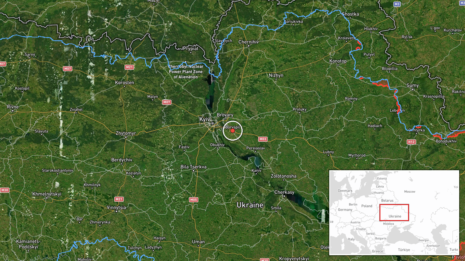
A Russian reactive or jet-powered Shahed-type kamikaze drone was detected passing over Boryspil in Kyiv Oblast on the morning of October 2, 2026, at approximately 02:49 UTC. The drone was reportedly en route to a target within the Kyiv region. The sighting was reported via Telegram by the war monitoring channel @war_monitor, which specializes in tracking Ukrainian air defense alerts and drone movements.
Context and assessment
The detection over Boryspil represents a continuation of an intensive Russian kamikaze drone campaign targeting the greater Kyiv area. Related sightings on October 1 and the early hours of October 2 tracked similar Shahed-type systems transiting through Kyiv Oblast near settlements including Hnidyn, Bortnychi, Brovary, and Pereyaslav. This pattern of multiple drone transits suggests a coordinated attack wave targeting the capital region or critical infrastructure nearby. Boryspil, home to Kyiv's primary international airport, may indicate targeting of transportation infrastructure, though intent cannot be confirmed from transit data alone.
Sources and confidence
Single source: Telegram channel @war_monitor, which monitors Ukrainian air alerts. Confidence score of 6.0 reflects sole-source reporting without independent cross-confirmation from Ukrainian official channels or multiple monitors. Confidence could increase with corroborating reports from Ukrainian air force or SBU sources; it would lower if the drone's actual flight path or target diverged significantly from reported trajectory.
Location
Boryspil is located approximately 38 kilometers southeast of Kyiv city center in Kyiv Oblast. The settlement hosts Boryspil Airport (Kyiv Boryspil), Ukraine's largest international aviation hub, situated near the Dnieper River floodplain. Geographic precision is regional; exact interception point within the settlement's airspace was not specified.
Related events nearby
- Russian Shahed-type kamikaze drone detected over Hnidyn (Ukrainian air monitoring).2026-10-01 17:08 UTC · Drone Transit · Hnidyn, Ukraine
- Russian Shahed-type kamikaze drone detected over Bortnychi (Ukrainian air monitoring).2026-10-01 17:07 UTC · Drone Transit · Bortnychi, Ukraine
- Russian Shahed-type kamikaze drone detected over Brovary (Ukrainian air monitoring).2026-10-01 17:14 UTC · Drone Transit · Brovary, Ukraine
- Russian Shahed/reactive kamikaze drones transiting through Kyiv Oblast. One sighted over Brovary, one over Tri2026-10-02 01:51 UTC · Drone Transit · Brovary, Kyiv Oblast, Ukraine
- Russian kamikaze drones (Shahed/reaktiv) transiting through Kyiv Oblast toward targets. Sighted passing over B2026-10-02 01:51 UTC · Drone Transit · Brovary, Kyiv Oblast, Ukraine
▶ View this event on the live map
Intel Mapper aggregates open-source reports from monitored Telegram and X channels, geolocates them, cross-checks duplicates across sources and assigns a confidence score. Entries are updated as new confirmations arrive. Read how we verify events.