Ukrainian air monitoring reports two Zircon/Oniks cruise missiles inbound to Kremenchuk
What happened
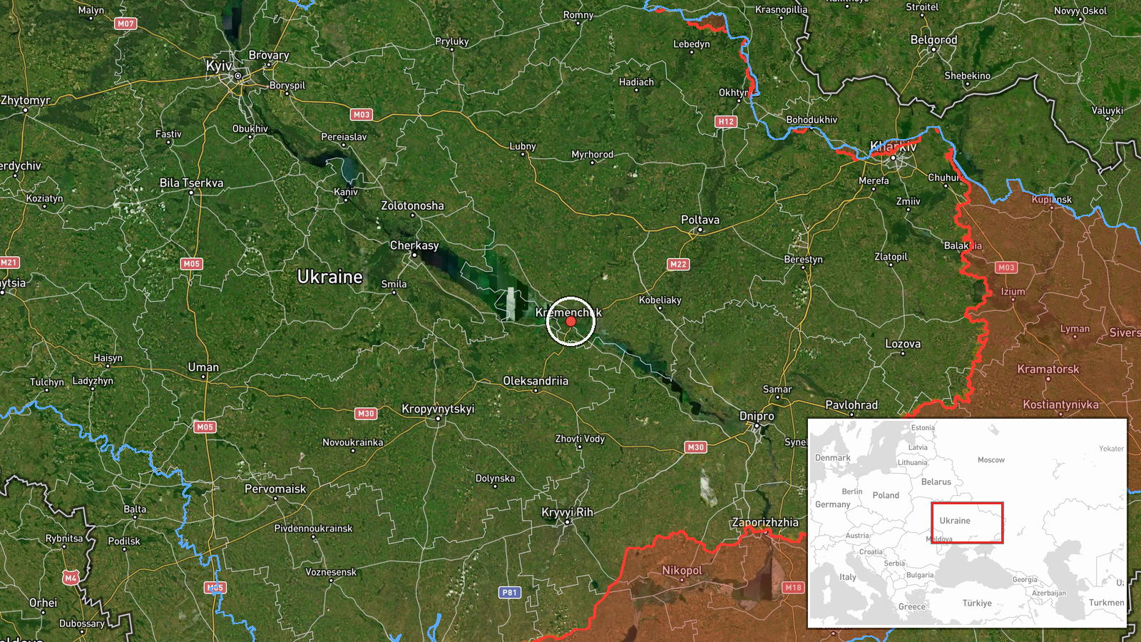
Ukrainian air monitoring channels reported the detection of two Russian Zircon or Oniks cruise missiles heading toward Kremenchuk in central Ukraine on October 7 at 00:32 UTC. The alert was posted in Russian on a Telegram channel dedicated to conflict monitoring. Zircon and Oniks are both sea-launched cruise missiles in the Russian inventory. The report indicates ongoing Ukrainian air defense tracking rather than confirmed impact or damage assessment.
Context and assessment
Kremenchuk, a city of roughly 200,000 in Poltava Oblast, has been a recurring target for Russian cruise and ballistic missile strikes throughout the conflict, likely due to its strategic infrastructure and transportation hub status. This detection occurred during a broader overnight Russian missile and drone campaign across central Ukraine, with simultaneous ballistic missile threats reported over Kremenchuk itself and nearby Dnipro. Ukrainian air defense reported intercepting 114 enemy drones the previous night. The pattern suggests a coordinated multi-axis strike effort combining drones, cruise missiles, and ballistic weapons, consistent with Russian operational doctrine of saturating air defenses across multiple targets.
Sources and confidence
Single Telegram channel (@war_monitor) reported the detection. Related simultaneous reports confirm broader Russian missile activity over the same cities and timeframe. Confidence is moderate (6/10) owing to single-source reporting; however, the alert aligns with confirmed Ukrainian air defense operations and related ballistic missile warnings over Kremenchuk within one minute. Impact or interception status remains unreported.
Location
Kremenchuk is located in Poltava Oblast in central Ukraine at approximately 49.07°N, 33.42°E. The city sits on the Dnipro River and serves as a major transport and industrial hub. It lies roughly 70 kilometers west of the Russian-occupied Donbas region and approximately 340 kilometers southeast of Kyiv, placing it within range of Russian cruise missiles based in the Black Sea or southern Russia.
Related events nearby
- Ukrainian air monitoring: 1 Russian Kh-101 cruise missile heading toward Kremenchuk.2026-10-07 02:58 UTC · Cruise Missile · Kremenchuk, Ukraine
- Ukrainian air monitoring: 1 Russian Kalibr cruise missile passing Kamyanske, heading toward Kremenchuk; 1 Russ2026-10-07 01:50 UTC · Cruise Missile · Kremenchuk, Ukraine
- Ongoing Russian ballistic missile strikes continue against Kyiv. Multiple ballistic threats detected over the 2026-10-07 00:33 UTC · Ballistic Missile · Kremenchuk, Poltava Oblast, Ukraine
- Ukrainian air monitoring: 1 Russian Kh-101 cruise missile heading toward Poltava district.2026-10-07 02:53 UTC · Cruise Missile · Poltava district, Ukraine
- Ukrainian air defense forces intercepted/suppressed 114 enemy drones overnight (Shahed, Gerber, Banderol types2026-10-06 07:02 UTC · Air Defense · Ukraine (Air Defense Operations)
▶ View this event on the live map
Intel Mapper aggregates open-source reports from monitored Telegram and X channels, geolocates them, cross-checks duplicates across sources and assigns a confidence score. Entries are updated as new confirmations arrive. Read how we verify events.