Single Shahed-type drone reported heading toward Brovary district, Kyiv Oblast, on Telegram
What happened
Ukrainian air monitoring channel @war_monitor on Telegram reported on 17 October 2026 at about 19:28 UTC that one Russian Shahed-type drone was moving toward Brovary district in Kyiv Oblast. The original post, written in Ukrainian, uses the shorthand 'БР' (a drone designation) and states the direction of travel toward the district rather than confirming a strike or impact. The report does not describe any detonation, damage, casualties or interception. Because the account is the only source attached to the event, the wording reflects a monitoring alert rather than a verified observation by officials or independent observers. The report is best read as a notice of an airborne threat in the area at that time.
Context and assessment
Brovary sits on the eastern edge of the Kyiv metropolitan area, along the Dnipro corridor, and is a logistics and residential hub that lies on approach routes toward the capital. Drones heading toward Kyiv Oblast have been frequent in the same day's record. Earlier alerts on 17 October included a Shahed-type drone from Belarus toward Kyiv Oblast at 06:39 UTC, two or more jet-powered Geran-3 drones from northern Chernihiv Oblast at 09:45 UTC, and a single Geran-3 from Cherkasy Oblast at 15:51 UTC. Taken together, these reports suggest a sustained pattern of individual drones moving across the region rather than one isolated launch. Operationally, a lone drone heading toward a district on the capital's periphery may indicate route probing, decoy activity, or simply the tail of a wider raid. Such inferences remain tentative without corroboration of trajectory, flight path, or target. The concurrent political and security items in the record are not directly linked to this air movement.
Sources and confidence
The event rests on a single Telegram channel, @war_monitor, with no independent confirmation from Ukrainian air force statements, regional administrations or other monitoring accounts in the dataset. The confidence score of 6.0 out of 10 reflects a credible but unverified single-channel alert whose sourcing and track history are not visible. Confidence would rise with corroboration from official Ukrainian air command notices, regional military administration posts, or multiple independent observers reporting the same track. It would fall if the channel is later found to have repeated or misattributed alerts, or if subsequent official reporting shows no drone in the area.
Location
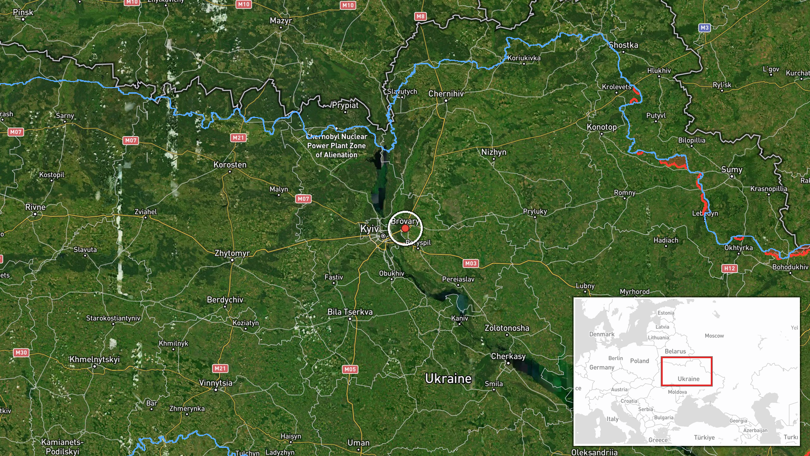
The coordinates correspond to the Brovary district of Kyiv Oblast, placed at settlement-level precision and marked high location confidence, meaning the district centroid rather than a specific facility. The area is flat, lies in the Dnipro river floodplain and surrounding terraces east of Kyiv, and contains a mix of suburban housing, industrial zones and transport links. Notable nearby features include the Dnipro river and the wider Kyiv ring road network. No specific target was named in the source, so the point marks the district rather than a site.
Related events nearby
- Zelensky says lifting sanctions against Russia will continue and calls the diesel deal only the first step.2026-10-17 16:47 UTC · Statement · Kyiv, Ukraine
- Reports claim paid 'titushky' provocateurs have gathered in Kyiv, with confrontation tensions escalating. Unve2026-10-17 10:20 UTC · Security · Kyiv, Kyiv City, Ukraine
- Ukrainian air monitoring: 1 Russian jet-powered Shahed (Geran-3) drone from Cherkasy Oblast toward Kyiv Oblast2026-10-17 15:51 UTC · Drone Transit · Kyiv Oblast, Ukraine
- Ukrainian air monitoring: 2+ Russian jet-powered Shahed (Geran-3) drones from northern Chernihiv Oblast toward2026-10-17 09:45 UTC · Drone Transit · Kyiv Oblast, Ukraine
- Ukrainian air monitoring: 1 Russian Shahed-type drone from Belarus toward Kyiv Oblast.2026-10-17 06:39 UTC · Drone Transit · Kyiv Oblast, Ukraine
▶ View this event on the live map

Intel Mapper aggregates open-source reports from monitored Telegram and X channels, geolocates them, cross-checks duplicates across sources and assigns a confidence score. Entries are updated as new confirmations arrive. Read how we verify events.