Single jet-powered Shahed drone reported moving from Cherkasy toward Kyiv Oblast on October 17, 2026
What happened
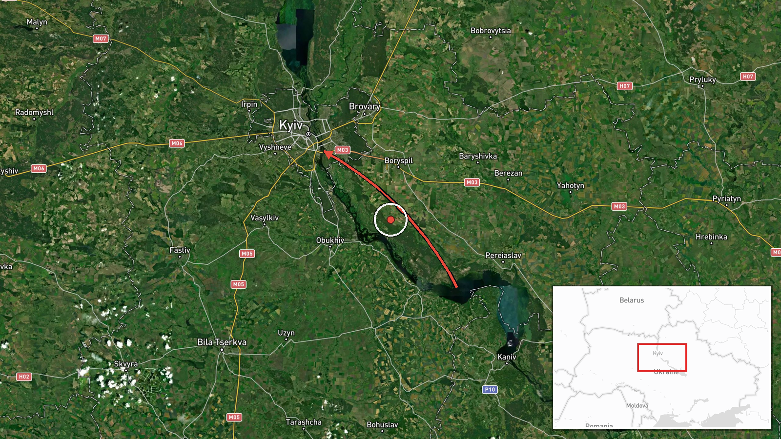
Ukrainian air monitoring reports, relayed through a single Telegram channel (@kpszsu), describe one Russian jet-powered Shahed (Geran-3) drone passing near Vilshana in Cherkasy Oblast and heading in the direction of Kyiv Oblast. The post was published at 15:51 UTC on October 17, 2026. The original Ukrainian wording describes a jet-powered UAV flying past Vilshana toward the Kyiv region, with no mention of impact, damage, or casualties. The report is a transit notice, not a strike report, so the drone's final destination and any outcome are not stated in the source.
Context and assessment
This report belongs to a dense series of drone transit alerts for Kyiv and its surrounding oblast on the same day. Related entries from earlier that morning and overnight describe Shahed-type drones entering from western and northern Chernihiv Oblast, one arriving from the direction of Belarus, and several passing near Hlevakha and the Vyshhorod district on routes toward the capital. The cumulative pattern suggests sustained, multi-axis flight paths into the Kyiv area rather than an isolated launch. Cherkasy Oblast lies to the south-east of the capital, so a track passing through it toward Kyiv Oblast suggests a separate approach corridor, one that may be used to complicate air defense coverage by forcing dispersed tracks across several regions. Jet-powered Geran-3 variants are generally faster than the older piston-engine Shahed models, which can shorten warning windows for interceptor and mobile fire groups. Taken alone, a single transit does not establish intent. Read together with the surrounding entries, however, it is consistent with a broader pressure campaign aimed at the Kyiv region and the logistics and energy infrastructure around it.
Sources and confidence
The event rests on one channel, Telegram @kpszsu, which carries Ukrainian air monitoring alerts. No independent outlet or second channel is listed as confirming this specific track, so cross-confirmation is absent. The confidence score of 8.0 reflects a clear, specific, timestamped report from an established monitoring source, offset by the single-channel basis and the transit-only nature of the content. Confidence would rise with corroboration from additional monitoring feeds, regional military administrations, or wreckage and impact reports. It would fall if later updates revised the track or the drone type.
Location
The coordinates (50.45, 30.52) sit at the centre of Kyiv Oblast and do not mark the drone's position at the time of the report. Because the source names Vilshana in Cherkasy Oblast as the point the drone passed, and the destination only as Kyiv Oblast, the location is recorded at region level with low precision. The area is mostly flat agricultural land along the Dnipro basin, with river valleys, reservoirs, and forest belts that can affect radar coverage. Mapped positions should be read as approximate regional markers rather than exact flight points.
Related events nearby
- Ukrainian air monitoring: 2+ Russian jet-powered Shahed (Geran-3) drones from northern Chernihiv Oblast toward2026-10-17 09:45 UTC · Drone Transit · Kyiv Oblast, Ukraine
- Ukrainian air monitoring: 1 Russian Shahed-type drone from Belarus toward Kyiv Oblast.2026-10-17 06:39 UTC · Drone Transit · Kyiv Oblast, Ukraine
- Ukrainian air monitoring: 1 Russian Shahed-type drone heading toward Kyiv; 1 Russian jet-powered Shahed (Geran2026-10-17 04:07 UTC · Drone Transit · Kyiv, Ukraine
- Ukrainian air monitoring: 3+ Russian Shahed-type drones from western Chernihiv Oblast toward Kyiv Oblast; 1 Ru2026-10-17 03:59 UTC · Drone Transit · Kyiv Oblast, Ukraine
- Ukrainian air monitoring: 1 Russian Shahed-type drone heading toward Kyiv.2026-10-17 01:36 UTC · Drone Transit · Kyiv, Ukraine
▶ View this event on the live map

Intel Mapper aggregates open-source reports from monitored Telegram and X channels, geolocates them, cross-checks duplicates across sources and assigns a confidence score. Entries are updated as new confirmations arrive. Read how we verify events.