Ukrainian air monitors report one Russian Shahed-type drone heading toward Kodra on 18 October
What happened
Ukrainian air monitoring reported on Telegram that one Russian Shahed-type drone was heading toward Kodra, a settlement in Ukraine, at about 15:34 UTC on 18 October 2026. The original post, written in Ukrainian, carries the header 'Київщина' (Kyiv region) and gives the bearing only as 'далі у напрямку Кодра', meaning further on in the direction of Kodra. The wording describes a drone in transit. It reports no explosion, impact, damage, casualties, or altitude and no detail beyond that bearing. The attribution to Russia rests on the monitor's identification of the aircraft as a Russian Shahed-type drone. The event data contains no independent confirmation of the sighting.
Context and assessment
Kodra is a small settlement, so its value to observers lies less in the place itself than in where it sits within a busy set of drone reports that day. The same feed logged five other drone transits between 02:04 and 15:27 UTC, including reports toward Korostyshiv, Dymer and Krasiatychi, and over Borshchahivka and Vyshneve near Kyiv. Those reports cluster in northern and central Ukraine, which suggests a sustained flight of drones moving through the region rather than a single isolated sortie. One related report describes a jet-powered Shahed variant, the Geran-3, which points to the Russian long-range drone family in use alongside the older piston-engined design. Transit reports of this kind are routinely issued to warn civilians and air defence units along a flight path. They show where drones are moving, but they do not on their own reveal the intended targets. Taken together, the day's reports suggest a broad, multi-axis drone activity across the north of the country. The data cannot establish whether any of these drones struck anything.
Sources and confidence
The event rests on a single Telegram channel, @war_monitor, and the source count is one. The related events are written in the same monitoring format and fall in the same area on the same day, but the data does not show independent confirmation of this specific drone by another outlet, official statement, or video. The confidence score of 6.0 reflects a credible monitoring channel with a clear original post, offset by the lack of cross-confirmation and the sparse detail in the message. Confidence would rise with a matching air force statement, a second monitor, geolocated imagery, or a report of an impact or debris at or near Kodra. It would fall if the channel corrected the report, if the location was disputed, or if later reports showed the drone was tracked along a different route.
Location
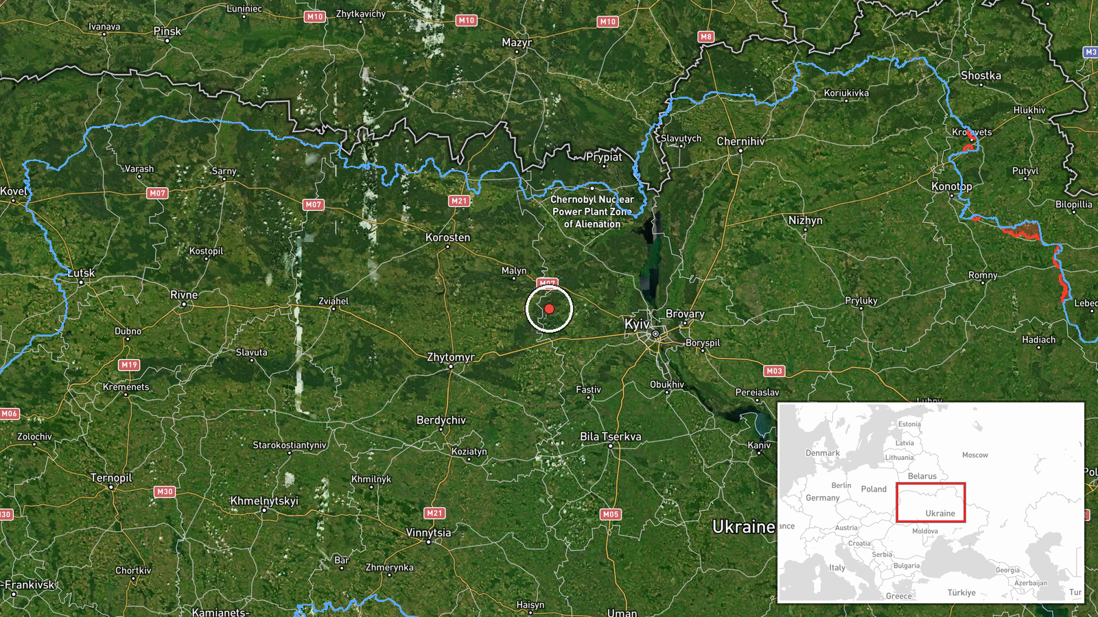
The location is recorded at settlement precision, with a high location confidence rating, and the coordinates are roughly 50.595 north and 29.559 east. The point appears to derive from the settlement name in the original post. The header refers to Kyiv region, so the pin should be read as approximate and anchored to the named settlement rather than to any facility or exact street. The area lies in northern Ukraine, in the broad Polissia belt of forests, wetlands and river valleys. The setting is largely rural and lightly built up. Several other reports from the same day place Korostyshiv in the same general northern zone, which helps situate Kodra within the wider flight corridor.
Related events nearby
- Ukrainian air monitoring: 1 Russian Shahed-type drone from Kyiv Oblast toward Korostyshiv.2026-10-18 02:04 UTC · Drone Transit · Korostyshiv, Ukraine
- Ukrainian air monitoring: 1 Russian jet-powered Shahed (Geran-3) drone heading toward Krasiatychi.2026-10-18 08:07 UTC · Drone Transit · Krasiatychi, Ukraine
- Ukrainian air monitoring: 1 Russian Shahed-type drone from northern Kyiv Oblast toward Dymer.2026-10-18 06:56 UTC · Drone Transit · Dymer, Ukraine
- Ukrainian air monitoring: 1 Russian Shahed-type drone over Borshchahivka, Kyiv.2026-10-18 15:26 UTC · Drone Transit · Borshchahivka, Kyiv, Ukraine
- Ukrainian air monitoring: 1 Russian Shahed-type drone over Vyshneve.2026-10-18 15:27 UTC · Drone Transit · Vyshneve, Ukraine
▶ View this event on the live map

Intel Mapper aggregates open-source reports from monitored Telegram and X channels, geolocates them, cross-checks duplicates across sources and assigns a confidence score. Entries are updated as new confirmations arrive. Read how we verify events.