Single Russian Banderol mini cruise missile reported over Myrhorod, Poltava Oblast, single-source report
What happened
Ukrainian air monitoring, as relayed by the Telegram channel @war_monitor, reported one Russian Banderol mini cruise missile passing over Myrhorod in Poltava Oblast, central Ukraine, at 18:40 UTC on 18 October 2026. The original Ukrainian-language post reads roughly as 'Poltava region: 1 Banderol mini cruise missile passing Myrhorod' and uses the abbreviation мгКР, a Ukrainian term for mini cruise missile. The report does not describe impact, damage, casualties, or any interception. It is the only source logged for this event, so the sighting rests on one channel's relay of air monitoring information rather than independent confirmation. A related entry, logged about eight minutes later, places a Banderol over the Zolotonosha district to the southwest.
Context and assessment
Myrhorod sits in the Poltava area, a central Ukrainian region that has appeared repeatedly in the day's air-threat reporting. Earlier on 18 October, a jet-powered Shahed-type drone, described as a Geran-3, was logged over Poltava around 06:35 and 06:45 UTC, with residents reportedly told to shelter, and a separate Shahed-type drone was reported heading toward Cherkasy at 02:02 UTC. The Banderol track then appears in Poltava and Zolotonosha within the same few hours, suggesting a sustained series of aerial movements across neighboring oblasts rather than a single isolated launch. Banderol is a small, low-flying Russian cruise missile, and its use alongside long-range drones is consistent with mixed strike packages designed to stretch air defense coverage across several regions. The sequence of sightings moving between Poltava and Cherkasy oblasts may indicate routing through central Ukraine, though the entries alone do not show the intended targets. Each entry is a sighting, not a confirmed impact, so the pattern should be read as indicating airspace activity rather than a particular strike outcome. Later reporting, if any, would be needed to establish whether these flights reached or hit specific targets.
Sources and confidence
The event is attributed to a single Telegram channel, @war_monitor, which relays Ukrainian air monitoring messages. No second channel, official Ukrainian Air Force statement, or independent outlet appears in the dataset for this entry, so cross-confirmation is absent. The confidence score of 6.0 reflects a credible-seeming relay of official-style air alerts, a location match at settlement level, and consistency with other same-day entries, offset by the lack of independent corroboration. Confidence would rise with matching reports from other monitoring channels, an official alert referencing Myrhorod, or verified debris or impact accounts. It would fall if the channel's timing proves inconsistent with other feeds or if the Banderol designation cannot be matched to a sighting.
Location
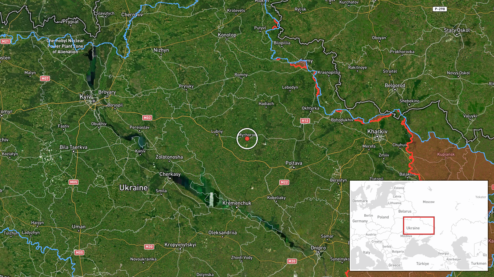
The location is placed at the settlement level for Myrhorod, Ukraine, with coordinates of approximately 49.96 north and 33.61 east, and the location confidence is marked high. The coordinates correspond to the town centre rather than a specific facility, since the report describes a missile passing over the settlement and not a target within it. Myrhorod lies in Poltava Oblast in central Ukraine, on relatively flat steppe terrain drained by the Khorol River. The town is a regional centre southeast of Poltava city. Because the coordinates refer to an overflight point, the spot marks where the sighting was reported and not necessarily the missile's path or endpoint.
Related events nearby
- Ukrainian air monitoring: 1 Russian Banderol mini cruise missile passing Okhtyrka, heading toward Myrhorod.2026-10-18 19:14 UTC · Cruise Missile · Myrhorod, Ukraine
- Ukrainian air monitoring: 1 Russian jet-powered Shahed (Geran-3) drone heading toward Poltava.2026-10-18 06:37 UTC · Drone Transit · Poltava, Ukraine
- Ukrainian air monitoring: 1 Russian jet-powered Shahed (Geran-3) drone over Poltava.2026-10-18 06:35 UTC · Drone Transit · Poltava, Ukraine
- Ukrainian air monitoring reports a Russian jet-powered Shahed (Geran-3) drone over Poltava; residents told to 2026-10-18 06:45 UTC · Drone Transit · Poltava, Poltava Oblast, Ukraine
- Ukrainian air monitoring: 2 Russian Banderol mini cruise missiles over Pryluky.2026-10-18 19:34 UTC · Cruise Missile · Pryluky, Ukraine
▶ View this event on the live map

Intel Mapper aggregates open-source reports from monitored Telegram and X channels, geolocates them, cross-checks duplicates across sources and assigns a confidence score. Entries are updated as new confirmations arrive. Read how we verify events.