Single Russian Shahed-type drone reported heading toward Kyiv Oblast amid wider air activity
What happened
A Telegram channel, @war_monitor, reported on 21 October 2026 at about 19:09 UTC that one Russian Shahed-type drone was heading toward Kyiv Oblast in Ukraine. The original post, written in Ukrainian, reads as a short notice that a launch was moving in the direction of the Kyiv region, using the phrase 'Вихід у напрямку Київщини', which describes an object emerging on a course toward Kyiv territory. The report does not give a track, altitude, speed, or any impact or damage. It is attributed to Ukrainian air monitoring as summarized by the channel. No independent outlet is listed as reporting the same detail, and the event carries no corrections. The wording indicates a transit warning rather than a confirmed strike.
Context and assessment
Kyiv Oblast sits around the Ukrainian capital and has been a recurring destination for Russian long-range strike waves, so a drone heading there draws attention even when the count is small. The related entries in this feed show a dense sequence on the same day. Jet-powered Shahed-type drones, described as Geran-3, were logged heading toward Kyiv Oblast in groups of two or more at 11:39 and 15:39 UTC, with a single Geran-3 toward Kyiv at 18:18. Cruise missiles described as Zircon or Oniks followed at 19:12 and 19:13 UTC, with two and then one reported heading toward Kyiv. A lone drone at 19:09 therefore most plausibly fits a continuing pattern of multi-hour waves rather than an isolated flight. Operationally, such single-track reports can mark a drone trailing a main formation, a decoy, or a unit taking a different approach path. The data does not establish which, and the sequence should not be read as proof of a particular plan.
Sources and confidence
The event rests on one channel, Telegram @war_monitor, with a source count of one and no corroborating outlet in the data. The confidence score of 6.0 out of 10 reflects a credible-looking monitoring-style notice that matches a wider same-day pattern, but it is held down by the single origin and the brief wording. Confidence would rise if an official Ukrainian air force statement, or several independent monitoring accounts, confirmed the track and direction. It would fall if the drone were later reported as a different type, a different target, or never entering Kyiv Oblast.
Location
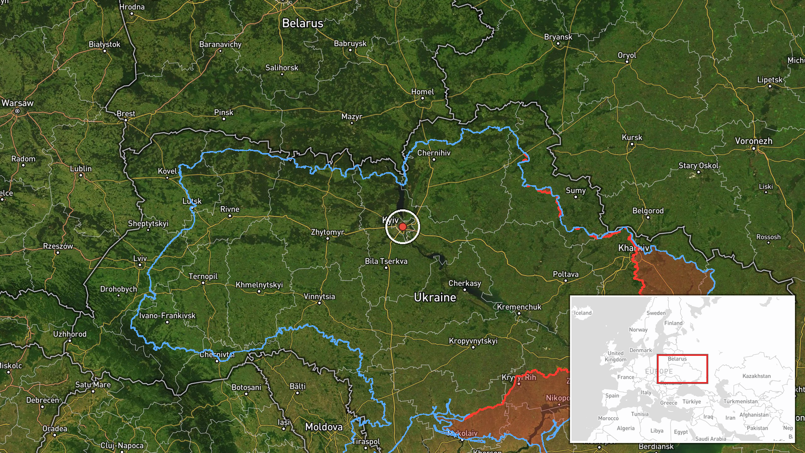
The location is recorded only at region level, Kyiv Oblast, with a low location confidence and coordinates near 50.45 N, 30.52 E. These approximate the Kyiv city area, which is the administrative centre of the surrounding oblast, so the point is a general reference rather than a tracked position. The region is largely flat to gently rolling terrain of the Dnipro basin, with the Dnipro River and its reservoirs running through or near it. Forest belts and the northern border with Chernihiv Oblast lie to the north, which is also the origin direction named in earlier related entries.
Related events nearby
- Ukrainian air monitoring: 1 Russian Zircon/Oniks missile passing Kipti, heading toward Kyiv.2026-10-21 19:13 UTC · Cruise Missile · Kyiv, Ukraine
- Ukrainian air monitoring: 2 Russian Zircon/Oniks missiles heading toward Kyiv.2026-10-21 19:12 UTC · Cruise Missile · Kyiv, Ukraine
- Ukrainian air monitoring: 1 Russian jet-powered Shahed (Geran-3) drone heading toward Kyiv.2026-10-21 18:18 UTC · Drone Transit · Kyiv, Ukraine
- Ukrainian air monitoring: 2+ Russian jet-powered Shahed (Geran-3) drones from Chernihiv Oblast toward Kyiv Obl2026-10-21 15:39 UTC · Drone Transit · Kyiv Oblast, Ukraine
- Ukrainian air monitoring: 2+ Russian jet-powered Shahed (Geran-3) drones heading toward Kyiv Oblast.2026-10-21 11:39 UTC · Drone Transit · Kyiv Oblast, Ukraine
▶ View this event on the live map

Intel Mapper aggregates open-source reports from monitored Telegram and X channels, geolocates them, cross-checks duplicates across sources and assigns a confidence score. Entries are updated as new confirmations arrive. Read how we verify events.