Ukrainian monitors and a Telegram channel report at least 25 Russian missiles fired at Kyiv area
What happened
A Telegram channel, @war_monitor, reported that at least 25 Russian missiles of Iskander, Oniks or Zircon types were launched at Kyiv and its suburbs, beginning in the evening and continuing overnight. The event is logged at 01:15 UTC on 22 October 2026 and geolocated to Peredmistia, a Ukrainian term for the suburban outskirts, at settlement precision. The original Ukrainian text describes ballistic fire against the capital. The English summary instead labels the weapons Zircon and Oniks and the attack type as cruise missile, a mismatch that is kept visible here. The data contains no reported impacts, casualties, or interception figures. Attribution to Russia comes from the channel's framing and the air-monitoring context.
Context and assessment
Kyiv is the national capital and a seat of government, so large missile salvos against it are typically read as aimed at political, energy, transport and industrial targets, as well as at stretching air defences. The related records show a separate drone pattern on 21 October. Five Russian Geran-3 jet-powered drones were logged between 02:16 and 18:10, moving from Khmelnytskyi Oblast and through Ternopil Oblast, with one track heading toward Dunayivtsi. Sustained drone activity across several hours can keep radars and interceptors occupied, and it often precedes or accompanies a missile wave. The drone tracks do not reveal their targets, however, so the sequence is suggestive rather than conclusive. The geographic detail is also a concern. The drone corridor runs through western Ukraine, and the coordinates attached to this event sit in the west, not near Kyiv. That raises the possibility that the missile report, the drone corridor, or the geolocation has been mixed up. Operationally, the pattern is consistent with a coordinated strike, but the data alone cannot confirm it.
Sources and confidence
The event rests on a single Telegram channel, with a source count of one and no cross-confirmation in the data. No wire service, official Ukrainian statement, or independent imagery is recorded. The confidence score of 6.0 reflects that single-channel basis, offset somewhat by the related drone reports that share the same monitoring framing. Confidence would rise with independent corroboration, such as an official air-force statement, wire reporting, or imagery of launches or impact sites, and with confirmation of the weapon types. It would fall if the channel corrected or withdrew the report, or if the location conflict remains unresolved. The record is not marked as corrected.
Location
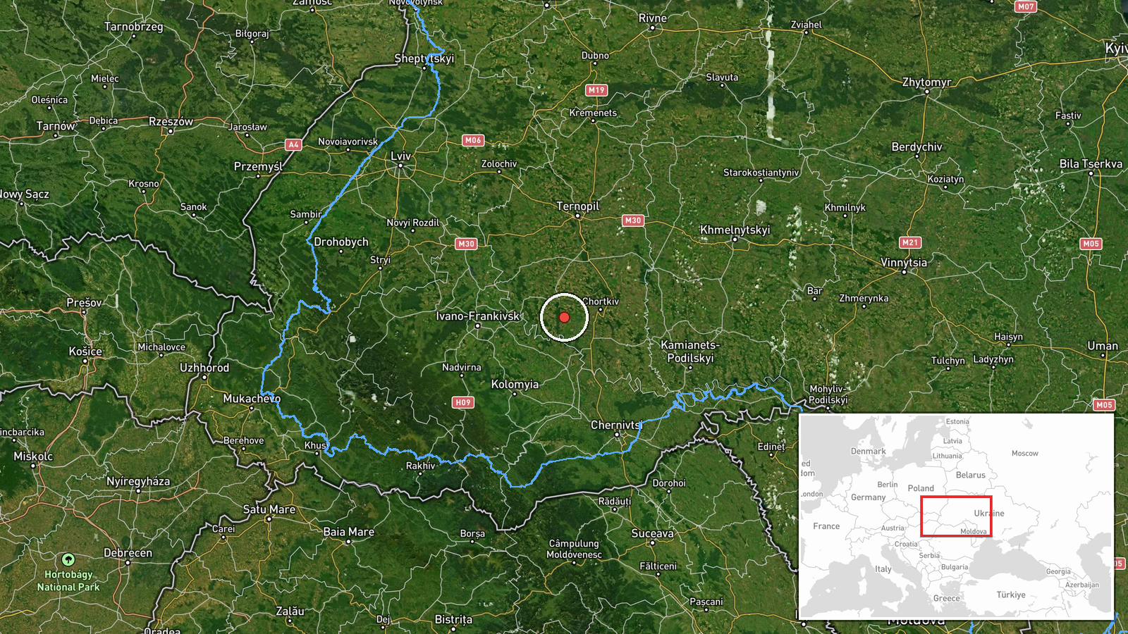
The coordinates, 48.97282 N and 25.47132 E, were assigned at settlement precision from the place name Peredmistia, with high location confidence. That is a conflict: the text describes Kyiv and its suburbs, yet the point lies in western Ukraine, several hundred kilometres from the capital. The surrounding terrain is upland country near the Carpathian foothills, roughly in the area of the Ternopil and Chernivtsi border regions. Readers should treat the map position as unreliable until the geolocation is checked.
Related events nearby
- Ukrainian air monitoring: 1 Russian jet-powered Shahed (Geran-3) drone from Khmelnytskyi Oblast toward souther2026-10-21 18:10 UTC · Drone Transit · southern Ternopil Oblast, Ukraine
- Ukrainian air monitoring: 1 Russian jet-powered Shahed (Geran-3) drone heading toward Ternopil Oblast.2026-10-21 16:39 UTC · Drone Transit · Ternopil Oblast, Ukraine
- Ukrainian air monitoring: 1 Russian jet-powered Shahed (Geran-3) drone heading toward Ternopil Oblast.2026-10-21 13:48 UTC · Drone Transit · Ternopil Oblast, Ukraine
- Ukrainian air monitoring: 1 Russian jet-powered Shahed (Geran-3) drone passing Husiatyn, heading toward Ternop2026-10-21 02:16 UTC · Drone Transit · Ternopil Oblast, Ukraine
- Ukrainian air monitoring: 1 Russian jet-powered Shahed (Geran-3) drone from southern Khmelnytskyi Oblast towar2026-10-21 17:58 UTC · Drone Transit · Dunayivtsi, Ukraine
▶ View this event on the live map

Intel Mapper aggregates open-source reports from monitored Telegram and X channels, geolocates them, cross-checks duplicates across sources and assigns a confidence score. Entries are updated as new confirmations arrive. Read how we verify events.