Hezbollah expands territorial control in Nabatîyé region of southern Lebanon
What happened
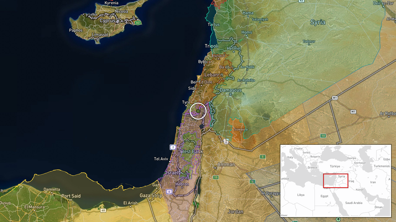
Hezbollah forces reportedly expanded their territorial control by approximately 10 square kilometers in the Nabatîyé area of southern Lebanon on 9 September 2026, according to an updated conflict control map. Nabatîyé is located in South Governorate near the Israeli border. The report reflects shifting territorial positions recorded on mapping platforms tracking the ongoing Israeli-Hezbollah conflict. Related updates from the same date indicate other armed actors also expanded control in the same region during this period.
Context and assessment
Nabatîyé sits in southern Lebanon's coastal zone, historically a stronghold of Hezbollah presence and a frequent flashpoint in Israeli-Hezbollah hostilities. The territorial expansion reported here aligns with intensified fighting documented in nearby Tyre on 9 September, where Israeli strikes reportedly killed at least 28 people and wounded 79, triggering further displacement. Control map updates from the same timestamp show multiple armed actors—Hezbollah, Lebanese forces, and others—simultaneously expanding holdings in the Nabatîyé district, suggesting fluid frontlines and contested terrain. This pattern may reflect tactical repositioning following airstrikes or ground operations, though the precise military significance of the reported 10 km² shift requires corroboration against operational reporting.
Sources and confidence
Single source: Wiki control map database, updated 9 September 2026. No cross-confirmation from independent military or news channels. Confidence score of 7.5 reflects reliance on one mapping platform without parallel reporting from conflict monitors or on-ground sources. Score would increase with confirmation from additional conflict mapping services or corroborating combat reports. Score would lower if map updates are later reversed or contradicted by independent observers.
Location
Nabatîyé region, South Governorate, Lebanon, approximately 33.16°N, 35.49°E. The town lies in the coastal plain of southern Lebanon near the Litani River, roughly 12 km north of the Israeli border and 25 km south of Sidon. The region is predominantly Shia-inhabited and has been a center of Hezbollah operations for decades.
Related events nearby
- Lebanon forces expanded control (~12 km²) in the Nabatîyé area per updated conflict control map.2026-09-09 17:30 UTC · Combat · Nabatîyé
- Lebanon forces expanded control (~61 km²) in the Nabatîyé area per updated conflict control map.2026-09-09 17:30 UTC · Combat · Nabatîyé
- Hezbollah forces expanded control (~23 km²) in the Nabatîyé area per updated conflict control map.2026-09-09 17:30 UTC · Combat · Nabatîyé
- Israeli Defense Minister announces military presence 35 km from Qصر al-Shara (Palace of Shara), Mount Hermon a2026-09-09 18:20 UTC · Statement · Mount Hermon (Jabal al-Sheikh), Rif Dimashq, Syria
- Al-Suwayda Governor Mustafa Al-Bakour announces readiness to facilitate the return of displaced residents to t2026-09-09 17:33 UTC · Humanitarian Aid · Al-Suwayda City, Al-Suwayda Governorate, Syria
▶ View this event on the live map
Intel Mapper aggregates open-source reports from monitored Telegram and X channels, geolocates them, cross-checks duplicates across sources and assigns a confidence score. Entries are updated as new confirmations arrive. Read how we verify events.