Hezbollah expands territorial control by ~23 km² in southern Lebanese Nabatîyé region
What happened
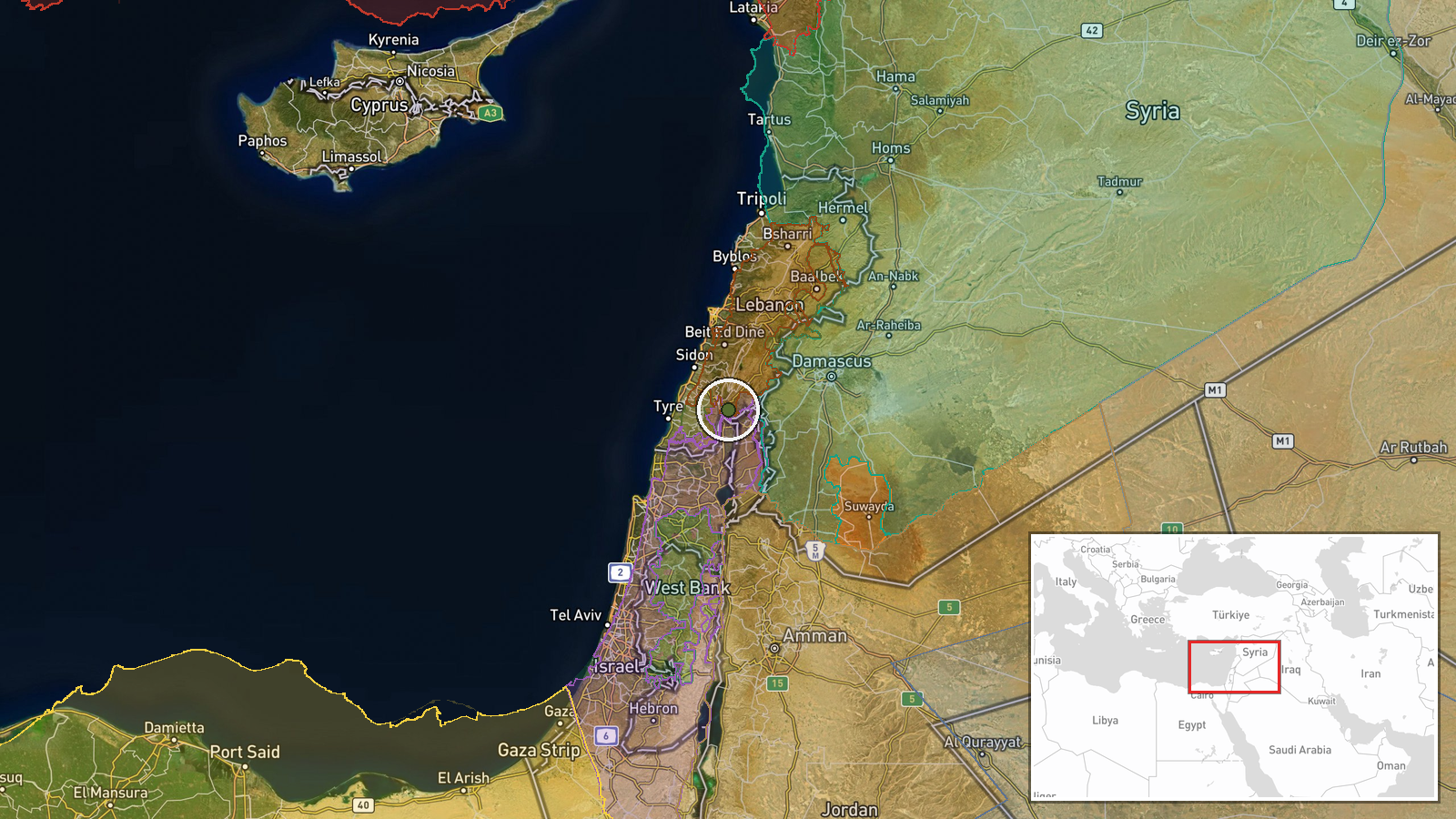
According to updates to a conflict control map logged on 9 September 2026, Hezbollah forces expanded their territorial control in the Nabatîyé region of southern Lebanon by approximately 23 square kilometres. The expansion was documented through map revisions that same day. Related map updates from the same timestamp indicate simultaneous territorial changes in the same area involving Lebanese state forces, suggesting fluid frontline conditions or competing claims to territory in the region.
Context and assessment
Nabatîyé, located in southern Lebanon near the Israeli border, has been a focal point of military activity as regional tensions escalated through 2026. The territory is strategically significant given its proximity to Israel and its position within Lebanon's Shia-majority south. Simultaneous reported territorial gains by Hezbollah and Lebanese state forces in the same region on the same date suggest either competing advances against external forces or territorial reorganisation among allied actors. Israeli military operations in adjacent Syrian territory on 8 September and statements regarding expanded Israeli territorial claims on 9 September provide broader context for heightened military activity across the border region, though direct causal links remain unclear.
Sources and confidence
Single source: Wiki conflict control map, updated 9 September 2026. Confidence score of 7.5/10 reflects sourcing from a crowdsourced mapping platform rather than military or official statements. Cross-confirmation limited to related map updates showing competing territorial claims same day. Score would increase with corroboration from military statements or independent reporting; it would decrease if map revisions are subsequently reversed or disputed.
Location
Nabatîyé region, southern Lebanon, approximately 33.3°N, 35.6°E. Located in the Shia-majority south near the Israeli border in the Eastern Mediterranean geopolitical zone. The region encompasses multiple settlements and is situated inland from the Mediterranean coast, in Lebanon's Governorate of Nabatîyé.
Related events nearby
- Lebanon forces expanded control (~12 km²) in the Nabatîyé area per updated conflict control map.2026-09-09 17:30 UTC · Combat · Nabatîyé
- Lebanon forces expanded control (~61 km²) in the Nabatîyé area per updated conflict control map.2026-09-09 17:30 UTC · Combat · Nabatîyé
- Hezbollah forces expanded control (~10 km²) in the Nabatîyé area per updated conflict control map.2026-09-09 17:30 UTC · Combat · Nabatîyé
- Israeli Defense Minister announces military presence 35 km from Qصر al-Shara (Palace of Shara), Mount Hermon a2026-09-09 18:20 UTC · Statement · Mount Hermon (Jabal al-Sheikh), Rif Dimashq, Syria
- Al-Suwayda Governor Mustafa Al-Bakour announces readiness to facilitate the return of displaced residents to t2026-09-09 17:33 UTC · Humanitarian Aid · Al-Suwayda City, Al-Suwayda Governorate, Syria
▶ View this event on the live map
Intel Mapper aggregates open-source reports from monitored Telegram and X channels, geolocates them, cross-checks duplicates across sources and assigns a confidence score. Entries are updated as new confirmations arrive. Read how we verify events.