Lebanese forces expand control in Nabatîyé region amid intensified southern fighting
What happened
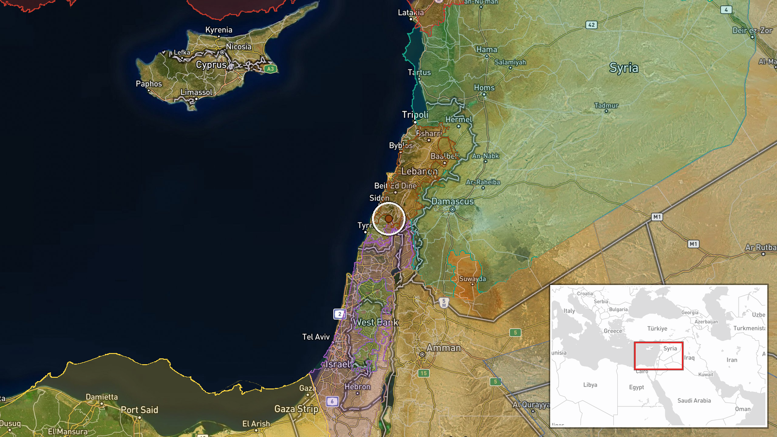
According to conflict control mapping, Lebanese forces expanded their territorial control by approximately 61 square kilometers in the Nabatîyé area on 9 September. The expansion was recorded on a collaborative conflict map tracking territorial changes in real time. Nabatîyé is located in southern Lebanon's South Governorate, a region that has seen escalating military activity. The report does not specify the circumstances of the expansion or whether it involved active combat operations.
Context and assessment
Nabatîyé lies in southern Lebanon, a region that has become increasingly contested following intensified Israeli-Hezbollah hostilities since early September. Related territorial updates from the same date indicate that both Lebanese state forces and Hezbollah separately expanded control in the Nabatîyé area, suggesting complex, overlapping operational dynamics in this zone. The broader pattern reflects active ground-level military repositioning across southern Lebanon, concurrent with Israeli airstrikes that reportedly killed at least 28 people and wounded 79 in the Tyre area. These territorial shifts may indicate efforts by Lebanese and Hezbollah forces to consolidate positions or respond to operational developments in the wider conflict.
Sources and confidence
Reported exclusively by a collaborative conflict control map wiki on 9 September. No independent corroboration from news agencies or military statements is noted. Confidence is moderate at 7.5/10 due to single-source reliance and lack of ground-level verification. Cross-confirmation by other mapping platforms, statement from Lebanese authorities, or Hezbollah media would strengthen confidence. Clarification of whether expansion involved active combat or repositioning would improve reliability.
Location
Nabatîyé region in Lebanon's South Governorate, approximately 33.42°N 35.49°E. The district is located in the southern coastal plain, roughly 20 kilometers northeast of Tyre. Geographic precision is regional rather than specific to individual settlements or military facilities. The area forms part of the historically contested border region between Lebanon and Israel.
Related events nearby
- Lebanon forces expanded control (~12 km²) in the Nabatîyé area per updated conflict control map.2026-09-09 17:30 UTC · Combat · Nabatîyé
- Hezbollah forces expanded control (~10 km²) in the Nabatîyé area per updated conflict control map.2026-09-09 17:30 UTC · Combat · Nabatîyé
- Hezbollah forces expanded control (~23 km²) in the Nabatîyé area per updated conflict control map.2026-09-09 17:30 UTC · Combat · Nabatîyé
- Israeli Defense Minister announces military presence 35 km from Qصر al-Shara (Palace of Shara), Mount Hermon a2026-09-09 18:20 UTC · Statement · Mount Hermon (Jabal al-Sheikh), Rif Dimashq, Syria
- Al-Suwayda Governor Mustafa Al-Bakour announces readiness to facilitate the return of displaced residents to t2026-09-09 17:33 UTC · Humanitarian Aid · Al-Suwayda City, Al-Suwayda Governorate, Syria
▶ View this event on the live map
Intel Mapper aggregates open-source reports from monitored Telegram and X channels, geolocates them, cross-checks duplicates across sources and assigns a confidence score. Entries are updated as new confirmations arrive. Read how we verify events.