Lebanese forces expand territorial control in Nabatîyé region
What happened
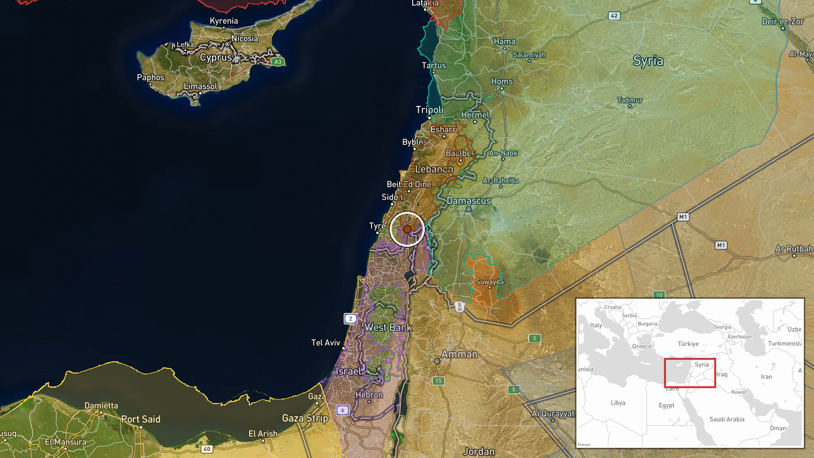
According to a conflict control map update, Lebanese forces expanded their territorial control in the Nabatîyé region by approximately 12 square kilometers on September 9, 2026. The expansion was documented through map revisions tracking frontline positions in southern Lebanon. Nabatîyé lies in Lebanon's administrative south, a border region with significant strategic importance in the ongoing regional conflict.
Context and assessment
Nabatîyé has been a focal point of military activity throughout the current conflict period. Multiple control map updates from the same date show concurrent territorial adjustments in the area, with both Lebanese state forces and Hezbollah reportedly expanding positions—Lebanon by approximately 61–73 square kilometers total and Hezbollah by roughly 33 square kilometers combined across documented entries. These simultaneous gains suggest coordinated or overlapping military operations, possibly reflecting recent tactical momentum or consolidation of contested territory. The pattern aligns with broader Israeli operations documented in nearby Syrian territory around Golan Heights, indicating regional escalation and shifting frontlines across the Israel-Lebanon-Syria border zone.
Sources and confidence
The report originates solely from Wiki control map, a crowdsourced conflict mapping platform. The confidence score of 7.5 reflects moderate reliance on a single source and the inherent variability in real-time map updates. Cross-confirmation with independent military observers or official statements would strengthen confidence. Consistency across multiple near-simultaneous map revisions in Nabatîyé provides some internal validation but does not eliminate the risk of mapping errors or delayed data integration.
Location
Nabatîyé is a town and administrative region in southern Lebanon, approximately 15 kilometers northeast of the Mediterranean coast and roughly 10 kilometers north of the Israeli border. The coordinates (33.31°N, 35.56°E) place the area in the Nabatîyé Governorate, a predominantly agricultural and residential region historically affected by cross-border tensions and military operations.
Related events nearby
- Lebanon forces expanded control (~61 km²) in the Nabatîyé area per updated conflict control map.2026-09-09 17:30 UTC · Combat · Nabatîyé
- Hezbollah forces expanded control (~10 km²) in the Nabatîyé area per updated conflict control map.2026-09-09 17:30 UTC · Combat · Nabatîyé
- Hezbollah forces expanded control (~23 km²) in the Nabatîyé area per updated conflict control map.2026-09-09 17:30 UTC · Combat · Nabatîyé
- Israeli Defense Minister announces military presence 35 km from Qصر al-Shara (Palace of Shara), Mount Hermon a2026-09-09 18:20 UTC · Statement · Mount Hermon (Jabal al-Sheikh), Rif Dimashq, Syria
- Al-Suwayda Governor Mustafa Al-Bakour announces readiness to facilitate the return of displaced residents to t2026-09-09 17:33 UTC · Humanitarian Aid · Al-Suwayda City, Al-Suwayda Governorate, Syria
▶ View this event on the live map
Intel Mapper aggregates open-source reports from monitored Telegram and X channels, geolocates them, cross-checks duplicates across sources and assigns a confidence score. Entries are updated as new confirmations arrive. Read how we verify events.