Hezbollah expands territorial control in southern Lebanon by approximately 17 km²
What happened
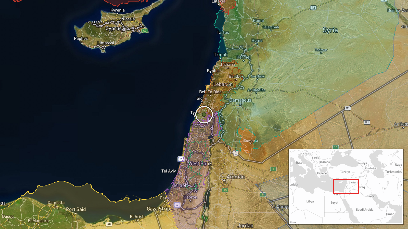
According to an updated conflict control map, Hezbollah forces have expanded their territorial control in the Liban-Sud region by approximately 17 square kilometers as of September 18, 2026. The expansion was recorded in the southern Lebanese area, a zone of ongoing military activity between Israeli forces and Lebanese armed groups. The report derives from Wiki control map documentation, which tracks shifts in territorial control across the conflict zone.
Context and assessment
Southern Lebanon has been a focal point of escalating military operations in recent days. On the same day, Israeli forces expanded control by roughly 8 km² in the nearby Nabatîyé area, suggesting active territorial contestation across multiple fronts in the south. Recent Israeli airstrikes, including one on Mansouri on September 17, indicate sustained pressure on Hezbollah positions. The simultaneous expansion by both Israeli and Lebanese forces, alongside Lebanese state forces gaining ground in Mont-Liban, suggests a fragmented and fluid tactical situation where multiple actors are advancing in different sectors, possibly reflecting localized tactical gains rather than a unified strategic breakthrough.
Sources and confidence
Sourced from Wiki control map, a single channel documenting territorial changes. The confidence score of 7.5 reflects reliance on a single source without independent cross-confirmation from military statements or other open-source channels. Confidence would increase with corroboration from satellite imagery, statements from military officials, or reports from multiple conflict monitoring organizations. Absence of competing claims does not itself confirm the figure.
Location
Liban-Sud (South Lebanon) region, centered approximately at 33.31°N, 35.43°E. The area encompasses southern Lebanon south of the Litani River, a historically contested zone bordering Israel. Precision is regional rather than site-specific, indicating the map reflects broader territorial shifts rather than pinpointed military positions or facilities.
Related events nearby
- Israel forces expanded control (~8 km²) in the Nabatîyé area per updated conflict control map.2026-09-18 05:52 UTC · Combat · Nabatîyé
- Israeli warplanes conducted an airstrike on the town of Mansouri in southern Lebanon.2026-09-17 14:07 UTC · Airstrike · Mansouri, South Lebanon
- Israeli military reduces reserve forces from Carmeli Brigade ahead of ~110-day operational mission in Syrian s2026-09-17 10:40 UTC · Deployment · Quneitra, Syria
- Lebanon forces expanded control (~4 km²) in the Mont-Liban area per updated conflict control map.2026-09-17 17:32 UTC · Combat · Mont-Liban
- Lebanese judicial source identifies Hezbollah liaison officer Yasser Ala al-Din ('Hajj Alaa') connected to net2026-09-17 18:32 UTC · Security · Beirut, Lebanon
▶ View this event on the live map
Intel Mapper aggregates open-source reports from monitored Telegram and X channels, geolocates them, cross-checks duplicates across sources and assigns a confidence score. Entries are updated as new confirmations arrive. Read how we verify events.