Israel expands control in southern Lebanon's Nabatîyé area
What happened
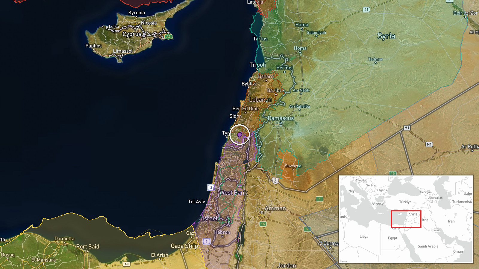
According to updated conflict control mapping, Israeli forces expanded territorial control by approximately 8 square kilometers in the Nabatîyé region of southern Lebanon as of 18 September 2026. The report comes from wiki-based conflict mapping sources tracking front-line positions in the ongoing Israel-Hezbollah escalation. Nabatîyé lies in southern Lebanon, a primary zone of military operations over recent weeks.
Context and assessment
The Nabatîyé expansion occurs amid broader territorial shifts across southern Lebanon and into Syria. Concurrent reports show Hezbollah forces gaining roughly 17 square kilometers in Liban-Sud on the same date, while Lebanese government forces advanced approximately 4 square kilometers in Mont-Liban. Israeli military operations in southern Lebanon have intensified following airstrikes on towns such as Mansouri on 17 September. Separately, Israeli reserve forces have been repositioned toward Syria's Quneitra sector for an extended operational mission. These overlapping movements suggest a sustained campaign across multiple Lebanese and Syrian fronts, with control shifting at localized scales even as broader strategic positions remain contested.
Sources and confidence
Single source: wiki-based conflict control mapping updated 18 September 2026. Cross-confirmation from related events (simultaneous Hezbollah and Lebanese advances, recent Israeli airstrikes, force deployments) suggests active operations in the region, but the specific 8 km² figure lacks independent corroboration. Confidence score 7.5 reflects reliable mapping methodology offset by limited source redundancy. Confirmation from additional map sources or military statements would strengthen confidence.
Location
Nabatîyé is a town and administrative region in South Lebanon governorate, situated approximately 15 kilometers inland from the Mediterranean coast and roughly 40 kilometers north of the Israeli border. The region is a longstanding area of Lebanese-Israeli contention and has been a focal point of Hezbollah military presence. Surrounding terrain is mixed urban-rural with notable Lebanese settlements nearby.
Related events nearby
- Hezbollah forces expanded control (~17 km²) in the Liban-Sud area per updated conflict control map.2026-09-18 05:52 UTC · Combat · Liban-Sud
- Israeli warplanes conducted an airstrike on the town of Mansouri in southern Lebanon.2026-09-17 14:07 UTC · Airstrike · Mansouri, South Lebanon
- Israeli military reduces reserve forces from Carmeli Brigade ahead of ~110-day operational mission in Syrian s2026-09-17 10:40 UTC · Deployment · Quneitra, Syria
- Lebanon forces expanded control (~4 km²) in the Mont-Liban area per updated conflict control map.2026-09-17 17:32 UTC · Combat · Mont-Liban
- Lebanese judicial source identifies Hezbollah liaison officer Yasser Ala al-Din ('Hajj Alaa') connected to net2026-09-17 18:32 UTC · Security · Beirut, Lebanon
▶ View this event on the live map
Intel Mapper aggregates open-source reports from monitored Telegram and X channels, geolocates them, cross-checks duplicates across sources and assigns a confidence score. Entries are updated as new confirmations arrive. Read how we verify events.