Yemen Government Forces Expand Control in Al Bayda' Governorate
What happened
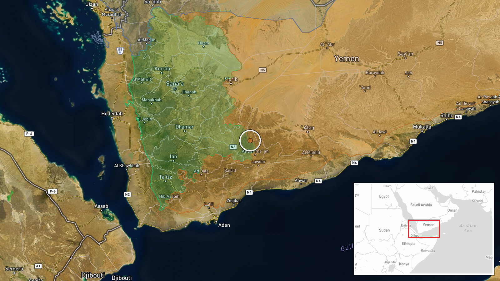
The Internationally Recognized Government (IRG) of Yemen, also referred to as the Presidential Leadership Council (PLC), reportedly expanded territorial control in Al Bayda' Governorate by approximately 14 square kilometers according to an updated conflict control map. The expansion was recorded on October 6, 2026. The report originates from Wiki control map tracking, a crowdsourced conflict cartography platform. No specific tactical details, units involved, or combat outcomes are provided in the source material.
Context and assessment
Al Bayda' Governorate, located in central Yemen, has been contested between the PLC-led government forces (backed by the Saudi-led coalition) and Houthi forces throughout Yemen's conflict. This territorial gain follows a broader pattern of government advances documented over the preceding days: coordinated offensives were launched across Marib and Al-Jawf governorates on October 5, suggesting a multi-front campaign with reported air support. The timing and geography suggest these may be part of a sustained push to consolidate control over central Yemen, though the specific strategic objectives remain unclear. RAF aerial refueling operations detected nearby indicate continued coalition logistical support for these operations.
Sources and confidence
Single source: Wiki control map, a collaborative conflict mapping platform. Confidence is moderate (7.5/10) due to reliance on one reporting channel without independent cross-confirmation from military sources, news agencies, or additional intelligence channels. Confidence would improve with corroboration from satellite imagery analysis, social media documentation from the theater, or statements from military command. Reliance on crowdsourced mapping introduces typical verification delays.
Location
Al Bayda' Governorate is a region in central Yemen located at approximately 14.36°N, 45.70°E. The governorate borders Marib to the north and Ma'rib to the east, sitting in Yemen's interior highlands. The region has sparse population centers and has served as a contested zone throughout the civil conflict, with no single dominant urban center defining the reported expansion.
Related events nearby
- British RAF KC-3 Voyager aerial refueling tankers tracked conducting missions near southern Yemen, likely supp2026-10-05 21:18 UTC · Deployment · Southern Yemen, Yemen
- Saudi-backed Yemeni government forces advancing across multiple fronts in Marib and Al-Jawf governorates with 2026-10-05 11:46 UTC · Combat · Marib Governorate, Yemen
- Saudi-backed Yemeni government forces launched coordinated offensive operations against Houthi positions acros2026-10-05 09:46 UTC · Combat · Marib, Marib Governorate, Yemen
- Saudi-backed Yemeni pro-government forces committed war crimes against surrendering Houthi fighters, using arm2026-10-05 12:31 UTC · Combat · Marib Governorate, Yemen
▶ View this event on the live map
Intel Mapper aggregates open-source reports from monitored Telegram and X channels, geolocates them, cross-checks duplicates across sources and assigns a confidence score. Entries are updated as new confirmations arrive. Read how we verify events.