Ukrainian Special Forces raid Russian military shelter in Donetsk Oblast
What happened
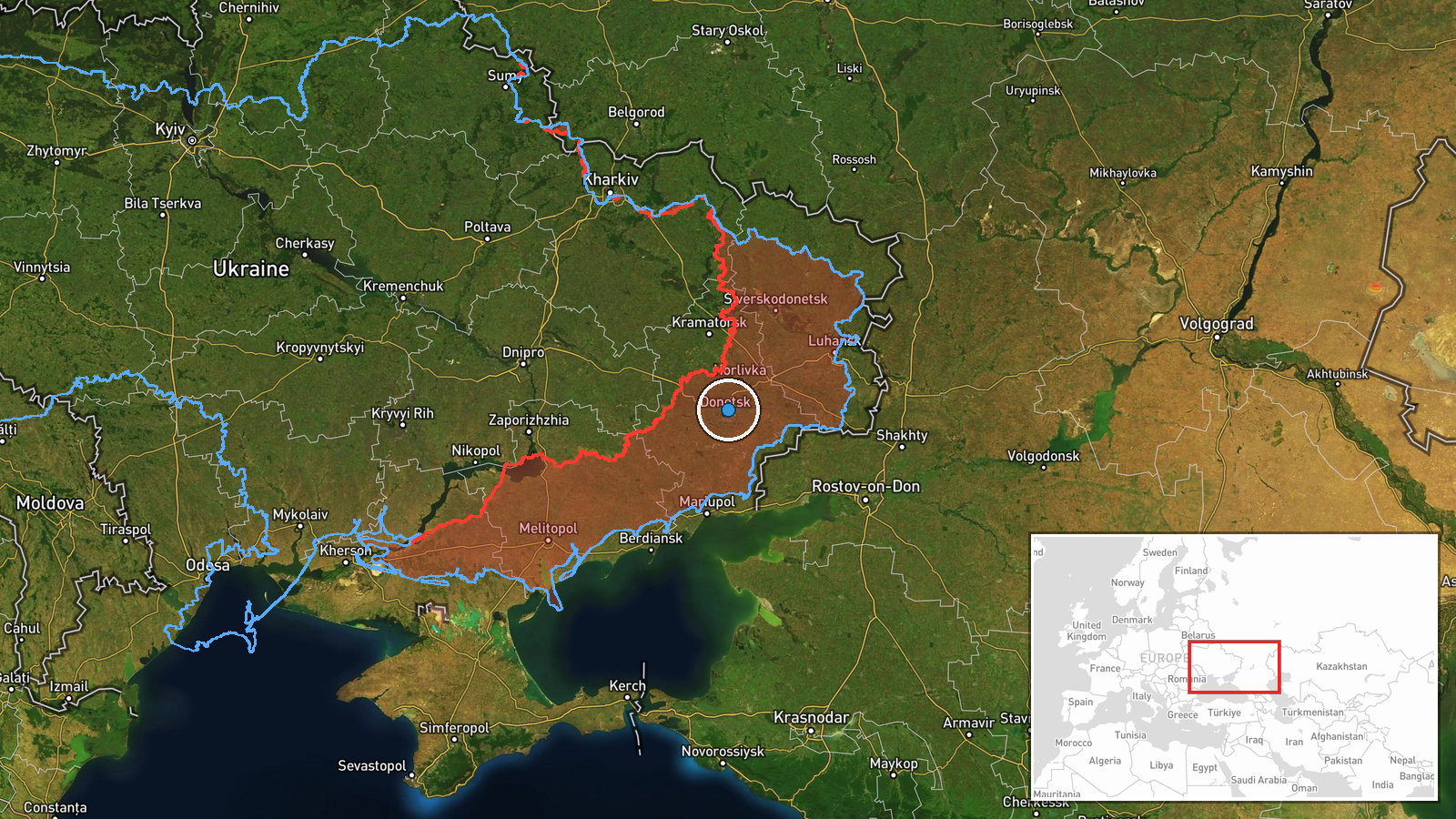
Ukrainian Special Forces reportedly conducted a raid targeting a Russian military shelter or dugout in the Oleksandrivka region of Donetsk Oblast on 13 October. The operation was reported via social media by a conflict monitoring account. No details were provided regarding the scale of the raid, specific targets engaged, or outcomes. The report represents an instance of Ukrainian direct-action operations against Russian positions in eastern Donetsk.
Context and assessment
Oleksandrivka lies in contested territory in Donetsk Oblast where Russian and Ukrainian forces have been engaged in grinding positional warfare. The raid occurred on a day marked by active Ukrainian drone strikes near Selidove and Myrnohrad to the south, and Russian advances of approximately 6 square kilometres in the Shakhove sector to the north. Ukrainian special operations against Russian shelters and fortified positions are part of a broader pattern of asymmetric pressure, complementing drone strikes and area denial operations. Such raids typically target command posts, ammunition storage, or personnel concentrations to disrupt Russian rear-area stability and logistics.
Sources and confidence
Reported solely by @ConflictTR on X (formerly Twitter). Single-source reporting with no cross-confirmation from other open-source monitors or official Ukrainian military channels limits confidence. The confidence score of 6.3 reflects this constraint. Confirmation from additional independent sources, Ukrainian official statements, or Russian acknowledgment would strengthen confidence. Current score also reflects the broad geographic precision of the original location data.
Location
Oleksandrivka is a settlement in the Donetsk Oblast region of southeastern Ukraine, located approximately at 48.05°N, 37.84°E. Precision is regional rather than exact; the specific shelter location within or near the settlement is not identified. The area sits within the active combat zone in eastern Donetsk, characterized by mixed urban and rural terrain under contested control.
Related events nearby
- Ukrainian air monitoring: 1 Russian jet-powered Shahed (Geran-3) drone heading toward Kalynivskyi; 1 Russian j2026-10-13 19:07 UTC · Drone Transit · Kalynivskyi, Ukraine
- Ukrainian forces struck enemy personnel concentrations near Selidove, Rozdolne, Suzhky, and Myrnohrad in Donet2026-10-13 08:40 UTC · UAS Strike · Selidove, Donetsk Oblast, Ukraine
- Russian forces advanced (~6 km²) in the Shakhove sector per DeepState frontline update. No settlement center c2026-10-13 18:20 UTC · Combat · Shakhove sector, Ukraine
- Russian forces advanced (~6 km²) in the Shakhove sector per DeepState frontline update. No settlement center c2026-10-13 18:20 UTC · Combat · Shakhove sector, Ukraine
- Ukrainian air monitoring: 1 Russian jet-powered Shahed (Geran-3) drone passing Lazurnyi, heading west.2026-10-13 16:49 UTC · Drone Transit · Lazurnyi, Ukraine
▶ View this event on the live map

Intel Mapper aggregates open-source reports from monitored Telegram and X channels, geolocates them, cross-checks duplicates across sources and assigns a confidence score. Entries are updated as new confirmations arrive. Read how we verify events.