IRGC releases footage of UAE-flagged container ship sinking after mine strike in Strait of Hormuz
What happened
The Iranian Revolutionary Guard Corps Navy released video footage on October 14 showing a container ship identified as the UAE-flagged GFS PRIDE sinking in waters south of the Strait of Hormuz. The vessel was carrying approximately 2,500 containers. Iran's IRGC had previously reported that the ship struck a naval mine while transiting an unauthorized route through the southern corridor of the Strait. The ship reportedly caught fire following the mine strike before ultimately sinking.
Context and assessment
The Strait of Hormuz remains one of the world's most critical maritime chokepoints, with roughly one-third of global seaborne oil passing through annually. The incident follows a pattern of escalating maritime incidents in the region: a tanker was reportedly struck by an unidentified projectile on October 13, and U.S. Navy warnings to vessels were also recorded. Iran's characterization of the vessel as "illegal" and emphasis on the unauthorized route suggest efforts to justify the incident. The ship's AIS (automatic identification system) had been disabled for ten days before the strike, complicating independent verification and raising questions about navigation intent and maritime coordination in disputed waters.
Sources and confidence
The report originates from IRGC-released footage distributed via X account @Osint613. A single source channel reports this specific sinking footage, though related events from the same date corroborate the mine strike on the same vessel. The confidence score of 6.8 reflects the single-source distribution of the sinking footage itself, offset by cross-confirmation of the underlying incident via multiple earlier reports. Higher confidence would require independent maritime or third-party verification of the vessel's loss.
Location
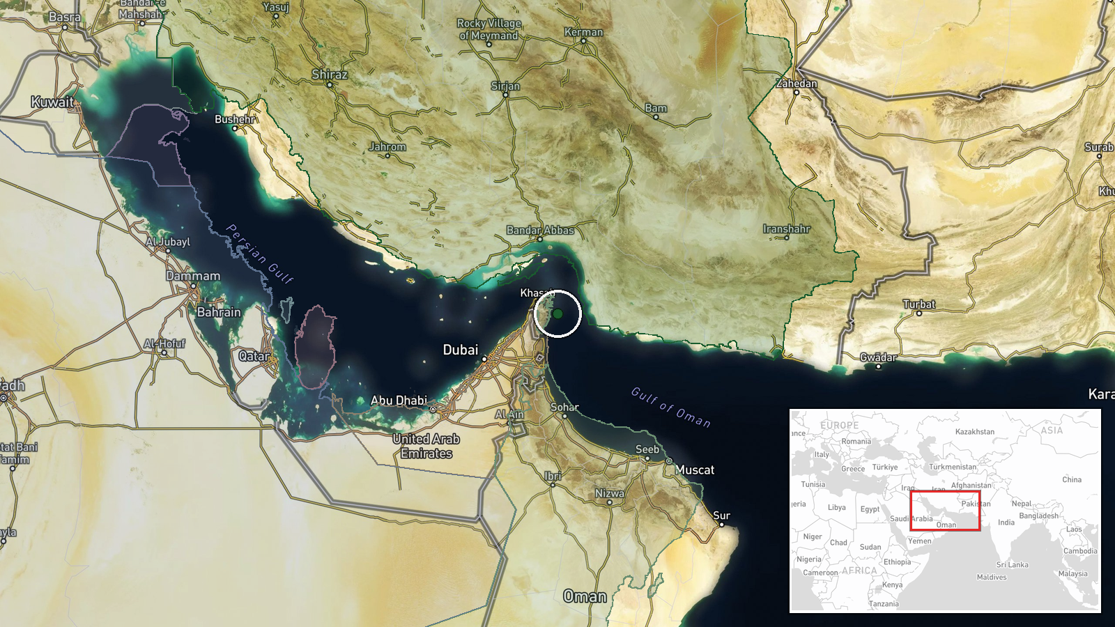
The incident location is identified as the southern Strait of Hormuz corridor, approximately 26.0°N, 56.6°E, at regional precision. The Strait of Hormuz lies between Iran's southern coast and Oman across the Gulf of Oman. The reported unauthorized route through the southern corridor places the incident in contested waters near Iran's maritime claims. Exact coordinates reflect reported mine strike location rather than precise sinking position.
Related events nearby
- CENTCOM reports 19+ million barrels of crude passed through Strait of Hormuz under U.S. escort on Monday; Iran2026-10-14 12:09 UTC · Naval · Strait of Hormuz, Iran-Oman
- IRGC Navy reports container ship (2,500+ containers) struck naval mine in southern Strait of Hormuz corridor v2026-10-14 09:39 UTC · Naval · Strait of Hormuz, Iran-Oman
- Iranian IRGC Navy reported a container ship with 2,500+ containers struck a naval mine while transiting the St2026-10-14 09:19 UTC · Report · Strait of Hormuz
- UAE-flagged container ship GFS PRIDE identified as vessel that struck mine in southern Strait of Hormuz corrid2026-10-14 09:19 UTC · Naval · Strait of Hormuz, Iran-Oman
- Unidentified projectile struck a tanker transiting the Strait of Hormuz. UK Maritime Trade Operations confirme2026-10-13 19:11 UTC · Report · Strait of Hormuz, Persian Gulf
▶ View this event on the live map

Intel Mapper aggregates open-source reports from monitored Telegram and X channels, geolocates them, cross-checks duplicates across sources and assigns a confidence score. Entries are updated as new confirmations arrive. Read how we verify events.