Singapore-flagged container ship GFS Pride sinks near Strait of Hormuz after projectile strike
What happened
The GFS Pride, a Singapore-flagged container ship, sank near the Strait of Hormuz on 14 October after being struck by a projectile, according to Reuters reporting cited on social media. The incident marks the second confirmed merchant vessel loss in the waters between Iran and Oman in recent operations. The timing coincides with sustained attacks on shipping in the region and represents an escalation in direct vessel losses beyond damage or temporary disruption to traffic.
Context and assessment
The Strait of Hormuz remains one of the world's most critical chokepoints for energy transit, with approximately 19 million barrels of crude passing through daily. Recent military operations have seen persistent targeting of commercial shipping, attributed to Houthi forces, creating a pattern of disruption to international maritime commerce. The loss of a fully laden container ship suggests either a significant strike capability or failure of defensive measures. This follows reports of other incidents in the corridor, including mine strikes and fires among container vessels, indicating sustained pressure on the shipping lanes and possible coordination or overlap of attack methods. The incidents may signal an attempt to raise the cost of transit and encourage rerouting away from the strait.
Sources and confidence
Reuters report cited via X (@Osint613) on 14 October. Single source channel limits independent verification; confidence score reflects this constraint. Cross-confirmation would require statements from the vessel's operator, flag state (Singapore), or maritime authorities. Salvage operations, survivor accounts, or satellite imagery of wreckage could strengthen confidence. Houthi claims or Iranian official statements would help establish attribution.
Location
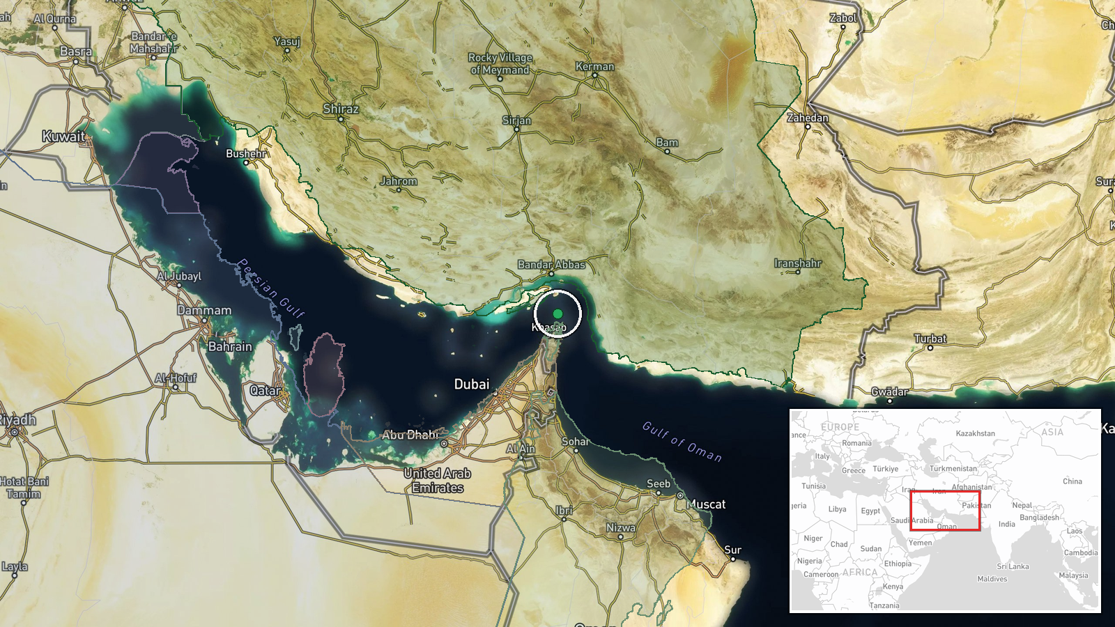
The Strait of Hormuz, the narrow waterway separating Iran and Oman, approximately 26.55°N, 56.4°E. The region designation reflects low positional precision; exact sinking location not specified in available reporting. The strait narrows to roughly 33 kilometers at its widest point and represents a major shipping lane for tanker and container traffic bound for global markets.
Related events nearby
- CENTCOM reports 19+ million barrels of crude passed through Strait of Hormuz under U.S. escort on Monday; Iran2026-10-14 12:09 UTC · Naval · Strait of Hormuz, Iran-Oman
- GFS Pride, Singapore-flagged container ship, sank near Strait of Hormuz after being struck by a projectile. Se2026-10-14 11:56 UTC · Naval · Strait of Hormuz, Iran-Oman
- IRGC Navy reports container ship (2,500+ containers) struck naval mine in southern Strait of Hormuz corridor v2026-10-14 09:39 UTC · Naval · Strait of Hormuz, Iran-Oman
- Iranian IRGC Navy reported a container ship with 2,500+ containers struck a naval mine while transiting the St2026-10-14 09:19 UTC · Report · Strait of Hormuz
- UAE-flagged container ship GFS PRIDE identified as vessel that struck mine in southern Strait of Hormuz corrid2026-10-14 09:19 UTC · Naval · Strait of Hormuz, Iran-Oman
▶ View this event on the live map

Intel Mapper aggregates open-source reports from monitored Telegram and X channels, geolocates them, cross-checks duplicates across sources and assigns a confidence score. Entries are updated as new confirmations arrive. Read how we verify events.