U.S. drone destroys two Iranian boats in Strait of Hormuz seizure attempt
What happened
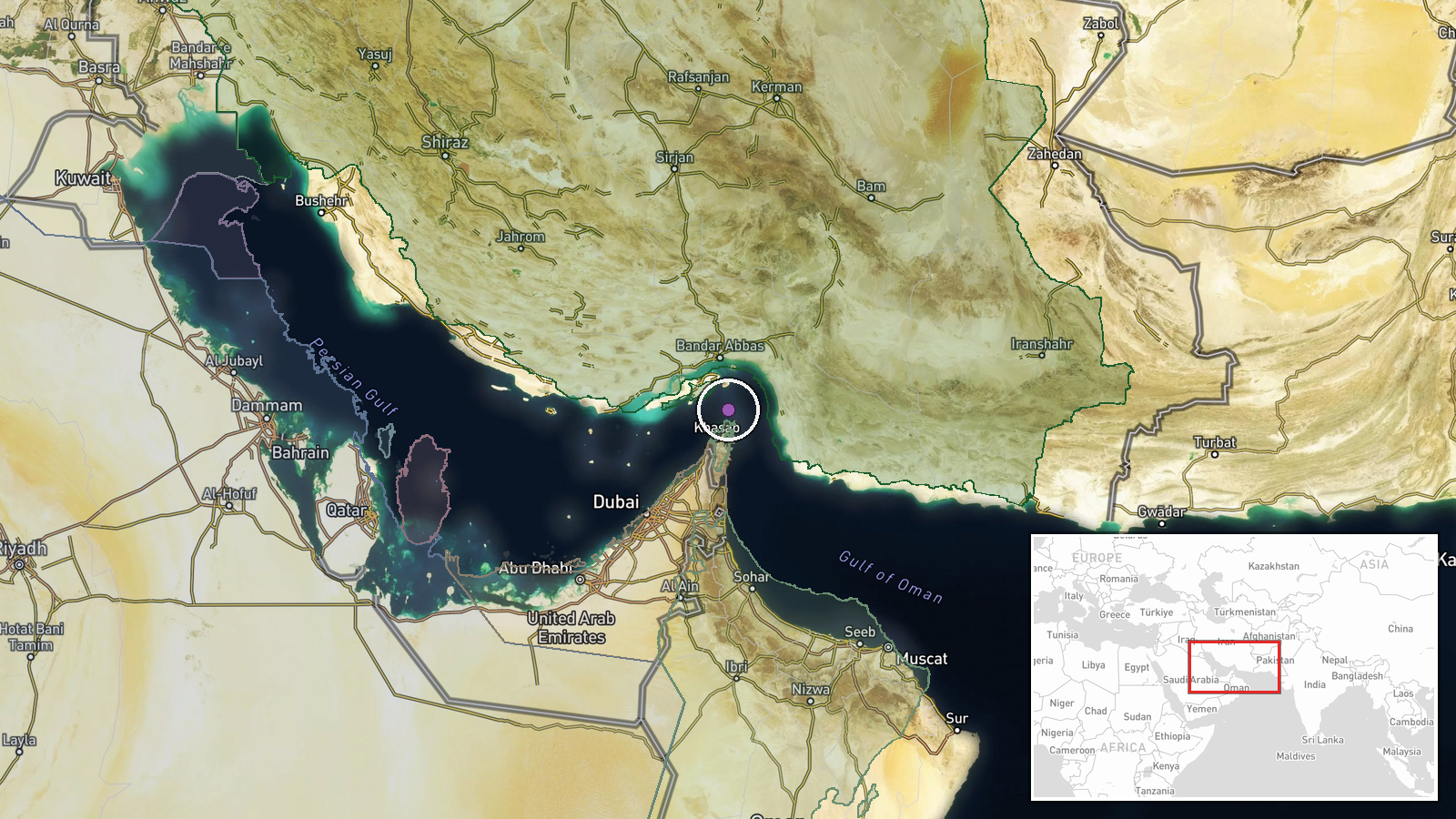
A U.S. Navy drone fired two missiles at two Iranian boats in the Strait of Hormuz on September 15, reportedly after they attempted to seize an American unmanned surface vessel. CENTCOM confirmed the incident and stated the U.S. drone remained under American control throughout. Iran disputed the characterization, describing the vessels as fishing boats and reporting that several crew members were missing. The strike reportedly killed most personnel aboard the Iranian boats.
Context and assessment
The incident occurs amid a sharp escalation in the Strait of Hormuz, a critical chokepoint for global oil transit. On the same day, Iranian forces conducted drone strikes on the Panama-flagged tanker El Gaia, and the IRGC claimed destruction of a fourth U.S. MQ-1 Predator drone in four days. These events suggest intensifying Iranian maritime operations and air defense activity, possibly in response to perceived U.S. naval encroachment or as part of broader regional tensions. Turkey's Foreign Minister issued a statement on September 15 emphasizing the importance of free passage through the strait, reflecting international concern over security deterioration in the region.
Sources and confidence
Single source: Telegram channel @ClashReport. CENTCOM confirmation is mentioned in the event summary but not independently verified in the data provided. Confidence score of 7.0 reflects official U.S. military acknowledgment alongside contradictory Iranian characterization. Cross-confirmation from other channels or independent maritime tracking would raise confidence; Iranian refutation of the seizure narrative without third-party verification limits certainty of operational details.
Location
Strait of Hormuz, Persian Gulf. Precision rated as regional due to the waterway's breadth and lack of specific settlement or facility reference. The strait lies between Iran's southern coast and the Musandam Peninsula, approximately 26.55°N, 56.4°E. Nearby features include major shipping lanes and oil tanker routes that have been targeted in recent incidents.
Related events nearby
- Turkish Foreign Minister Hakan Fidan stated that Iran's security directly affects the region and called for sa2026-09-15 10:57 UTC · Statement · Strait of Hormuz, Persian Gulf
- Iranian missile and drone strikes on oil tanker El Gaia near Strait of Hormuz; vessel hit last month by missil2026-09-15 09:55 UTC · Ballistic Missile · Strait of Hormuz, Persian Gulf
- Iran's IRGC claims interception and destruction of a fourth U.S. MQ-1 Predator drone in four days east of the 2026-09-15 07:11 UTC · Drone Shootdown · East of Strait of Hormuz, Persian Gulf
- U.S. naval forces issued warning to Chinese-flagged vessel in Strait of Hormuz before engaging nearby oil tank2026-09-15 05:37 UTC · Naval · Strait of Hormuz, Persian Gulf
- Iran's IRGC conducted drone strike on Panama-flagged tanker El Gaia in Persian Gulf waters off Oman coast. Ves2026-09-14 19:03 UTC · Cargo Ship · Strait of Hormuz, Persian Gulf
▶ View this event on the live map
Intel Mapper aggregates open-source reports from monitored Telegram and X channels, geolocates them, cross-checks duplicates across sources and assigns a confidence score. Entries are updated as new confirmations arrive. Read how we verify events.